Flat 7, 15 Portchester Road, Bournemouth, BH8 8JT
About Flat 7
Flat 7 is a two-bedroom detached house in Bournemouth (BH8 8JT). It has a recorded floor area of 52 m² (around 560 sq ft), construction records dating it to 1996-2002 and council tax band C. At 52 m² this is the 2nd smallest of 6 units on EPC record in the building, where floor areas span 50–82 m². The building's EPC ratings span E to C, with this unit at the top. Records show the property has been extended at some point in its history. The home occupies a cul-de-sac position. The latest certificate (July 2019) shows a C (score 74). When first surveyed in June 2009 the rating was D, the property has climbed 1 band since. Between certificates, window efficiency went from Poor to Average and lighting went from Very Poor to Very Good.
Last sale on file: £200,000 in July 2024. Across the public record there are 5 sales, relatively high churn for a single property. Across 2003–2024, sale prices on this property compounded at 1.7% per year. On a £-per-square-foot basis, the last sale (£357/sq ft) was about 55% above the typical sold price in the postcode.
What this property has
Inside
- Bedrooms2
- Bathrooms2
- Dining roomYes
- EnsuiteYes
Outside
- ParkingAllocated
- Cul-de-sacYes
Building
- Previously extendedYes
- RefurbishedYes
Everything you need to know about Flat 7
The true value, the hidden risks and the full sale history, in one report.
Pick your report · every report is £14.99
One time fee only - money back guarantee

The data behind every report


Energy performance
EPC Rating
Property Improvements
Changes detected from historical EPC data
Heating controls upgraded for better temperature management
Windows upgraded, improving insulation
More low energy lighting installed
Get a survey for this property
Level 2 HomeBuyer Report
We've checked 10 risk factors against the available data for this property and believe a Level 2 HomeBuyer Report could be a suitable option for you.
From £545 · Includes VAT
Planning history
Flat 7 has no planning applications on record.
But the area is active
34 notable applications nearby — larger schemes and conversions that could reshape the street. The report maps them all.
Sales history & valuation
Flat 7 has changed hands more often than typical for the area.
£217,000
Modelled from EPC, postcode comparables and a sale-price growth of 1.7% per year over 21 years.
£200,000
Growth on file: 1.7% per year over 21 years.
Sales timeline
25 July 2024Most recent
£200,000
+24.2%over 8 years29 June 2016
£161,000
-1.8%over 6 years9 May 2010
£164,000
+5.8%over 6 years9 March 2004
£155,000
+10.7%over 9 months19 June 2003
£140,000
Median price across the last 5 sales in BH8 8JT: £235,000 (2025–2022).
Nearby sales in BH8 8JT
Flat 1, 37 Portchester Road, Bournemouth, BH8 8JT
Sold May 2025
£156,000Flat 1, 15 Portchester Road, Bournemouth, BH8 8JT
Sold Feb 2024
£235,00035 Portchester Road, Bournemouth, BH8 8JT
Sold Dec 2023
£700,00023 Portchester Road, Bournemouth, BH8 8JT
Sold Mar 2022
£665,000Flat 3, 37 Portchester Road, Bournemouth, BH8 8JT
Sold Feb 2022
£104,000
Versus other Portchester Road homes
Flat 7 is notably below the street on years held.
Price per m²
£3,846
Street avg £2,885
Floor Area
52 m²
Street avg 52 m²
Habitable Rooms
3 rooms
Street avg 3 rooms
CO₂ Emissions
1.6 t/year
Street avg 2.3 t/year
Everything you need to know about Flat 7
The true value, the hidden risks and the full sale history, in one report.
Pick your report · every report is £14.99
One time fee only - money back guarantee
The data behind every report
Similar properties nearby
1a, Flat 1, Methuen Close
BH8 8NA
18 22, Flat 5, Holdenhurst Road
BH8 8AD
18 22, Flat 4, Holdenhurst Road
BH8 8AD
15a, Flat 2, Holdenhurst Road
BH8 8EH
15a, Flat 1, Holdenhurst Road
BH8 8EH
101 103, Flat, Charminster Road
BH8 8UH
10 16, Flat 5, Holdenhurst Road
BH8 8AD
1a, Flat 13, Methuen Close
BH8 8NA
The neighbourhood at a glance
Rail-style transport is unusually close for this postcode.
Crime
14/mo
Steady year-on-year across the wider district.
Nearest stop
0.2 km
Portchester Road — bus stop.
Closest school
0.3 km
Malmesbury Park Primary School. 23 schools nearby.
Go deeper on the local area
A Local Area report breaks down crime, transport links, schools and air quality in depth.
Road noise across the postcode
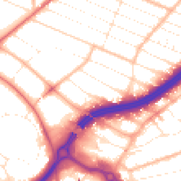
Daytime· 07:00 – 23:00
53.6dB
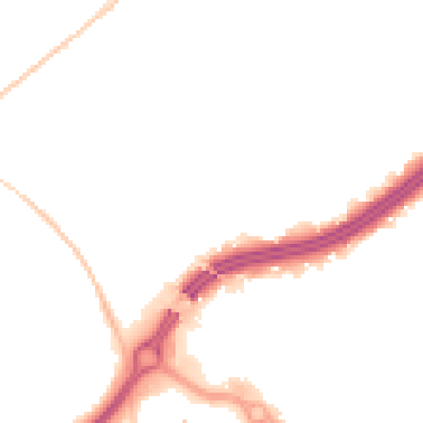
Night-time· 23:00 – 07:00
44.0dB