23 Springfield Road, Wolverhampton, WV10 0LQ
About 23 Springfield Road
23 Springfield Road is a three-bedroom semi-detached house in Wolverhampton (WV10 0LQ). It has a recorded floor area of 113 m² (around 1216 sq ft), construction records dating it to 1900-1929 and council tax band A. Tenure is freehold. The latest certificate (May 2021) shows a D (score 62), on the cusp of jumping into the C band. The rating has held steady at D across 2 certificates since March 2011. The recommended improvements would lift it to B (score 82), a 2-band jump.
Held since July 1997 — that's 29 years off the open market, well above the local norm. Only one transfer is on record with HM Land Registry, suggesting it has stayed in the same hands for a long time. Today's modelled estimate of £212,000 sits 1414.3% above the 1997 sale of £14,000. On a £-per-square-foot basis, the last sale (£12/sq ft) was about 85.9% below the postcode norm. At 113 m² it's 27% larger than the typical home in the postcode (89 m² median across 49 EPCs).
What this property has
Inside
- Bedrooms3
- Bathrooms1
- Dining roomYes
Outside
- Private gardenRear
Building
- TenureFreehold
Everything you need to know about 23 Springfield Road
The true value, the hidden risks and the full sale history, in one report.
Pick your report · every report is £14.99
One time fee only - money back guarantee

The data behind every report


Energy performance
Recommended upgrades on file would lift this property by multiple EPC bands.
EPC Rating
Get a survey for this property
Level 3 Building Survey
Because the property was built before 1919, has been extended more than once, and has solid (non-cavity) walls, we believe a Level 3 building survey should be considered.
From £885 · Includes VAT
Planning history
23 Springfield Road has no planning applications on record.
But the area is active
4 notable applications nearby — larger schemes and conversions that could reshape the street. The report maps them all.
Sales history & valuation
Latest sale on 23 Springfield Road was the lowest on Land Registry record across the postcode.
£212,000
Modelled from EPC, postcode comparables.
£14,000
Recorded with HM Land Registry.
Sales timeline
2 July 1997Most recent
£14,000
Median price across the last 5 sales in WV10 0LQ: £160,000 (2024–2023).
Nearby sales in WV10 0LQ
137 Springfield Road, Wolverhampton, WV10 0LQ
Sold Oct 2024
£160,00051 Springfield Road, Wolverhampton, WV10 0LQ
Sold Jun 2024
£215,000129 Springfield Road, Wolverhampton, WV10 0LQ
Sold Jan 2024
£161,00049 Springfield Road, Wolverhampton, WV10 0LQ
Sold Dec 2023
£100,000153 Springfield Road, Wolverhampton, WV10 0LQ
Sold Sept 2023
£132,500
Versus other Springfield Road homes
23 Springfield Road is notably below the street on price per m².
Price per m²
£124
Street avg £1,177
Floor Area
113 m²
Street avg 91 m²
Habitable Rooms
6 rooms
Street avg 5 rooms
CO₂ Emissions
5.4 t/year
Street avg 5.0 t/year
Everything you need to know about 23 Springfield Road
The true value, the hidden risks and the full sale history, in one report.
Pick your report · every report is £14.99
One time fee only - money back guarantee
The data behind every report
Similar properties nearby
The neighbourhood at a glance
Rail-style transport is unusually close for this postcode.
Crime
6/mo
Steady year-on-year across the wider district.
Nearest stop
0.6 km
Wolverhampton Rail Station — railway station.
Closest school
0.2 km
Woden Primary School. 39 schools nearby.
Go deeper on the local area
A Local Area report breaks down crime, transport links, schools and air quality in depth.
Road noise across the postcode
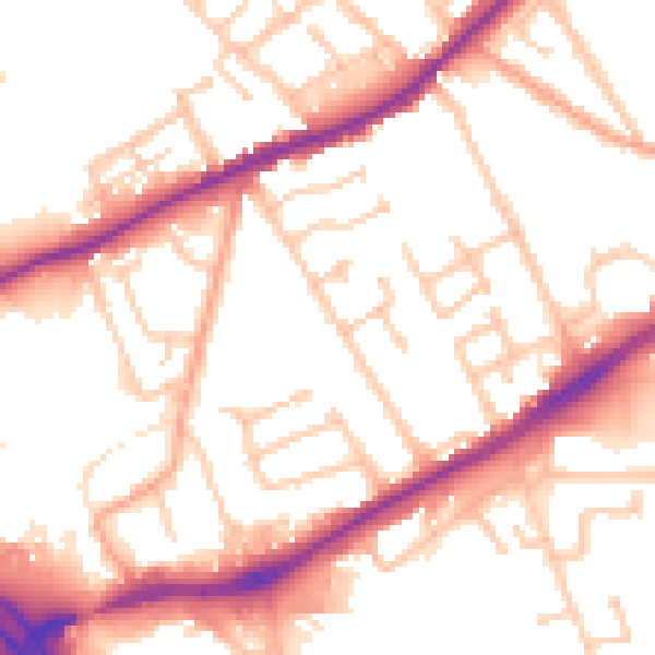
Daytime· 07:00 – 23:00
53.1dB

Night-time· 23:00 – 07:00
43.9dB