1 Jeremiah Road, Wolverhampton, WV10 0AJ
About 1 Jeremiah Road
1 Jeremiah Road is a three-bedroom semi-detached house in Wolverhampton (WV10 0AJ). It has a recorded floor area of 89 m² (around 958 sq ft), construction records dating it to 2007 onwards and council tax band C. The latest certificate (October 2016) shows a C (score 76), near the top of the C band. The recommended improvements would push it to B (score 88).
Held since December 2007 — that's 18 years off the open market, well above the local norm. That sale landed at the peak of the pre-credit-crunch market, which is a useful reference point when interpreting the price. Today's modelled estimate of £231,000 is 38.3% above the 2007 sale price. On a £-per-square-foot basis, the last sale (£174/sq ft) was about 22.6% above the typical sold price in the postcode.
What this property has
Inside
- Bedrooms3
- Bathrooms2
Everything you need to know about 1 Jeremiah Road
The true value, the hidden risks and the full sale history, in one report.
Pick your report · every report is £14.99
One time fee only - money back guarantee

The data behind every report


Energy performance
EPC Rating
Get a survey for this property
Level 2 HomeBuyer Report
We've checked 10 risk factors against the available data for this property and believe a Level 2 HomeBuyer Report could be a suitable option for you.
From £545 · Includes VAT
Planning history
1 Jeremiah Road has no planning applications on record.
But the area is active
4 notable applications nearby — larger schemes and conversions that could reshape the street. The report maps them all.
Sales history & valuation
The latest sale landed at the peak of the pre-credit-crunch market — a high-water reference point.
£231,000
Modelled from EPC, postcode comparables.
£167,000
Recorded with HM Land Registry.
Sales timeline
21 December 2007Most recent
£167,000
Median price across the last 5 sales in WV10 0AJ: £185,500 (2023–2019).
Nearby sales in WV10 0AJ
7 Jeremiah Road, Wolverhampton, WV10 0AJ
Sold Dec 2023
£240,00043 Jeremiah Road, Wolverhampton, WV10 0AJ
Sold Apr 2022
£231,00041 Jeremiah Road, Wolverhampton, WV10 0AJ
Sold Mar 2021
£150,0005 Jeremiah Road, Wolverhampton, WV10 0AJ
Sold Oct 2019
£150,00021 Jeremiah Road, Wolverhampton, WV10 0AJ
Sold May 2019
£185,500
Versus other Jeremiah Road homes
Years Held for 1 Jeremiah Road runs comfortably ahead of the street norm.
Price per m²
£1,876
Street avg £1,709
Floor Area
89 m²
Street avg 100 m²
Habitable Rooms
5 rooms
Street avg 5 rooms
CO₂ Emissions
2.4 t/year
Street avg 2.5 t/year
Everything you need to know about 1 Jeremiah Road
The true value, the hidden risks and the full sale history, in one report.
Pick your report · every report is £14.99
One time fee only - money back guarantee
The data behind every report
Similar properties nearby
The neighbourhood at a glance
Rail-style transport is unusually close for this postcode.
Crime
6/mo
Steady year-on-year across the wider district.
Nearest stop
0.8 km
Wolverhampton Rail Station — railway station.
Closest school
0.1 km
St Stephen's Church of England Primary School. 39 schools nearby.
Go deeper on the local area
A Local Area report breaks down crime, transport links, schools and air quality in depth.
Road noise across the postcode
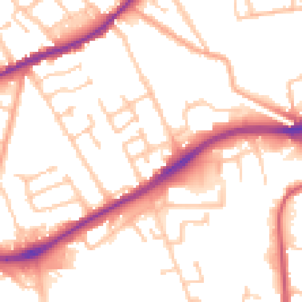
Daytime· 07:00 – 23:00
52.4dB

Night-time· 23:00 – 07:00
42.9dB