14 Jacobs Hall Lane, Walsall, WS6 6AD
About 14 Jacobs Hall Lane
14 Jacobs Hall Lane is a five-bedroom detached house in Walsall (WS6 6AD). It has a recorded floor area of 247 m² (around 2659 sq ft), construction records dating it to 2003-2006 and council tax band G. The latest certificate (March 2021) shows a C (score 77), near the top of the C band. The recommended improvements would push it to B (score 81). Other recorded features include a balcony. Period features are noted in the property record.
At 247 m² the property is well over the postcode median (93 m² across 28 EPCs), placing it in the larger end of the local stock. Its energy rating outperforms most of the postcode (better than 79% of similar EPCs). 5 bedrooms is on the larger side for this postcode, where 3 is the typical count. Across 2006–2021, sale prices on this property compounded at 2.6% per year. Today's modelled estimate of £768,000 is 13.8% above the 2021 sale price. On a £-per-square-foot basis, the last sale (£254/sq ft) was about 33.3% above the typical sold price in the postcode. Sold October 2021 for £675,000. That sale was during the post-pandemic price surge, when transactions cleared materially above pre-2020 trend. One historical planning record sits against the property in 2024.
What this property has
Inside
- Bedrooms5
- Bathrooms3
- Dining roomYes
- EnsuiteYes
Outside
- Private gardenSouth-facing
- GarageDouble
- BalconyYes
Building
- Period featuresYes
Everything you need to know about 14 Jacobs Hall Lane
The true value, the hidden risks and the full sale history, in one report.
Pick your report · every report is £14.99
One time fee only - money back guarantee

The data behind every report


Energy performance
14 Jacobs Hall Lane's carbon output runs well above what efficient homes in the postcode produce.
EPC Rating
Get a survey for this property
Level 2 HomeBuyer Report
We've checked 10 risk factors against the available data for this property and believe a Level 2 HomeBuyer Report could be a suitable option for you.
From £995 · Includes VAT
Planning history
1 application on record at 14 Jacobs Hall Lane, Walsall, WS6 6AD
- Mar 2024RenovationFullOutcome in report
Retention of driveway gate, front boundary wall and railings and brick pillars
- Documents
- 13 docs on file
- Reference
- 23/00946/FULHH
Unlock 14 Jacobs Hall Lane, Walsall, WS6 6AD's full planning history
You're seeing the shape of it. The report has the substance.
- Every decision — granted, refused or withdrawn (1 on record)
- All 1 application on this property in full, plus 2 notable nearby
- The 13 documents, officer reports & conditions
- What the pattern means for extending or converting here
One time fee only - money back guarantee
Sales history & valuation
Latest sale on 14 Jacobs Hall Lane was the highest on Land Registry record across the postcode.
£768,000
Modelled from EPC, postcode comparables and a sale-price growth of 2.6% per year over 16 years.
£675,000
Growth on file: 2.6% per year over 16 years.
Sales timeline
14 October 2021Most recent
£675,000
+50.0%over 15 years6 January 2006
£450,000
Median price across the last 5 sales in WS6 6AD: £297,000 (2025–2022).
Nearby sales in WS6 6AD
Versus other Jacobs Hall Lane homes
14 Jacobs Hall Lane outperforms the street on floor area by a wide margin.
Price per m²
£2,733
Street avg £2,619
Floor Area
247 m²
Street avg 109 m²
Habitable Rooms
10 rooms
Street avg 5 rooms
CO₂ Emissions
6.1 t/year
Street avg 5.1 t/year
Everything you need to know about 14 Jacobs Hall Lane
The true value, the hidden risks and the full sale history, in one report.
Pick your report · every report is £14.99
One time fee only - money back guarantee
The data behind every report
Similar properties nearby
1 Appledore Close, Great Wyrley
WS6 6DQ
1 Estridge Lane
WS6 6EL
1 Bentons Lane
WS6 6EF
1 Anson Road, Great Wyrley
WS6 6JE
1 Brooklands Avenue
WS6 6LF
1 Bobbin Close, Great Wyrley
WS6 6GF
1 Brook Lane, Great Wyrley
WS6 6BQ
1 Alpha Way
WS6 6AH
The neighbourhood at a glance
Rail-style transport is unusually close for this postcode.
Crime
3/mo
Steady year-on-year across the wider district.
Nearest stop
0.3 km
Jacobs Hall Lane — bus stop.
Closest school
0.8 km
Landywood Primary School. 8 schools nearby.
Go deeper on the local area
A Local Area report breaks down crime, transport links, schools and air quality in depth.
Road noise across the postcode
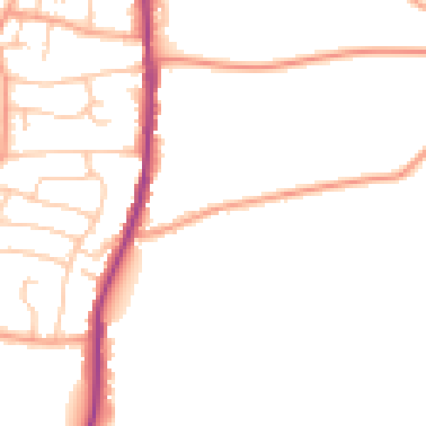
Daytime· 07:00 – 23:00
47.1dB

Night-time· 23:00 – 07:00
38.7dB