1 Pasture View, Pelsall, Walsall, WS3 4NP
About 1 Pasture View
1 Pasture View is a four-bedroom detached house in Pelsall, Walsall, Walsall (WS3 4NP). It has a recorded floor area of 147 m² (around 1582 sq ft), construction records dating it to 1996-2002 and council tax band E. The property has an EV charger on record, all of which lower running costs and tend to lift resale appeal. Other recorded features include outbuildings. Records show the property has been extended at some point in its history. The latest certificate (May 2025) shows a C (score 72).
At 147 m² the property is well over the postcode median (109 m² across 5 EPCs), placing it in the larger end of the local stock. On energy efficiency it sits in the top 10% of properties in this postcode. It changed hands recently, sold October 2025 for £485,000. 3 planning records sit against the property, 2 approved, 0 refused. Past consents include an extension, meaningful when judging how the property has evolved. Across 1998–2025, sale prices on this property compounded at 6.3% per year. On a £-per-square-foot basis, the last sale (£307/sq ft) was about 108.2% above the typical sold price in the postcode.
What this property has
Inside
- Bedrooms4
- Bathrooms2
- Open-plan layoutYes
- Dining roomYes
- Utility roomYes
- CloakroomYes
- EnsuiteYes
- FireplaceYes
Outside
- Private gardenRear
- DrivewayYes
- OutbuildingsYes
Building
- EV chargerYes
- Previously extendedYes
Everything you need to know about 1 Pasture View
The true value, the hidden risks and the full sale history, in one report.
Pick your report · from £14.99
One time fee only - money back guarantee

The data behind every report







Energy performance
1 Pasture View ranks among the most efficient homes in the postcode for energy use.
EPC Rating
Certificate validity
Valid until 1 May 2035

Get a survey for this property
Level 3 Building Survey
Because the property has permanent outbuildings, we believe a Level 3 building survey should be considered.
From £1,020 · Includes VAT
Planning history
1 Pasture View has an approved single-storey rear extension on the planning record.
3 applications on record at 1 Pasture View, Pelsall, Walsall, WS3 4NP
- Oct 2008FullOutcome in report
Boundary Wall
- Reference
- 08/1634/FL
- More recent applications — locked
- FullFeb 2023Decision
- ExtensionMar 2012Decision
Unlock 1 Pasture View, Pelsall, Walsall, WS3 4NP's full planning history
You're seeing the shape of it. The report has the substance.
- Every decision — granted, refused or withdrawn (2 on record)
- All 3 applications on this property in full, plus 1 notable nearby
- The 7 documents, officer reports & conditions
- What the pattern means for extending or converting here
One time fee only - money back guarantee
Sales history & valuation
Latest sale on 1 Pasture View was the highest on Land Registry record across the postcode.
£498,000
Modelled from EPC, postcode comparables and a sale-price growth of 6.3% per year over 27 years.
£485,000
Growth on file: 6.3% per year over 27 years.
Sales timeline
27 October 2025Most recent
£485,000
+438.9%over 26 years25 August 1999
£90,000
+1.1%over 1 year25 June 1998
£89,000
-3.3%25 June 1998
£92,000
Median price across the last 5 sales in WS3 4NP: £202,000 (2022–2007).
Nearby sales in WS3 4NP
6 Pasture View, Pelsall, Walsall, WS3 4NP
Sold Nov 2022
£365,0007 Pasture View, Pelsall, Walsall, WS3 4NP
Sold Nov 2015
£250,0004 Pasture View, Pelsall, Walsall, WS3 4NP
Sold Nov 2014
£202,0009 Pasture View, Pelsall, Walsall, WS3 4NP
Sold Mar 2013
£188,0008 Pasture View, Pelsall, Walsall, WS3 4NP
Sold Sept 2007
£193,000
Versus other Pasture View homes
On price per m², 1 Pasture View stands well clear of the street.
Price per m²
£3,299
Street avg £2,034
Floor Area
147 m²
Street avg 117 m²
Habitable Rooms
6 rooms
Street avg 6 rooms
CO₂ Emissions
5.0 t/year
Street avg 5.7 t/year
Everything you need to know about 1 Pasture View
The true value, the hidden risks and the full sale history, in one report.
Pick your report · from £14.99
One time fee only - money back guarantee
The data behind every report
Similar properties nearby
1 Commonside, Pelsall
WS3 4QL
1 Almond Close
WS3 4LA
1 Enterprise Grove, Pelsall
WS3 4PY
1 Hall Lane, Pelsall
WS3 4JQ
1 Green Lane, Pelsall
WS3 4PA
1 Farriers Mill, Pelsall
WS3 4QZ
1 Copse Crescent
WS3 4DY
1 Clockmill Avenue
WS3 4AN
The neighbourhood at a glance
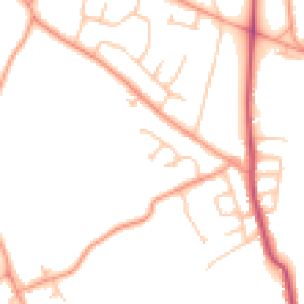
Daytime road noise here sits well below conversation level — a quiet pocket of the postcode.
Crime
337/mo
Steady year-on-year across the wider district.
Nearest stop
2.6 km
Bloxwich Rail Station — railway station.
Closest school
0.4 km
St Michael's Church of England C Primary School. 23 schools nearby.
Go deeper on the local area
A Local Area report breaks down crime, transport links, schools and air quality in depth.
Road noise across the postcode
Daytime· 07:00 – 23:00
48.4dB

Night-time· 23:00 – 07:00
38.6dB