12 Field Road, Watford, WD19 4DR
About 12 Field Road
12 Field Road is a four-bedroom mid-terrace house in Watford (WD19 4DR). It has a recorded floor area of 122 m² (around 1313 sq ft), construction records dating it to 1900-1929 and council tax band D. The latest certificate (January 2020) shows a D (score 62), on the cusp of jumping into the C band. When first surveyed in December 2011 the rating was E, the property has climbed 1 band since. Between certificates, lighting went from Very Poor to Very Good; while roof efficiency dropped from Good to Very Poor. The recommended improvements would push it to C (score 76). Period features are noted in the property record.
At 122 m² the property is well over the postcode median (92 m² across 11 EPCs), placing it in the larger end of the local stock. Across 1998–2020, sale prices on this property compounded at 9.8% per year. Today's modelled estimate of £733,000 is 14.5% above the 2020 sale price. Last sale on file: £640,000 in March 2020. One historical planning record sits against the property in 2012.
What this property has
Inside
- Bedrooms4
- Bathrooms2
- Dining roomYes
- EnsuiteYes
Outside
- Private gardenSouth-east-facing
Building
- Period featuresYes
- RefurbishedYes
Everything you need to know about 12 Field Road
The true value, the hidden risks and the full sale history, in one report.
30-day money-back guarantee

The data behind every report


Energy performance
EPC Rating
Property Improvements
Changes detected from historical EPC data
Heating controls upgraded for better temperature management
More low energy lighting installed
Planning history
- Aug 2012ExtensionFullIn report
Extension: Single storey · Side and rear of property
Erection of single storey side and rear extension
- Documents
- 19 docs on file
- Reference
- 12/00733/FULH
We flagged 1 thing worth checking at 12 Field Road
Independent checks surfaced things a buyer would want to understand before offering. The report explains each one in full, with the underlying data and what to ask.
- Larger development activity nearby
30-day money-back guarantee
Sales history & valuation
12 Field Road has more than quadrupled in price since its earliest registered sale in 1998.
£733,000
Modelled from EPC, postcode comparables and a sale-price growth of 9.8% per year over 22 years.
£640,000
Growth on file: 9.8% per year over 22 years.
Sales timeline
24 March 2020Most recent
£640,000
+86.9%over 8 years9 March 2012
£342,500
+307.7%over 13 years9 July 1998
£84,000
Median price across the last 5 sales in WD19 4DR: £580,000 (2024–2020).
Versus other Field Road homes
CO₂ Emissions for 12 Field Road lags the street by a wide margin.
Price per m²
£5,246
Street avg £5,274
Floor Area
122 m²
Street avg 97 m²
Habitable Rooms
7 rooms
Street avg 5 rooms
CO₂ Emissions
5.3 t/year
Street avg 3.9 t/year
Everything you need to know about 12 Field Road
The true value, the hidden risks and the full sale history, in one report.
30-day money-back guarantee
The data behind every report
Similar properties nearby
1 Elm Avenue
WD19 4BD
1 Eley Place
WD19 4FQ
1 Cedar Road
WD19 4QP
1 Brookdene Avenue
WD19 4LG
1 Brookmill Close
WD19 4BB
1 Brookside Road
WD19 4BW
1 Blackwell Drive
WD19 4HP
1 Caroline Place, Capel Road
WD19 4AF
The neighbourhood at a glance
Rail-style transport is unusually close for this postcode.
Crime
4/mo
Steady year-on-year across the wider district.
Nearest stop
0.2 km
Grange Road — bus stop.
Closest school
0.3 km
Bushey and Oxhey Infant School. 34 schools nearby.
Go deeper on the local area
The full report breaks down crime, transport links, schools and air quality in depth.
Road noise across the postcode
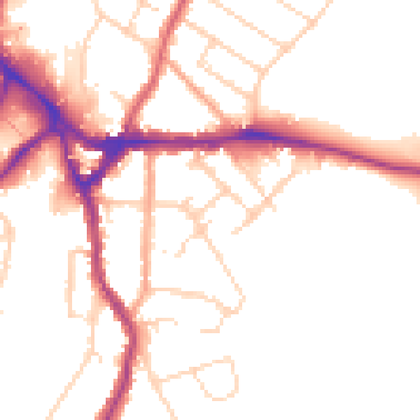
Daytime· 07:00 – 23:00
50.1dB

Night-time· 23:00 – 07:00
41.7dB