33 St Johns Road, Watford, WD17 1QB
About 33 St Johns Road
33 St Johns Road is a two-bedroom detached house in Watford (WD17 1QB). It has a recorded floor area of 82 m² (around 883 sq ft), construction records dating it to 1900-1929 and council tax band B. The latest certificate (November 2018) shows a D (score 65), on the cusp of jumping into the C band. Earlier certificates rated it C (November 2008); the latest reading is one band lower. Between certificates, lighting went from Very Poor to Very Good; while window efficiency dropped from Good to Average. The recommended improvements would push it to C (score 77). At 82 m² this is the 9th smallest of 21 units on EPC record in the building, where floor areas span 24–185 m². The building's EPC ratings span E to B across 21 units on file.
It hasn't traded since October 2005, a hold of 21 years that's notably long for the area. At 82 m² it sits well below the postcode median (125 m² across 20 EPCs), making it one of the more compact homes locally. Across 2004–2005, sale prices on this property compounded at 18.2% per year. Today's modelled estimate of £384,000 is 25.9% above the 2005 sale price. On a £-per-square-foot basis, the last sale (£346/sq ft) was about 41.5% above the typical sold price in the postcode. 2 planning records sit against the property, 0 approved, 1 refused.
What this property has
Inside
- Bedrooms2
Everything you need to know about 33 St Johns Road
The true value, the hidden risks and the full sale history, in one report.
30-day money-back guarantee

The data behind every report


Energy performance
EPC Rating
Property Improvements
Changes detected from historical EPC data
Heating controls changed
More low energy lighting installed
Heating controls upgraded for better temperature management
Low energy lighting percentage decreased
Heating controls changed
More low energy lighting installed
Planning history
Council records include a part-single-part-two-storey side and rear extension at 33 St Johns Road.
- Apr 2018ExtensionFullIn report
Extension: Part single, part two storey
Erection of a single storey rear extension, two storey side extension with roof alterations to extend the existing dwellings.
- Documents
- 14 docs on file
- Reference
- 18/00324/FUL
- Feb 2018ExtensionFullIn report
Extension: Part single, part two storey · Side and rear of property
Erection of a part three storey, part second floor side extension and a single storey rear extension to extend the existing dwellings.
- Documents
- 18 docs on file
- Reference
- 17/01740/FUL
We flagged 2 things worth checking at 33 St Johns Road
Independent checks surfaced things a buyer would want to understand before offering. The report explains each one in full, with the underlying data and what to ask.
- Signs of HMO activity in the area
- Larger development activity nearby
30-day money-back guarantee
Sales history & valuation
33 St Johns Road changed hands twice within eighteen months — unusual for the area.
£384,000
Modelled from EPC, postcode comparables and a sale-price growth of 18.2% per year over 2 years.
£305,000
Growth on file: 18.2% per year over 2 years.
Sales timeline
2 October 2005Most recent
£305,000
+4.5%5 April 2005
£292,000
+27.0%over 1 year26 January 2004
£230,000
Median price across the last 5 sales in WD17 1QB: £398,000 (2023–2021).
Nearby sales in WD17 1QB
Versus other St Johns Road homes
Price per m² for 33 St Johns Road lags the street by a wide margin.
Price per m²
£3,720
Street avg £7,593
Floor Area
82 m²
Street avg 58 m²
Habitable Rooms
4 rooms
Street avg 3 rooms
CO₂ Emissions
3.6 t/year
Street avg 2.6 t/year
Everything you need to know about 33 St Johns Road
The true value, the hidden risks and the full sale history, in one report.
30-day money-back guarantee
The data behind every report
Similar properties nearby
10 Terrace Gardens
WD17 1RB
10 Franklin Road
WD17 1QD
1 Franklin Road
WD17 1QD
1 Orphanage Road
WD17 1PG
10 Elm Court, Albert Road South
WD17 1QQ
1 Wellington Road
WD17 1QU
1 Elm Court, Albert Road South
WD17 1QQ
10 Caledonian Court, West Street
WD17 1RY
The neighbourhood at a glance
Rail-style transport is unusually close for this postcode.
Crime
10/mo
Steady year-on-year across the wider district.
Nearest stop
0.1 km
Beechen Grove North — bus stop.
Closest school
0.4 km
Watford St John's Church of England Primary School. 36 schools nearby.
Go deeper on the local area
The full report breaks down crime, transport links, schools and air quality in depth.
Road noise across the postcode
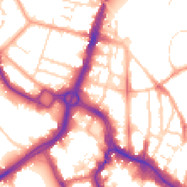
Daytime· 07:00 – 23:00
55.0dB

Night-time· 23:00 – 07:00
45.6dB