23 Alfred Road, Lowton, Warrington, WA3 1EA
About 23 Alfred Road
23 Alfred Road is an end-of-terrace house in Lowton, Warrington, Warrington (WA3 1EA). It has a recorded floor area of 70 m² (around 753 sq ft), construction records dating it to 1930-1949 and council tax band A. The latest certificate (July 2022) shows a D (score 64), on the cusp of jumping into the C band. The rating has held steady at D across 3 certificates since June 2010. Between certificates, wall efficiency dropped from Poor to Very Poor and roof efficiency dropped from Good to Poor. The recommended improvements would lift it to B (score 88), a 2-band jump.
Across 2003–2022, sale prices on this property compounded at 3.4% per year. Today's modelled estimate of £181,000 is 47.2% above the 2022 sale price. On a £-per-square-foot basis, the last sale (£163/sq ft) was about 20.9% above the typical sold price in the postcode. Last sale on file: £123,000 in October 2022. That sale was during the post-pandemic price surge, when transactions cleared materially above pre-2020 trend.
Everything you need to know about 23 Alfred Road
The true value, the hidden risks and the full sale history, in one report.
Pick your report · every report is £14.99
One time fee only - money back guarantee

The data behind every report


Energy performance
Recommended upgrades on file would lift this property by multiple EPC bands.
EPC Rating
Property Improvements
Changes detected from historical EPC data
Get a survey for this property
Level 3 Building Survey
Because the property has solid (non-cavity) walls, we believe a Level 3 building survey should be considered.
From £820 · Includes VAT
Planning history
23 Alfred Road has no planning applications on record.
A planning report still maps activity across the surrounding area and reads this property's extension & conversion potential.
Sales history & valuation
The latest sale landed in the post-pandemic price surge — useful context when reading the figure.
£181,000
Modelled from EPC, postcode comparables and a sale-price growth of 3.4% per year over 19 years.
£123,000
Growth on file: 3.4% per year over 19 years.
Sales timeline
23 October 2022Most recent
£123,000
+89.2%over 19 years3 July 2003
£65,000
Median price across the last 5 sales in WA3 1EA: £123,000 (2024–2016).
Nearby sales in WA3 1EA
45 Alfred Road, Lowton, Warrington, WA3 1EA
Sold Aug 2024
£198,00039 Alfred Road, Lowton, Warrington, WA3 1EA
Sold Mar 2021
£185,0003 Alfred Road, Lowton, Warrington, WA3 1EA
Sold Jul 2018
£88,00017 Alfred Road, Lowton, Warrington, WA3 1EA
Sold Jun 2016
£109,00025 Alfred Road, Lowton, Warrington, WA3 1EA
Sold May 2015
£115,000
Versus other Alfred Road homes
Floor Area for 23 Alfred Road lags the street by a wide margin.
Price per m²
£1,757
Street avg £1,522
Floor Area
70 m²
Street avg 78 m²
Habitable Rooms
4 rooms
Street avg 5 rooms
CO₂ Emissions
3.3 t/year
Street avg 3.3 t/year
Everything you need to know about 23 Alfred Road
The true value, the hidden risks and the full sale history, in one report.
Pick your report · every report is £14.99
One time fee only - money back guarantee
The data behind every report
Similar properties nearby
1 Gregory Row, Lowton
WA3 1DJ
1 Kay Gardens, Lowton
WA3 1AG
1 Chapel Terrace, Lowton
WA3 1EF
1 Bodden Street, Lowton
WA3 1DX
1 Carr Lane, Lowton
WA3 1AF
1 Carr Green, Lowton
WA3 1EQ
1 Heathmoor Avenue, Lowton
WA3 1HP
1 Clayhill Grove, Lowton
WA3 1FZ
The neighbourhood at a glance
Daytime road noise here sits well below conversation level — a quiet pocket of the postcode.
Crime
1/mo
Steady year-on-year across the wider district.
Nearest stop
0.2 km
Morgans Way — bus stop.
Closest school
0.1 km
Lowton St Mary's CofE (Voluntary Aided) Primary School. 13 schools nearby.
Go deeper on the local area
A Local Area report breaks down crime, transport links, schools and air quality in depth.
Road noise across the postcode
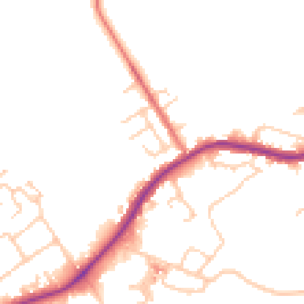
Daytime· 07:00 – 23:00
48.6dB

Night-time· 23:00 – 07:00
42.4dB