4 Carr Lane, Lowton, Warrington, WA3 1AQ
About 4 Carr Lane
4 Carr Lane is a two-bedroom semi-detached house in Lowton, Warrington, Warrington (WA3 1AQ). It has a recorded floor area of 73 m² (around 786 sq ft), construction records dating it to 1996-2002 and council tax band C. Other recorded features include a conservatory. The latest certificate (September 2024) shows a C (score 69), just inside the C band. The recommended improvements would push it to B (score 83).
Untraded for 20 years, with the last transfer in November 2006. Across 2000–2006, sale prices on this property compounded at 12.6% per year. Today's modelled estimate of £204,000 sits 63.3% above the 2006 sale of £124,950. On a £-per-square-foot basis, the last sale (£159/sq ft) was about 42.8% above the typical sold price in the postcode.
What this property has
Inside
- Bedrooms2
- Bathrooms1
- ConservatoryYes
Outside
- Private gardenYes
Everything you need to know about 4 Carr Lane
The true value, the hidden risks and the full sale history, in one report.
Pick your report · every report is £14.99
One time fee only - money back guarantee

The data behind every report


Energy performance
EPC Rating
Get a survey for this property
Level 2 HomeBuyer Report
We've checked 10 risk factors against the available data for this property and believe a Level 2 HomeBuyer Report could be a suitable option for you.
From £545 · Includes VAT
Planning history
4 Carr Lane has no planning applications on record.
A planning report still maps activity across the surrounding area and reads this property's extension & conversion potential.
Sales history & valuation
4 Carr Lane has more than doubled in price since the earliest registered sale in 2000.
£204,000
Modelled from EPC, postcode comparables and a sale-price growth of 12.6% per year over 6 years.
£124,950
Growth on file: 12.6% per year over 6 years.
Sales timeline
30 November 2006Most recent
£124,950
+115.6%over 6 years15 June 2000
£57,950
Median price across the last 5 sales in WA3 1AQ: £145,000 (2022–2011).
Nearby sales in WA3 1AQ
2 Carr Lane, Lowton, Warrington, WA3 1AQ
Sold Sept 2022
£220,00018 Carr Lane, Lowton, Warrington, WA3 1AQ
Sold Nov 2013
£145,00016 Carr Lane, Lowton, Warrington, WA3 1AQ
Sold Feb 2011
£128,0006 Carr Lane, Lowton, Warrington, WA3 1AQ
Sold Jul 2006
£124,99512 Carr Lane, Lowton, Warrington, WA3 1AQ
Sold Jan 2002
£69,950
Versus other Carr Lane homes
Price per m²
£1,712
Street avg £1,846
Floor Area
73 m²
Street avg 75 m²
Habitable Rooms
4 rooms
Street avg 5 rooms
CO₂ Emissions
2.9 t/year
Street avg 2.8 t/year
Everything you need to know about 4 Carr Lane
The true value, the hidden risks and the full sale history, in one report.
Pick your report · every report is £14.99
One time fee only - money back guarantee
The data behind every report
Similar properties nearby
1 Chapel Terrace, Lowton
WA3 1EF
1 Carr Lane, Lowton
WA3 1AF
1 Bodden Street, Lowton
WA3 1DX
1 Heathmoor Avenue, Lowton
WA3 1HP
1 Clayhill Grove, Lowton
WA3 1FZ
1 Adwell Close, Lowton
WA3 1DE
1 Kirkham Avenue, Lowton
WA3 1LL
1 Glastonbury Avenue, Lowton
WA3 1ET
The neighbourhood at a glance
Crime
1/mo
Steady year-on-year across the wider district.
Nearest stop
0.2 km
Pocket Nook Lane — bus stop.
Closest school
0.3 km
Lowton Junior and Infant School. 11 schools nearby.
Go deeper on the local area
A Local Area report breaks down crime, transport links, schools and air quality in depth.
Road noise across the postcode
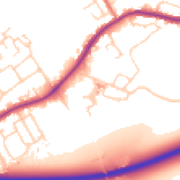
Daytime· 07:00 – 23:00
54.4dB

Night-time· 23:00 – 07:00
47.8dB