8 Cotterill Drive, Woolston, Warrington, WA1 4AS
About 8 Cotterill Drive
8 Cotterill Drive is a three-bedroom semi-detached house in Woolston, Warrington, Warrington (WA1 4AS). It has a recorded floor area of 105 m² (around 1130 sq ft), construction records dating it to 1950-1966 and council tax band B. The latest certificate (February 2020) shows a D (score 59), a step below the typical UK home. The recommended improvements would lift it to B (score 83), a 2-band jump. Other recorded features include a conservatory and attached land beyond the plot.
At 105 m² it's 23.5% larger than the typical home in the postcode (85 m² median across 5 EPCs). Today's modelled estimate of £250,000 is 47.9% above the 2020 sale price. On a £-per-square-foot basis, the last sale (£150/sq ft) was about 39.6% above the typical sold price in the postcode. Sold July 2020 for £169,000.
What this property has
Inside
- Bedrooms3
- Bathrooms1
- ConservatoryYes
Outside
- LandYes
Everything you need to know about 8 Cotterill Drive
The true value, the hidden risks and the full sale history, in one report.
30-day money-back guarantee

The data behind every report


Energy performance
Recommended upgrades on file would lift this property by multiple EPC bands.
EPC Rating
Planning history
8 Cotterill Drive has no planning applications on record.
Notable planning nearby
3applications of note in the surrounding area
We flagged 1 thing worth checking at 8 Cotterill Drive
Independent checks surfaced things a buyer would want to understand before offering. The report explains each one in full, with the underlying data and what to ask.
- Larger development activity nearby
30-day money-back guarantee
Sales history & valuation
The latest sale landed in the post-pandemic price surge — useful context when reading the figure.
£250,000
Modelled from EPC, postcode comparables.
£169,000
Recorded with HM Land Registry.
Sales timeline
9 July 2020Most recent
£169,000
Median price across the last 5 sales in WA1 4AS: £138,000 (2022–2012).
Nearby sales in WA1 4AS
Versus other Cotterill Drive homes
On price per m², 8 Cotterill Drive runs well behind the street norm.
Price per m²
£1,610
Street avg £2,208
Floor Area
105 m²
Street avg 93 m²
Habitable Rooms
6 rooms
Street avg 5 rooms
CO₂ Emissions
4.5 t/year
Street avg 4.0 t/year
Everything you need to know about 8 Cotterill Drive
The true value, the hidden risks and the full sale history, in one report.
30-day money-back guarantee
The data behind every report
Similar properties nearby
1 Baron Close, Woolston
WA1 4EU
1 Epping Drive, Woolston
WA1 4QL
1 Clifton Close, Woolston
WA1 4BE
1 Ascot Close, Woolston
WA1 4HE
1 Berkshire Drive, Woolston
WA1 4EX
1 Firtree Avenue, Padgate
WA1 4HY
1 Alder Road, Woolston
WA1 4EJ
1 Durham Close, Woolston
WA1 4DZ
The neighbourhood at a glance
Crime
3/mo
Steady year-on-year across the wider district.
Nearest stop
0.1 km
Greymist Avenue — bus stop.
Closest school
0.3 km
Woolston Community Primary School. 27 schools nearby.
Go deeper on the local area
The full report breaks down crime, transport links, schools and air quality in depth.
Road noise across the postcode
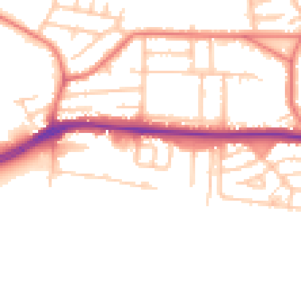
Daytime· 07:00 – 23:00
51.6dB

Night-time· 23:00 – 07:00
42.9dB