2 All Saints Terrace, Shrewsbury, SY1 2LG
About 2 All Saints Terrace
2 All Saints Terrace is a two-bedroom mid-terrace house in Shrewsbury (SY1 2LG). It has a recorded floor area of 55 m² (around 592 sq ft), construction records dating it to 1996-2002 and council tax band B. The latest certificate (November 2015) shows a C (score 69), just inside the C band. The recommended improvements would push it to B (score 86). The latest certificate is from November 2015, so improvements made since then won't be reflected.
Held since December 2000 — that's 25 years off the open market, well above the local norm. Across 1996–2000, sale prices on this property compounded at 6% per year. Today's modelled estimate of £180,000 sits 200% above the 2000 sale of £60,000. On a £-per-square-foot basis, the last sale (£101/sq ft) was about 51.4% below the postcode norm.
What this property has
Inside
- Bedrooms2
Everything you need to know about 2 All Saints Terrace
The true value, the hidden risks and the full sale history, in one report.
30-day money-back guarantee

The data behind every report


Energy performance
EPC Expired
This certificate is over 10 years old and is no longer valid.Expired 05 Nov 2025
EPC Rating
Planning history
2 All Saints Terrace has no planning applications on record.
Notable planning nearby
2applications of note in the surrounding area
Sales history & valuation
2 All Saints Terrace's estimated value is more than triple its earliest registered sale price (1996).
£180,000
Modelled from EPC, postcode comparables and a sale-price growth of 6.0% per year over 4 years.
£60,000
Growth on file: 6.0% per year over 4 years.
Sales timeline
8 December 2000Most recent
£60,000
+29.2%over 4 years25 July 1996
£46,450
Median price across the last 5 sales in SY1 2LG: £139,950 (2025–2004).
Everything you need to know about 2 All Saints Terrace
The true value, the hidden risks and the full sale history, in one report.
30-day money-back guarantee
The data behind every report
Similar properties nearby
1 Albert Street
SY1 2HT
1 Cornmill Square
SY1 2LQ
1 Argyll Street
SY1 2SF
1 Albafont Terrace, Severn Street
SY1 2HY
1 Broome Place
SY1 2DS
1 Coton Manor, Berwick Road
SY1 2LT
1 Benbow Quay
SY1 2DL
1 Corporation Lane
SY1 2PB
The neighbourhood at a glance
Rail-style transport is unusually close for this postcode.
Crime
10/mo
Rising year-on-year across the wider district.
Nearest stop
0.5 km
Shrewsbury Rail Station — railway station.
Closest school
0.6 km
Shrewsbury Cathedral Catholic Primary School and Nursery. 21 schools nearby.
Go deeper on the local area
The full report breaks down crime, transport links, schools and air quality in depth.
Road noise across the postcode
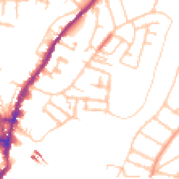
Daytime· 07:00 – 23:00
49.4dB

Night-time· 23:00 – 07:00
39.8dB