149 Streatham High Road, Lambeth, London, SW16 6EG
About 149 Streatham High Road
149 Streatham High Road is a mid-terrace house in Lambeth, London, London (SW16 6EG). It has a recorded floor area of 73 m² (around 786 sq ft) and construction records dating it to 1900-1929. At 73 m² this is the 17th smallest of 19 units on EPC record in the building, where floor areas span 11–74 m². The building's EPC ratings span E to C, with this unit at the bottom. On EPC score it ranks last in the building (39 versus a best of 80). The latest certificate (October 2021) shows an E (score 39), well below the UK norm with real room to improve. The recommended improvements would push it to D (score 66). Main heating runs on electricity.
Today's modelled estimate of £379,000 is 85.7% below the 2021 sale of £2,650,000, below the original sale price, which typically signals condition or completion-status changes worth verifying. On a £-per-square-foot basis, the last sale (£3,373/sq ft) was about 1372.3% above the typical sold price in the postcode. At 73 m² the property is well over the postcode median (41 m² across 63 EPCs), placing it in the larger end of the local stock. It lags the bulk of the postcode on energy efficiency (less efficient than 84% of similar EPCs). 6 planning records sit against the property, 4 approved, 2 refused. Sold December 2021 for £2,650,000. That sale was during the post-pandemic price surge, when transactions cleared materially above pre-2020 trend.
Everything you need to know about 149 Streatham High Road
The true value, the hidden risks and the full sale history, in one report.
Pick your report · from £14.99
One time fee only - money back guarantee

The data behind every report







Energy performance
EPC Rating
Certificate validity
Valid until 29 October 2031

Get a survey for this property
Level 3 Building Survey
Because the property was built before 1919, has no mains gas supply, and has solid (non-cavity) walls, we believe a Level 3 building survey should be considered.
From £955 · Includes VAT
Planning history
A recent planning application at 149 Streatham High Road was refused — worth checking the council file.
6 applications on record at 149 Streatham High Road, Lambeth, London, SW16 6EG
- Apr 2023Change of UseFullOutcome in report
Change of use of two semi-detached outbuildings at the rear of 147-149 Streatham High Road to a one-bed flat (C3), including alterations to the roof and the ground floor rear elevation of the commercial building, partial demolition of the rear boundary wall together with provision of waste and cycling store.
Demolition- Documents
- 11 docs on file
- Reference
- 23/00494/FUL
- More recent applications — locked
- Change Of UseJul 2025Decision
- RenovationSept 2023Decision
+ 3 more applications in the report
Unlock 149 Streatham High Road, Lambeth, London, SW16 6EG's full planning history
You're seeing the shape of it. The report has the substance.
- Every decision — granted, refused or withdrawn (6 on record)
- All 6 applications on this property in full, plus 8 notable nearby
- The 66 documents, officer reports & conditions
- What the pattern means for extending or converting here
One time fee only - money back guarantee
Sales history & valuation
Latest sale on 149 Streatham High Road was the highest on Land Registry record across the postcode.
£379,000
Modelled from EPC, postcode comparables.
£2,650,000
Recorded with HM Land Registry.
Sales timeline
22 December 2021Most recent
£2,650,000
Median price across the last 5 sales in SW16 6EG: £240,000 (2025–2019).
Nearby sales in SW16 6EG
181 Streatham High Road, Lambeth, London, SW16 6EG
Sold Nov 2025
£5,000199 Streatham High Road, Lambeth, London, SW16 6EG
Sold Jul 2025
£250,000Flat 1, 143 Streatham High Road, London, SW16 6EG
Sold Feb 2024
£280,000Flat B, 163 Streatham High Road, London, SW16 6EG
Sold May 2021
£200,000Flat A, 163 Streatham High Road, London, SW16 6EG
Sold Oct 2019
£240,000
Versus other Streatham High Road homes
CO₂ Emissions for 149 Streatham High Road lags the street by a wide margin.
Price per m²
£36,301
Street avg £8,530
Floor Area
73 m²
Street avg 43 m²
Habitable Rooms
2 rooms
Street avg 2 rooms
CO₂ Emissions
4.3 t/year
Street avg 1.9 t/year
Everything you need to know about 149 Streatham High Road
The true value, the hidden risks and the full sale history, in one report.
Pick your report · from £14.99
One time fee only - money back guarantee
The data behind every report
Similar properties nearby
1 Ambleside Gardens, Lambeth
SW16 6LH
1 Flather Close, Wandsworth
SW16 6BX
1 Brunswick Mews, Lambeth
SW16 6EA
1 Leverson Street, Wandsworth
SW16 6DQ
1 Besley Street, Wandsworth
SW16 6BH
1 Blegborough Road, Wandsworth
SW16 6DL
1 Kettering Street, Wandsworth
SW16 6QA
1 Gleneagle Road, Lambeth
SW16 6AX
The neighbourhood at a glance
Rail-style transport is unusually close for this postcode.
Crime
524/mo
Falling year-on-year across the wider district.
Nearest stop
0.0 km
St Leonard's Church — bus stop.
Closest school
0.4 km
St Leonard's Church of England Primary School. 68 schools nearby.
Go deeper on the local area
A Local Area report breaks down crime, transport links, schools and air quality in depth.
Road noise across the postcode
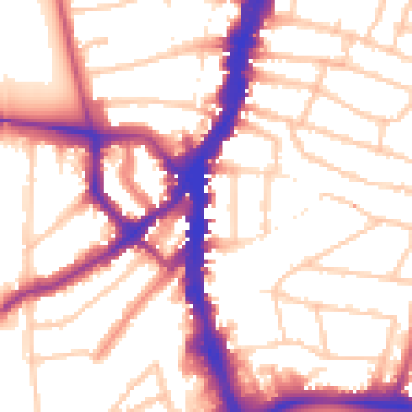
Daytime· 07:00 – 23:00
54.7dB
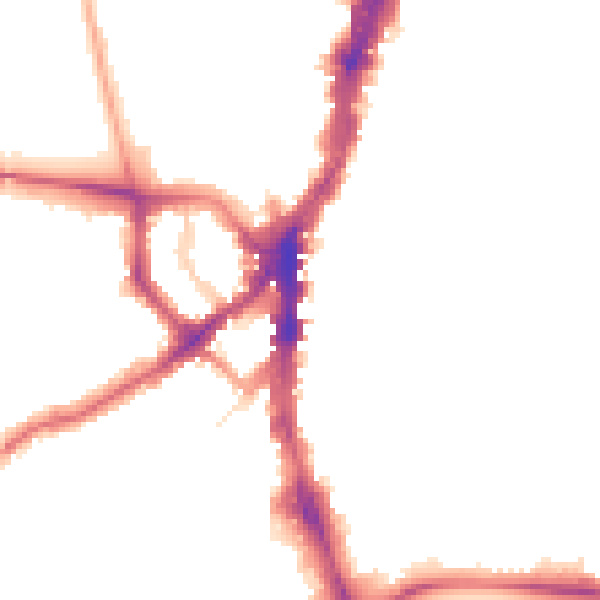
Night-time· 23:00 – 07:00
45.5dB