53 Rowley Street, Stafford, ST16 2RH
About 53 Rowley Street
53 Rowley Street is a three-bedroom mid-terrace house in Stafford (ST16 2RH). It has a recorded floor area of 98 m² (around 1055 sq ft), construction records dating it to 1900-1929 and council tax band A. Other recorded features include a basement. The latest certificate (April 2019) shows a C (score 70). The recommended improvements would push it to B (score 85).
Most recent transfer was July 2025 at £175,000 — fresh data. At 98 m² it's 22.5% larger than the typical home in the postcode (80 m² median across 38 EPCs). Its energy rating outperforms most of the postcode (better than 71% of similar EPCs). Across 1998–2025, sale prices on this property compounded at 5.7% per year. On a £-per-square-foot basis, the last sale (£166/sq ft) was about 78.6% above the typical sold price in the postcode.
What this property has
Inside
- Bedrooms3
- Bathrooms1
- Open-plan layoutYes
- Dining roomYes
- Utility roomYes
- CloakroomYes
- BasementYes
Outside
- GarageYes
Everything you need to know about 53 Rowley Street
The true value, the hidden risks and the full sale history, in one report.
Pick your report · every report is £14.99
One time fee only - money back guarantee

The data behind every report


Energy performance
EPC Rating
Get a survey for this property
Level 3 Building Survey
Because the property was built before 1919, has been extended more than once, and has solid (non-cavity) walls, we believe a Level 3 building survey should be considered.
From £820 · Includes VAT
Planning history
53 Rowley Street has no planning applications on record.
But the area is active
4 notable applications nearby — larger schemes and conversions that could reshape the street. The report maps them all.
Sales history & valuation
Price for 53 Rowley Street has grown more than fourfold since the 1998 starting point.
£183,000
Modelled from EPC, postcode comparables and a sale-price growth of 5.7% per year over 27 years.
£175,000
Growth on file: 5.7% per year over 27 years.
Sales timeline
8 July 2025Most recent
£175,000
+29.6%over 5 years15 August 2019
£135,000
+250.6%over 21 years16 April 1998
£38,500
Median price across the last 5 sales in ST16 2RH: £126,500 (2025–2023).
Nearby sales in ST16 2RH
Versus other Rowley Street homes
53 Rowley Street is notably below the street on years held.
Price per m²
£1,786
Street avg £1,325
Floor Area
98 m²
Street avg 85 m²
Habitable Rooms
4 rooms
Street avg 4 rooms
CO₂ Emissions
3.6 t/year
Street avg 4.1 t/year
Everything you need to know about 53 Rowley Street
The true value, the hidden risks and the full sale history, in one report.
Pick your report · every report is £14.99
One time fee only - money back guarantee
The data behind every report
Similar properties nearby
1 Sherwood Court
ST16 2RN
1 Ebony Close
ST16 2TW
1 Kerr Lane
ST16 2EP
1 Jerningham Street
ST16 2EG
1 County Road
ST16 2PU
1 Rowley Street
ST16 2RH
1 Avarne Place
ST16 2ND
1 Lime Tree Avenue
ST16 2RR
The neighbourhood at a glance
Crime
7/mo
Steady year-on-year across the wider district.
Nearest stop
0.2 km
Greyfriars Way — bus stop.
Closest school
0.2 km
St Patrick's Catholic Primary School. 19 schools nearby.
Go deeper on the local area
A Local Area report breaks down crime, transport links, schools and air quality in depth.
Road noise across the postcode
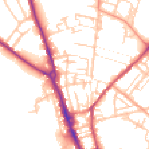
Daytime· 07:00 – 23:00
53.0dB

Night-time· 23:00 – 07:00
43.4dB