2 Coronation Villa, Netheravon, Salisbury, SP4 9PW
About 2 Coronation Villa
2 Coronation Villa is a three-bedroom semi-detached house in Netheravon, Salisbury, Salisbury (SP4 9PW). It has a recorded floor area of 86 m² (around 926 sq ft), construction records dating it to 1900-1929 and council tax band C. The latest certificate (July 2013) shows a D (score 64), on the cusp of jumping into the C band. The recommended improvements would lift it to B (score 86), a 2-band jump. Main heating runs on oil. The latest certificate is from July 2013, so improvements made since then won't be reflected.
Today's modelled estimate of £293,000 sits 54.2% above the 2014 sale of £190,000. Last changed hands 13 years ago, in January 2014.
What this property has
Inside
- Bedrooms3
Everything you need to know about 2 Coronation Villa
The true value, the hidden risks and the full sale history, in one report.
Pick your report · from £14.99
One time fee only - money back guarantee

The data behind every report







Energy performance
Recommended upgrades on file would lift this property by multiple EPC bands.
EPC Expired
This certificate is over 10 years old and is no longer valid.Expired 05 Jul 2023
EPC Rating
Certificate validity
Expired on 5 July 2023

Get a survey for this property
Level 3 Building Survey
Because the property was built before 1919 and has no mains gas supply, we believe a Level 3 building survey should be considered.
From £885 · Includes VAT
Planning history
2 Coronation Villa has no planning applications on record.
A planning report still maps activity across the surrounding area and reads this property's extension & conversion potential.
Sales history & valuation
£293,000
Modelled from EPC, postcode comparables.
£190,000
Recorded with HM Land Registry.
Sales timeline
24 January 2014Most recent
£190,000
Median price across the last 2 sales in SP4 9PW: £247,500 (2019–2016).
Nearby sales in SP4 9PW
Everything you need to know about 2 Coronation Villa
The true value, the hidden risks and the full sale history, in one report.
Pick your report · from £14.99
One time fee only - money back guarantee
The data behind every report
Similar properties nearby
1 Clayton Road, Bulford
SP4 9HR
1 Chestnut Rise, Haxton
SP4 9PR
1 Coronation Villa, Netheravon
SP4 9PW
1 Court Farm Close, Netheravon
SP4 9QX
1 Camilla Close, Bulford
SP4 9PE
1 Crusader Cottages, High Street, Netheravon
SP4 9QP
1 Avon Villas, Kings Hill, Netheravon
SP4 9PN
1 Bourlon Wood, Bulford
SP4 9FA
The neighbourhood at a glance
Daytime road noise here sits well below conversation level — a quiet pocket of the postcode.
Crime
167/mo
Falling year-on-year across the wider district.
Nearest stop
0.1 km
Post Office — bus stop.
Closest school
0.4 km
Netheravon All Saints CofE Primary School. 1 school nearby.
Go deeper on the local area
A Local Area report breaks down crime, transport links, schools and air quality in depth.
Road noise across the postcode
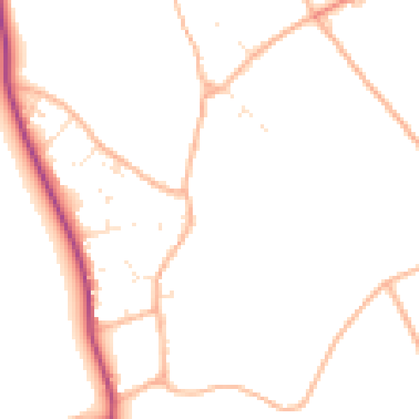
Daytime· 07:00 – 23:00
47.1dB

Night-time· 23:00 – 07:00
38.6dB