Bartley Mount House, Shepherds Road, Bartley, Southampton, SO40 2LH
About Bartley Mount House
Bartley Mount House is a five-bedroom detached house in Bartley, Southampton, Southampton (SO40 2LH). It has a recorded floor area of 166 m² (around 1786 sq ft), construction records dating it to before 1900 and council tax band F. The latest certificate (June 2010) shows an F (score 25), near the bottom of the EPC scale. Main heating runs on oil. The latest certificate is from June 2010, so improvements made since then won't be reflected.
Held since November 2010 — that's 16 years off the open market, well above the local norm. At 166 m² the property is well over the postcode median (109 m² across 26 EPCs), placing it in the larger end of the local stock. On energy efficiency it sits in the bottom 10% of properties in this postcode — significant headroom for improvement. 5 bedrooms is on the larger side for this postcode, where 4 is the typical count. 2 planning records sit against the property, 1 approved, 0 refused. Past consents include an extension, meaningful when judging how the property has evolved. Today's modelled estimate of £964,000 is 29.5% above the 2010 sale price. On a £-per-square-foot basis, the last sale (£417/sq ft) was about 63.2% above the typical sold price in the postcode.
What this property has
Inside
- Bedrooms5
Everything you need to know about Bartley Mount House
The true value, the hidden risks and the full sale history, in one report.
Pick your report · from £14.99
One time fee only - money back guarantee

The data behind every report







Energy performance
Bartley Mount House sits at the bottom of the postcode for energy efficiency — meaningful headroom to improve.
EPC Expired
This certificate is over 10 years old and is no longer valid.Expired 02 Jun 2020
EPC Rating
Certificate validity
Expired on 2 June 2020

Get a survey for this property
Level 3 Building Survey
Because the property was built before 1919, has been extended more than once, and has no mains gas supply, we believe a Level 3 building survey should be considered.
From £1,495 · Includes VAT
Planning history
2 applications on record at Bartley Mount House, Shepherds Road, Bartley, Southampton, SO40 2LH
- Mar 2011ExtensionFullOutcome in report
Two-storey extension; replacement roof; alterations to fenestration (demolition of single & two-storey elements)
- Documents
- 11 docs on file
- Reference
- 11/96091
- More recent applications — locked
- Tree WorksJan 2022Decision
Unlock Bartley Mount House, Shepherds Road, Bartley, Southampton, SO40 2LH's full planning history
You're seeing the shape of it. The report has the substance.
- Every decision — granted, refused or withdrawn (1 on record)
- All 2 applications on this property in full, plus 2 notable nearby
- The 15 documents, officer reports & conditions
- What the pattern means for extending or converting here
One time fee only - money back guarantee
Sales history & valuation
Bartley Mount House valuation sits well clear of the typical sold price in this postcode.
£964,000
Modelled from EPC, postcode comparables.
£744,400
Recorded with HM Land Registry.
Sales timeline
4 November 2010Most recent
£744,400
Median price across the last 5 sales in SO40 2LH: £800,000 (2026–2022).
Nearby sales in SO40 2LH
Paddock View, Shepherds Road, Bartley, Southampton, SO40 2LH
Sold Mar 2026
£815,000Silver Dale, Shepherds Road, Bartley, Southampton, SO40 2LH
Sold Sept 2025
£640,0001 Hudson Cottage, Shepherds Road, Bartley, Southampton, SO40 2LH
Sold Jun 2025
£570,000Martins Farm, Shepherds Road, Bartley, Southampton, SO40 2LH
Sold Feb 2022
£1,150,000Charcoal Cottage, Shepherds Road, Bartley, Southampton, SO40 2LH
Sold Sept 2021
£595,000
Versus other Shepherds Road homes
EPC Rating for Bartley Mount House lags the street by a wide margin.
Price per m²
£4,487
Street avg £4,864
Floor Area
166 m²
Street avg 108 m²
Habitable Rooms
7 rooms
Street avg 5 rooms
CO₂ Emissions
14.0 t/year
Street avg 4.5 t/year
Everything you need to know about Bartley Mount House
The true value, the hidden risks and the full sale history, in one report.
Pick your report · from £14.99
One time fee only - money back guarantee
The data behind every report
Similar properties nearby
1 Amey Gardens, Totton
SO40 2BB
1 Blenheim Close, Totton
SO40 2QR
1 Buckland Gardens, Calmore
SO40 2SB
1 Blackwater Mews, Totton
SO40 2GL
1 Calmore Crescent, Calmore
SO40 2RJ
1 Bowater Way, Calmore
SO40 2UT
1 Benbow Gardens, Calmore
SO40 2SX
1 Beechdale Close, Calmore
SO40 2QH
The neighbourhood at a glance
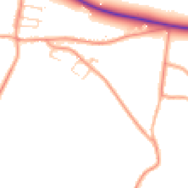
Daytime road noise here sits well below conversation level — a quiet pocket of the postcode.
Crime
229/mo
Falling year-on-year across the wider district.
Nearest stop
0.3 km
Home Lea — bus stop.
Closest school
1.0 km
Bartley Church of England Junior School. 3 schools nearby.
Go deeper on the local area
A Local Area report breaks down crime, transport links, schools and air quality in depth.
Road noise across the postcode
Daytime· 07:00 – 23:00
47.9dB

Night-time· 23:00 – 07:00
39.4dB