22 Banbury Avenue, Southampton, SO19 8GH
About 22 Banbury Avenue
22 Banbury Avenue is a two-bedroom semi-detached house in Southampton (SO19 8GH). It has a recorded floor area of 59 m² (around 635 sq ft), construction records dating it to 1950-1966 and council tax band B. The latest certificate (July 2017) shows an E (score 47), well below the UK norm with real room to improve. The recommended improvements would lift it to C (score 76), a 2-band jump. Main heating runs on electricity. At 59 m² this is the 6th smallest of 36 units on EPC record in the building, where floor areas span 47–138 m². The building's EPC ratings span F to B across 36 units on file.
Most recent transfer: September 2021 at £190,000. Across the public record there are 5 sales, relatively high churn for a single property. That sale was during the post-pandemic price surge, when transactions cleared materially above pre-2020 trend. It lags the bulk of the postcode on energy efficiency (less efficient than 89% of similar EPCs). Across 1998–2021, sale prices on this property compounded at 5.9% per year. Today's modelled estimate of £212,000 is 11.6% above the 2021 sale price. On a £-per-square-foot basis, the last sale (£299/sq ft) was about 50.3% above the typical sold price in the postcode.
What this property has
Inside
- Bedrooms2
- Bathrooms1
Outside
- Private gardenRear
- GarageEn bloc
Building
- Heating systemGas
- RefurbishedYes
Everything you need to know about 22 Banbury Avenue
The true value, the hidden risks and the full sale history, in one report.
Pick your report · every report is £14.99
One time fee only - money back guarantee

The data behind every report


Energy performance
Recommended upgrades on file would lift this property by multiple EPC bands.
EPC Rating
Get a survey for this property
Level 3 Building Survey
Because the property has no mains gas supply, we believe a Level 3 building survey should be considered.
From £885 · Includes VAT
Planning history
22 Banbury Avenue has no planning applications on record.
A planning report still maps activity across the surrounding area and reads this property's extension & conversion potential.
Sales history & valuation
Sale price has grown by over 3x since 1998.
£212,000
Modelled from EPC, postcode comparables and a sale-price growth of 5.9% per year over 23 years.
£190,000
Growth on file: 5.9% per year over 23 years.
Sales timeline
28 September 2021Most recent
£190,000
+2.7%over 4 years28 September 2017
£185,000
+48.0%over 6 years7 April 2011
£125,000
+1.6%over 5 years29 September 2005
£123,000
+146.0%over 7 years20 August 1998
£50,000
Median price across the last 5 sales in SO19 8GH: £212,000 (2025–2023).
Nearby sales in SO19 8GH
8 Banbury Avenue, Southampton, SO19 8GH
Sold Mar 2025
£205,00048 Banbury Avenue, Southampton, SO19 8GH
Sold Nov 2024
£212,00018 Banbury Avenue, Southampton, SO19 8GH
Sold Apr 2024
£208,00023 Banbury Avenue, Southampton, SO19 8GH
Sold Jul 2023
£270,00027 Banbury Avenue, Southampton, SO19 8GH
Sold May 2023
£280,000
Versus other Banbury Avenue homes
On epc rating, 22 Banbury Avenue runs well behind the street norm.
Price per m²
£3,220
Street avg £2,212
Floor Area
59 m²
Street avg 66 m²
Habitable Rooms
3 rooms
Street avg 3 rooms
CO₂ Emissions
5.2 t/year
Street avg 2.7 t/year
Everything you need to know about 22 Banbury Avenue
The true value, the hidden risks and the full sale history, in one report.
Pick your report · every report is £14.99
One time fee only - money back guarantee
The data behind every report
Similar properties nearby
The neighbourhood at a glance
Crime
12/mo
Steady year-on-year across the wider district.
Nearest stop
0.1 km
Gladstone Road — bus stop.
Closest school
0.6 km
Thornhill Primary School. 28 schools nearby.
Go deeper on the local area
A Local Area report breaks down crime, transport links, schools and air quality in depth.
Road noise across the postcode
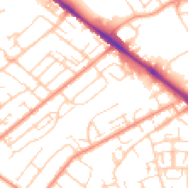
Daytime· 07:00 – 23:00
52.4dB

Night-time· 23:00 – 07:00
41.0dB