243 Botley Road, Southampton, SO19 0NL
About 243 Botley Road
243 Botley Road is a two-bedroom semi-detached house in Southampton (SO19 0NL). It has a recorded floor area of 55 m² (around 592 sq ft), construction records dating it to 1967-1975 and council tax band A. The latest certificate (September 2021) shows a C (score 73). The rating has held steady at C across 2 certificates since December 2010. Between certificates, lighting went from Very Poor to Very Good.
Last sale on file: £180,000 in December 2021. Across the public record there are 5 sales, relatively high churn for a single property. That sale was during the post-pandemic price surge, when transactions cleared materially above pre-2020 trend. Across 1998–2021, sale prices on this property compounded at 6.5% per year. On a £-per-square-foot basis, the last sale (£304/sq ft) was about 66.1% above the typical sold price in the postcode.
What this property has
Inside
- Bedrooms2
- Bathrooms1
Everything you need to know about 243 Botley Road
The true value, the hidden risks and the full sale history, in one report.
Pick your report · every report is £14.99
One time fee only - money back guarantee

The data behind every report


Energy performance
EPC Rating
Property Improvements
Changes detected from historical EPC data
Heating controls upgraded for better temperature management
Loft insulation upgraded to recommended levels
More low energy lighting installed
Get a survey for this property
Level 2 HomeBuyer Report
We've checked 10 risk factors against the available data for this property and believe a Level 2 HomeBuyer Report could be a suitable option for you.
From £495 · Includes VAT
Planning history
243 Botley Road has no planning applications on record.
A planning report still maps activity across the surrounding area and reads this property's extension & conversion potential.
Sales history & valuation
Price for 243 Botley Road has grown more than fourfold since the 1998 starting point.
£189,000
Modelled from EPC, postcode comparables and a sale-price growth of 6.5% per year over 23 years.
£180,000
Growth on file: 6.5% per year over 23 years.
Sales timeline
10 December 2021Most recent
£180,000
+33.3%over 6 years9 June 2015
£135,000
+17.4%over 4 years31 March 2011
£115,000
-19.3%over 5 years23 June 2005
£142,500
+235.3%over 6 years21 December 1998
£42,500
Median price across the last 5 sales in SO19 0NL: £410,000 (2025–2020).
Nearby sales in SO19 0NL
Versus other Botley Road homes
On epc rating, 243 Botley Road stands well clear of the street.
Price per m²
£3,273
Street avg £2,820
Floor Area
55 m²
Street avg 48 m²
Habitable Rooms
3 rooms
Street avg 3 rooms
CO₂ Emissions
1.8 t/year
Street avg 2.0 t/year
Everything you need to know about 243 Botley Road
The true value, the hidden risks and the full sale history, in one report.
Pick your report · every report is £14.99
One time fee only - money back guarantee
The data behind every report
Similar properties nearby
The neighbourhood at a glance
Crime
12/mo
Steady year-on-year across the wider district.
Nearest stop
0.3 km
Sullivan Road Park — bus stop.
Closest school
0.5 km
Hightown Primary School. 29 schools nearby.
Go deeper on the local area
A Local Area report breaks down crime, transport links, schools and air quality in depth.
Road noise across the postcode
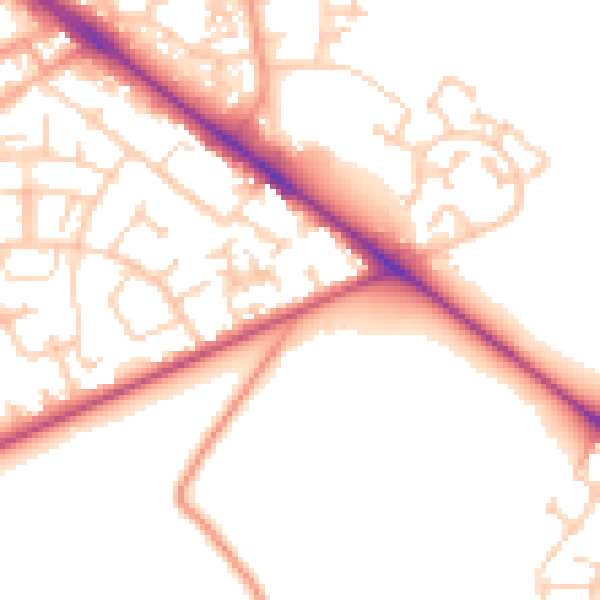
Daytime· 07:00 – 23:00
52.4dB

Night-time· 23:00 – 07:00
43.3dB