7 Parry Road, Southampton, SO19 0HT
About 7 Parry Road
7 Parry Road is a mid-terrace house in Southampton (SO19 0HT). It has a recorded floor area of 72 m² (around 775 sq ft), construction records dating it to 1950-1966 and council tax band B. The latest certificate (July 2014) shows an E (score 45), well below the UK norm with real room to improve. Earlier certificates rated it C (July 2012); the latest reading is 2 bands lower. Between certificates, roof efficiency went from Poor to Good and window efficiency went from Average to Good; while wall efficiency dropped from Poor to Very Poor and hot-water efficiency dropped from Good to Very Poor. The recommended improvements would lift it to C (score 75), a 2-band jump. The latest certificate is from July 2014, so improvements made since then won't be reflected.
It hasn't traded since September 1999, a hold of 27 years that's notably long for the area. On energy efficiency it sits in the bottom 10% of properties in this postcode — significant headroom for improvement. Across 1996–1999, sale prices on this property compounded at 10.1% per year. Today's modelled estimate of £217,000 sits 282.4% above the 1999 sale of £56,750. On a £-per-square-foot basis, the last sale (£73/sq ft) was about 44% below the postcode norm. One planning record on file: an extension refused in 2005.
Everything you need to know about 7 Parry Road
The true value, the hidden risks and the full sale history, in one report.
Pick your report · every report is £14.99
One time fee only - money back guarantee

The data behind every report


Energy performance
7 Parry Road sits at the bottom of the postcode for energy efficiency — meaningful headroom to improve.
EPC Expired
This certificate is over 10 years old and is no longer valid.Expired 13 Jul 2024
EPC Rating
Property Improvements
Changes detected from historical EPC data
Heating controls changed
Hot water system changed
Window efficiency improved
Loft insulation upgraded to recommended levels
Get a survey for this property
Level 2 HomeBuyer Report
We've checked 10 risk factors against the available data for this property and believe a Level 2 HomeBuyer Report could be a suitable option for you.
From £545 · Includes VAT
Planning history
1 application on record at 7 Parry Road, Southampton, SO19 0HT
- Mar 2005ExtensionFullOutcome in report
Extension: Single storey · Rear of property
Erection of a single storey rear extension.
- Documents
- 4 docs on file
- Reference
- 05/00047/FUL
Unlock 7 Parry Road, Southampton, SO19 0HT's full planning history
You're seeing the shape of it. The report has the substance.
- Every decision — granted, refused or withdrawn (1 on record)
- All 1 application on this property in full
- The 4 documents, officer reports & conditions
- What the pattern means for extending or converting here
One time fee only - money back guarantee
Sales history & valuation
7 Parry Road's modelled value sits at over four times its earliest registered sale price (1996).
£217,000
Modelled from EPC, postcode comparables and a sale-price growth of 10.1% per year over 3 years.
£56,750
Growth on file: 10.1% per year over 3 years.
Sales timeline
5 September 1999Most recent
£56,750
+41.9%over 3 years15 July 1996
£40,000
-4.8%15 July 1996
£42,000
Median price across the last 5 sales in SO19 0HT: £210,000 (2022–2018).
Nearby sales in SO19 0HT
Versus other Parry Road homes
Floor Area for 7 Parry Road lags the street by a wide margin.
Price per m²
£788
Street avg £1,984
Floor Area
72 m²
Street avg 92 m²
Habitable Rooms
5 rooms
Street avg 5 rooms
CO₂ Emissions
4.5 t/year
Street avg 4.1 t/year
Everything you need to know about 7 Parry Road
The true value, the hidden risks and the full sale history, in one report.
Pick your report · every report is £14.99
One time fee only - money back guarantee
The data behind every report
Similar properties nearby
The neighbourhood at a glance
Crime
12/mo
Steady year-on-year across the wider district.
Nearest stop
0.1 km
Coates Road — bus stop.
Closest school
0.6 km
Valentine Primary School & Nursery. 28 schools nearby.
Go deeper on the local area
A Local Area report breaks down crime, transport links, schools and air quality in depth.
Road noise across the postcode
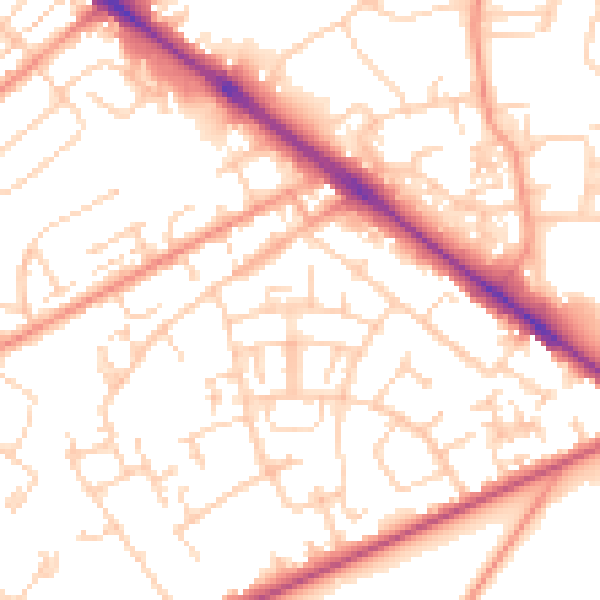
Daytime· 07:00 – 23:00
53.5dB

Night-time· 23:00 – 07:00
42.6dB