8 Alston Close, Hazel Grove, Stockport, SK7 5LR
About 8 Alston Close
8 Alston Close is a property in Hazel Grove, Stockport, Stockport (SK7 5LR). It has council tax band C.
One planning record on file: tree works approved in 2015. Past consents include tree works, meaningful when judging how the property has evolved.
Energy performance
No EPC on record
This property doesn't have an Energy Performance Certificate yet. An EPC is required to sell or let — and unlocks our automated valuation.
Get a survey for this property
Level 2 HomeBuyer Report
We've checked 10 risk factors against the available data for this property and believe a Level 2 HomeBuyer Report could be a suitable option for you.
Planning history
- Jul 2015Tree WorksTreesOutcome in report
T1 - to be reduced by 25% secondary branches only self seeding Ash tree. T2 - to be reduced by 25% secondary branches only Beech tree. TPO 88W.
- Documents
- 3 docs on file
- Reference
- DC/058794
Sales history & valuation
No sales recorded with HM Land Registry
That can mean the property has never traded since the registry began publishing in 1995, was a new build that hasn't been registered yet, or is held in the same hands long-term.
Median price across the last 5 sales in SK7 5LR: £227,000 (2023–2013).
Nearby sales in SK7 5LR
5 Alston Close, Hazel Grove, Stockport, SK7 5LR
Sold Aug 2023
£120,0006 Alston Close, Hazel Grove, Stockport, SK7 5LR
Sold Sept 2020
£236,5001 Alston Close, Hazel Grove, Stockport, SK7 5LR
Sold Aug 2019
£300,0004 Alston Close, Hazel Grove, Stockport, SK7 5LR
Sold Jul 2019
£227,0009 Alston Close, Hazel Grove, Stockport, SK7 5LR
Sold Apr 2013
£215,000
Similar properties nearby
1 Aldwyn Crescent, Hazel Grove
SK7 5HY
1 Alston Close, Hazel Grove
SK7 5LR
1 Alvington Grove, Hazel Grove
SK7 5LS
1 Arnside Avenue, Hazel Grove
SK7 5AP
1 Arundel Avenue, Hazel Grove
SK7 5LA
1 Barlows Lane South, Hazel Grove
SK7 5AJ
1 Beaumaris Crescent, Hazel Grove
SK7 5NG
1 Bickerton Drive, Hazel Grove
SK7 5QY
The neighbourhood at a glance
Daytime road noise here sits well below conversation level — a quiet pocket of the postcode.
Crime
1/mo
Steady year-on-year across the wider district.
Nearest stop
0.1 km
Langston Green — bus stop.
Closest school
0.8 km
Hazel Grove High School. 28 schools nearby.
Road noise across the postcode
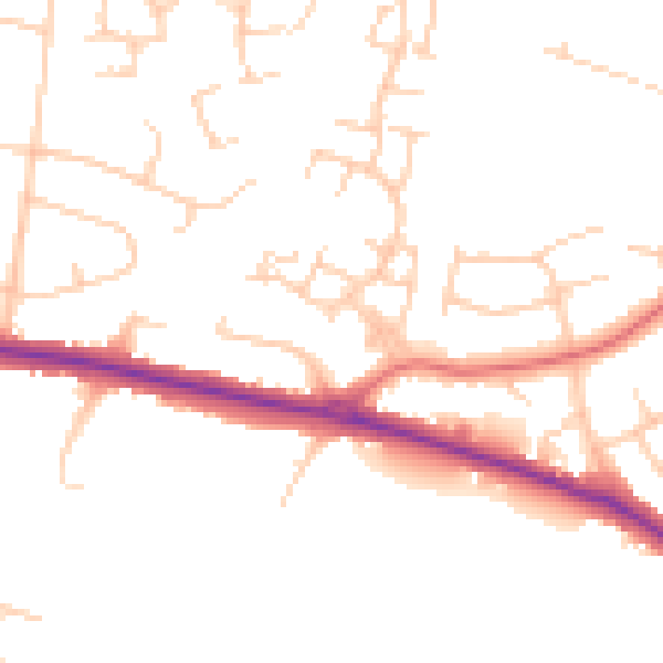
Daytime· 07:00 – 23:00
48.2dB

Night-time· 23:00 – 07:00
39.0dB