10 Birchway, Bramhall, Stockport, SK7 2AG
About 10 Birchway
10 Birchway is a semi-detached house in Bramhall, Stockport, Stockport (SK7 2AG). It has a recorded floor area of 132 m² (around 1421 sq ft), construction records dating it to 1930-1949 and council tax band D. The latest certificate (January 2016) shows a D (score 60), on the cusp of jumping into the C band. The recommended improvements would push it to C (score 77). The latest certificate is from January 2016, so improvements made since then won't be reflected.
Held since October 2001 — that's 25 years off the open market, well above the local norm. Across 1997–2001, sale prices on this property compounded at 14.9% per year. Today's modelled estimate of £578,000 sits 227.5% above the 2001 sale of £176,500. On a £-per-square-foot basis, the last sale (£124/sq ft) was about 50.8% below the postcode norm. One planning record on file: an extension approved in 2014. Past consents include an extension, meaningful when judging how the property has evolved. At 132 m² it's 25.8% larger than the typical home in the postcode (105 m² median across 11 EPCs).
Everything you need to know about 10 Birchway
The true value, the hidden risks and the full sale history, in one report.
Pick your report · every report is £14.99
One time fee only - money back guarantee

The data behind every report


Energy performance
10 Birchway's carbon output runs well above what efficient homes in the postcode produce.
EPC Expired
This certificate is over 10 years old and is no longer valid.Expired 21 Jan 2026
EPC Rating
Get a survey for this property
Level 2 HomeBuyer Report
We've checked 10 risk factors against the available data for this property and believe a Level 2 HomeBuyer Report could be a suitable option for you.
From £795 · Includes VAT
Planning history
10 Birchway has an approved side and rear extension on the planning record.
1 application on record at 10 Birchway, Bramhall, Stockport, SK7 2AG
- Apr 2014ExtensionFullOutcome in report
Extension: Side and rear of property
Single storey side/rear extension.
- Documents
- 6 docs on file
- Reference
- DC/054953
Unlock 10 Birchway, Bramhall, Stockport, SK7 2AG's full planning history
You're seeing the shape of it. The report has the substance.
- Every decision — granted, refused or withdrawn (1 on record)
- All 1 application on this property in full
- The 6 documents, officer reports & conditions
- What the pattern means for extending or converting here
One time fee only - money back guarantee
Sales history & valuation
10 Birchway's modelled value sits at over four times its earliest registered sale price (1997).
£578,000
Modelled from EPC, postcode comparables and a sale-price growth of 14.9% per year over 5 years.
£176,500
Growth on file: 14.9% per year over 5 years.
Sales timeline
1 October 2001Most recent
£176,500
+89.8%over 4 years17 February 1997
£93,000
Median price across the last 5 sales in SK7 2AG: £511,000 (2025–2021).
Nearby sales in SK7 2AG
28 Birchway, Bramhall, Stockport, SK7 2AG
Sold Jun 2025
£450,00014 Birchway, Bramhall, Stockport, SK7 2AG
Sold Jul 2023
£511,00012 Birchway, Bramhall, Stockport, SK7 2AG
Sold Oct 2022
£610,00022 Birchway, Bramhall, Stockport, SK7 2AG
Sold Feb 2022
£683,0009 Birchway, Bramhall, Stockport, SK7 2AG
Sold Feb 2021
£405,000
Versus other Birchway homes
Price per m² for 10 Birchway lags the street by a wide margin.
Price per m²
£1,337
Street avg £3,537
Floor Area
132 m²
Street avg 113 m²
Habitable Rooms
6 rooms
Street avg 5 rooms
CO₂ Emissions
6.2 t/year
Street avg 4.9 t/year
Everything you need to know about 10 Birchway
The true value, the hidden risks and the full sale history, in one report.
Pick your report · every report is £14.99
One time fee only - money back guarantee
The data behind every report
Similar properties nearby
1 Ashness Drive, Bramhall
SK7 2JH
1 Ainsdale Close, Bramhall
SK7 2LR
1 Bude Close, Bramhall
SK7 2QP
1 Dale Avenue, Bramhall
SK7 2JP
1 Bramley Close, Bramhall
SK7 2DT
1 Denham Drive, Bramhall
SK7 2AT
1 Bodmin Drive, Bramhall
SK7 2HX
1 Carmenna Drive, Bramhall
SK7 2HQ
The neighbourhood at a glance
Rail-style transport is unusually close for this postcode.
Crime
1/mo
Steady year-on-year across the wider district.
Nearest stop
0.2 km
Robins Lane — bus stop.
Closest school
0.6 km
Hursthead Junior School. 25 schools nearby.
Go deeper on the local area
A Local Area report breaks down crime, transport links, schools and air quality in depth.
Road noise across the postcode
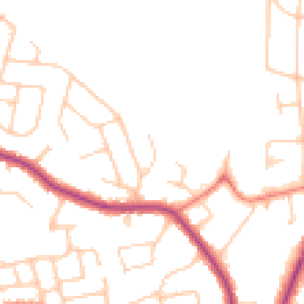
Daytime· 07:00 – 23:00
47.8dB

Night-time· 23:00 – 07:00
38.8dB