11 Cherry Tree Lane, Romiley, Stockport, SK6 4ER
About 11 Cherry Tree Lane
11 Cherry Tree Lane is a three-bedroom semi-detached house in Romiley, Stockport, Stockport (SK6 4ER). It has a recorded floor area of 83 m² (around 893 sq ft), construction records dating it to 1930-1949 and council tax band B. The latest certificate (April 2016) shows a D (score 67), on the cusp of jumping into the C band. The recommended improvements would lift it to B (score 84), a 2-band jump. The latest certificate is from April 2016, so improvements made since then won't be reflected.
At 83 m² the property is well over the postcode median (63 m² across 18 EPCs), placing it in the larger end of the local stock. It lags the bulk of the postcode on energy efficiency (less efficient than 78% of similar EPCs). Today's modelled estimate of £262,000 sits 114.8% above the 2016 sale of £122,000. 10 years since the last transfer (July 2016). One historical planning record sits against the property in 2004.
What this property has
Inside
- Bedrooms3
- Bathrooms1
- Dining roomYes
Outside
- Private gardenFront and rear
- GarageYes
Building
- Heating systemGas
- RefurbishedYes
Everything you need to know about 11 Cherry Tree Lane
The true value, the hidden risks and the full sale history, in one report.
Pick your report · every report is £14.99
One time fee only - money back guarantee

The data behind every report


Energy performance
Recommended upgrades on file would lift this property by multiple EPC bands.
EPC Expired
This certificate is over 10 years old and is no longer valid.Expired 04 Apr 2026
EPC Rating
Get a survey for this property
Level 2 HomeBuyer Report
We've checked 10 risk factors against the available data for this property and believe a Level 2 HomeBuyer Report could be a suitable option for you.
From £545 · Includes VAT
Planning history
1 application on record at 11 Cherry Tree Lane, Romiley, Stockport, SK6 4ER
- Aug 2004Change Of UseFullOutcome in report
Change of use from post office to veterinary surgery
- Documents
- 1 doc on file
- Reference
- DC/015935
Unlock 11 Cherry Tree Lane, Romiley, Stockport, SK6 4ER's full planning history
You're seeing the shape of it. The report has the substance.
- Every decision — granted, refused or withdrawn (1 on record)
- All 1 application on this property in full, plus 1 notable nearby
- The 1 documents, officer reports & conditions
- What the pattern means for extending or converting here
One time fee only - money back guarantee
Sales history & valuation
11 Cherry Tree Lane valuation sits well clear of the typical sold price in this postcode.
£262,000
Modelled from EPC, postcode comparables.
£122,000
Recorded with HM Land Registry.
Sales timeline
7 July 2016Most recent
£122,000
Median price across the last 5 sales in SK6 4ER: £117,500 (2023–1998).
Versus other Cherry Tree Lane homes
Price per m²
£1,470
Street avg £1,887
Floor Area
83 m²
Street avg 84 m²
Habitable Rooms
5 rooms
Street avg 5 rooms
CO₂ Emissions
3.3 t/year
Street avg 3.1 t/year
Everything you need to know about 11 Cherry Tree Lane
The true value, the hidden risks and the full sale history, in one report.
Pick your report · every report is £14.99
One time fee only - money back guarantee
The data behind every report
Similar properties nearby
1 Cherry Tree Close, Romiley
SK6 4HD
1 Far Ridings, Romiley
SK6 4NN
1 Cornfield Road, Romiley
SK6 4LU
1 Colborne Avenue, Romiley
SK6 4AE
1 Brabyns Avenue, Romiley
SK6 4NG
1 Gothic Close, Romiley
SK6 4JT
1 Barlow Fold, Romiley
SK6 4LQ
1 Greave, Romiley
SK6 4PU
The neighbourhood at a glance
Daytime road noise here sits well below conversation level — a quiet pocket of the postcode.
Crime
1/mo
Steady year-on-year across the wider district.
Nearest stop
0.1 km
Cherry Tree Lane — bus stop.
Closest school
0.7 km
Romiley Primary School. 16 schools nearby.
Go deeper on the local area
A Local Area report breaks down crime, transport links, schools and air quality in depth.
Road noise across the postcode
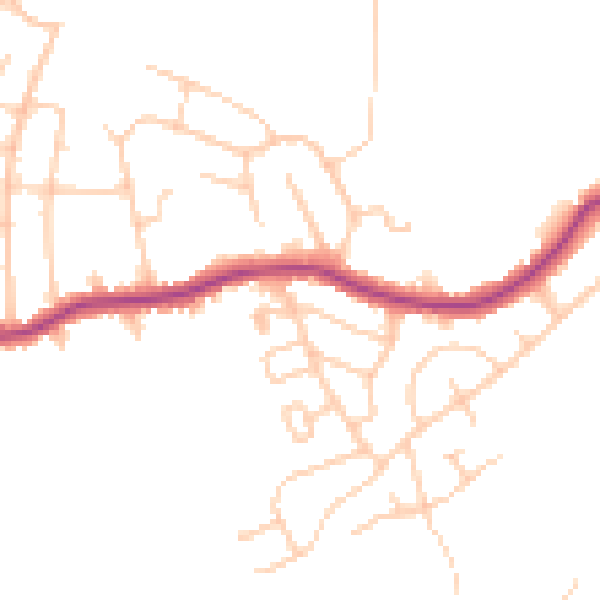
Daytime· 07:00 – 23:00
46.5dB

Night-time· 23:00 – 07:00
38.0dB