10 Gorsey Brow, Romiley, Stockport, SK6 3BQ
About 10 Gorsey Brow
10 Gorsey Brow is a three-bedroom end-of-terrace house in Romiley, Stockport, Stockport (SK6 3BQ). It has a recorded floor area of 157 m² (around 1690 sq ft), construction records dating it to before 1900 and council tax band D. The latest certificate (March 2014) shows a D (score 64), on the cusp of jumping into the C band. The recommended improvements would lift it to B (score 81), a 2-band jump. The latest certificate is from March 2014, so improvements made since then won't be reflected.
On the market in February 2017 and unlisted since — roughly 9 years. Across the public record there are 4 sales, relatively high churn for a single property. One planning record on file: an extension approved in 2005. Past consents include an extension, meaningful when judging how the property has evolved. At 157 m² it's 22.9% larger than the typical home in the postcode (128 m² median across 4 EPCs). Across 2001–2017, sale prices on this property compounded at 7.4% per year. Today's modelled estimate of £379,000 is 41.2% above the 2017 sale price. On a £-per-square-foot basis, the last sale (£159/sq ft) was about 153.7% above the typical sold price in the postcode.
What this property has
Inside
- Bedrooms3
Everything you need to know about 10 Gorsey Brow
The true value, the hidden risks and the full sale history, in one report.
Pick your report · every report is £14.99
One time fee only - money back guarantee

The data behind every report


Energy performance
Recommended upgrades on file would lift this property by multiple EPC bands.
EPC Expired
This certificate is over 10 years old and is no longer valid.Expired 31 Mar 2024
EPC Rating
Get a survey for this property
Level 3 Building Survey
Because the property was built before 1919, we believe a Level 3 building survey should be considered.
From £955 · Includes VAT
Planning history
Council records include a two-storey extension at 10 Gorsey Brow.
1 application on record at 10 Gorsey Brow, Romiley, Stockport, SK6 3BQ
- May 2005ExtensionFullOutcome in report
Extension: Two storey
Two storey side extension and rear balcony
- Documents
- 1 doc on file
- Reference
- DC/019105
Unlock 10 Gorsey Brow, Romiley, Stockport, SK6 3BQ's full planning history
You're seeing the shape of it. The report has the substance.
- Every decision — granted, refused or withdrawn (1 on record)
- All 1 application on this property in full, plus 1 notable nearby
- The 1 documents, officer reports & conditions
- What the pattern means for extending or converting here
One time fee only - money back guarantee
Sales history & valuation
Latest sale on 10 Gorsey Brow was the highest on Land Registry record across the postcode.
£379,000
Modelled from EPC, postcode comparables and a sale-price growth of 7.4% per year over 16 years.
£268,500
Growth on file: 7.4% per year over 16 years.
Sales timeline
10 February 2017Most recent
£268,500
+9.6%over 10 years10 November 2006
£245,000
+48.5%over 2 years15 April 2004
£165,000
+94.1%over 3 years5 January 2001
£85,000
Median price across the last 5 sales in SK6 3BQ: £193,000 (2014–2002).
Nearby sales in SK6 3BQ
18 Gorsey Brow, Romiley, Stockport, SK6 3BQ
Sold Jun 2014
£245,00014 Gorsey Brow, Romiley, Stockport, SK6 3BQ
Sold Sept 2007
£210,00012 Gorsey Brow, Romiley, Stockport, SK6 3BQ
Sold Jan 2003
£140,00020 Gorsey Brow, Romiley, Stockport, SK6 3BQ
Sold Feb 2002
£160,0002 Gorsey Brow, Romiley, Stockport, SK6 3BQ
Sold Sept 1998
£82,500
Versus other Gorsey Brow homes
On years held, 10 Gorsey Brow runs well behind the street norm.
Price per m²
£1,710
Street avg £1,155
Floor Area
157 m²
Street avg 133 m²
Habitable Rooms
8 rooms
Street avg 6 rooms
CO₂ Emissions
5.5 t/year
Street avg 5.8 t/year
Everything you need to know about 10 Gorsey Brow
The true value, the hidden risks and the full sale history, in one report.
Pick your report · every report is £14.99
One time fee only - money back guarantee
The data behind every report
Similar properties nearby
1 Eastover, Romiley
SK6 3ES
1 Hill Rise, Romiley
SK6 3AP
1 Buckley Drive, Romiley
SK6 3EW
1 Highfield Avenue, Romiley
SK6 3DA
1 Beverley Walk, Romiley
SK6 3HG
1 Bredbury Green, Romiley
SK6 3DN
1 Chadkirk Cottages, Vale Road, Romiley
SK6 3LE
1 Agecroft Road, Romiley
SK6 3HT
The neighbourhood at a glance
Rail-style transport is unusually close for this postcode.
Crime
1/mo
Steady year-on-year across the wider district.
Nearest stop
0.0 km
Hatherlow — bus stop.
Closest school
0.3 km
Harrytown Catholic High School. 20 schools nearby.
Go deeper on the local area
A Local Area report breaks down crime, transport links, schools and air quality in depth.
Road noise across the postcode
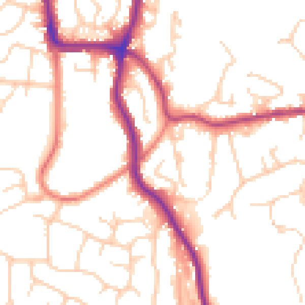
Daytime· 07:00 – 23:00
51.9dB

Night-time· 23:00 – 07:00
41.7dB