3 Bankfield Cottages, Woodley, Stockport, SK6 1RG
About 3 Bankfield Cottages
3 Bankfield Cottages is a three-bedroom end-of-terrace house in Woodley, Stockport, Stockport (SK6 1RG). It has a recorded floor area of 112 m² (around 1206 sq ft), construction records dating it to before 1900 and council tax band B. The latest certificate (August 2025) shows a D (score 65), on the cusp of jumping into the C band. The recommended improvements would push it to C (score 77). Period features are noted in the property record. Our model identifies extension potential, subject to local planning policy. The home occupies a corner plot.
It hasn't traded since June 2005, a hold of 21 years that's notably long for the area. Across 2004–2005, sale prices on this property compounded at 68.5% per year. Today's modelled estimate of £328,000 sits 138.5% above the 2005 sale of £137,500. On a £-per-square-foot basis, the last sale (£114/sq ft) was about 27.5% below the postcode norm.
What this property has
Inside
- Bedrooms3
- Bathrooms2
Outside
- Private gardenWrap around
- DrivewayYes
- Corner plotYes
Building
- Period featuresYes
- RefurbishedYes
- Extension potentialPossible
Everything you need to know about 3 Bankfield Cottages
The true value, the hidden risks and the full sale history, in one report.
Pick your report · every report is £14.99
One time fee only - money back guarantee

The data behind every report


Energy performance
EPC Rating
Get a survey for this property
Level 3 Building Survey
Because the property was built before 1919 and has solid (non-cavity) walls, we believe a Level 3 building survey should be considered.
From £955 · Includes VAT
Planning history
3 Bankfield Cottages has no planning applications on record.
But the area is active
2 notable applications nearby — larger schemes and conversions that could reshape the street. The report maps them all.
Sales history & valuation
3 Bankfield Cottages's modelled value sits at over four times its earliest registered sale price (2004).
£328,000
Modelled from EPC, postcode comparables and a sale-price growth of 68.5% per year over 1 year.
£137,500
Growth on file: 68.5% per year over 1 year.
Sales timeline
29 June 2005Most recent
£137,500
+78.3%over 1 year20 May 2004
£77,100
Median price across the last 5 sales in SK6 1RG: £117,000 (2021–2004).
Everything you need to know about 3 Bankfield Cottages
The true value, the hidden risks and the full sale history, in one report.
Pick your report · every report is £14.99
One time fee only - money back guarantee
The data behind every report
Similar properties nearby
1 Boundary Close, Woodley
SK6 1LA
1 Davenport Drive, Woodley
SK6 1PX
1 Clough Meadow, Woodley
SK6 1JZ
1 Briar Grove, Woodley
SK6 1QW
1 Coppice Close, Woodley
SK6 1JH
1 Chorlton Fold, Woodley
SK6 1NZ
1 Bankfield Cottages, Woodley
SK6 1RG
1 Ashdown Avenue, Woodley
SK6 1LL
The neighbourhood at a glance
Rail-style transport is unusually close for this postcode.
Crime
1/mo
Steady year-on-year across the wider district.
Nearest stop
0.3 km
Woodley Precinct — bus stop.
Closest school
0.6 km
Bredbury St. Marks CofE Primary School. 25 schools nearby.
Go deeper on the local area
A Local Area report breaks down crime, transport links, schools and air quality in depth.
Road noise across the postcode
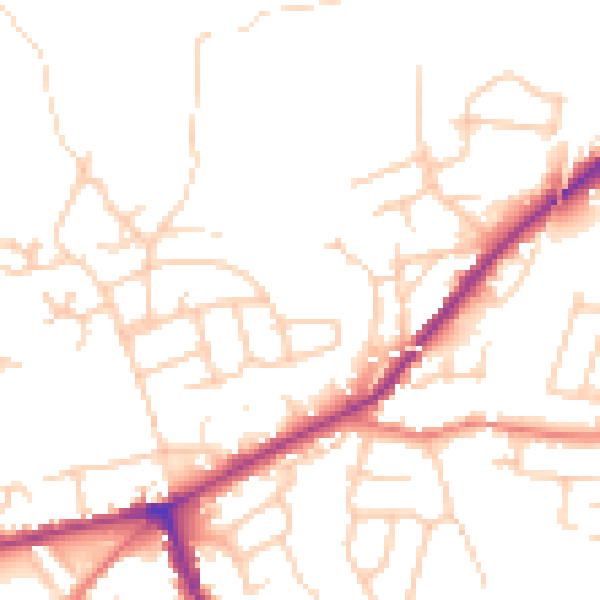
Daytime· 07:00 – 23:00
49.8dB

Night-time· 23:00 – 07:00
40.3dB