2 Oak Road, Chelford, Macclesfield, SK11 9AY
About 2 Oak Road
2 Oak Road is a detached house in Chelford, Macclesfield, Macclesfield (SK11 9AY). It has a recorded floor area of 117 m² (around 1259 sq ft), construction records dating it to 1950-1966 and council tax band D. The latest certificate (August 2013) shows an E (score 41), well below the UK norm with real room to improve. The recommended improvements would lift it to C (score 77), a 2-band jump. The latest certificate is from August 2013, so improvements made since then won't be reflected.
At 117 m² the property is well over the postcode median (69 m² across 12 EPCs), placing it in the larger end of the local stock. On energy efficiency it sits in the bottom 10% of properties in this postcode — significant headroom for improvement.
Everything you need to know about 2 Oak Road
The true value, the hidden risks and the full sale history, in one report.
30-day money-back guarantee

The data behind every report


Energy performance
2 Oak Road sits at the bottom of the postcode for energy efficiency — meaningful headroom to improve.
EPC Expired
This certificate is over 10 years old and is no longer valid.Expired 20 Aug 2023
EPC Rating
Planning history
2 Oak Road has no planning applications on record.
Notable planning nearby
2applications of note in the surrounding area
We flagged 1 thing worth checking at 2 Oak Road
Independent checks surfaced things a buyer would want to understand before offering. The report explains each one in full, with the underlying data and what to ask.
- Larger development activity nearby
30-day money-back guarantee
Sales history & valuation
2 Oak Road has no Land Registry sales on file, suggesting it has stayed in the same hands since registration began.
£433,000
Modelled from EPC, postcode comparables.
No sales recorded with HM Land Registry
That can mean the property has never traded since the registry began publishing in 1995, was a new build that hasn't been registered yet, or is held in the same hands long-term.
Median price across the last 5 sales in SK11 9AY: £287,000 (2023–2013).
Nearby sales in SK11 9AY
Police House, Oak Road, Chelford, Macclesfield, SK11 9AY
Sold Mar 2023
£300,0009 Oak Road, Chelford, Macclesfield, SK11 9AY
Sold Jun 2022
£277,5001 Oak Road, Chelford, Macclesfield, SK11 9AY
Sold Jul 2021
£325,0005 Oak Road, Chelford, Macclesfield, SK11 9AY
Sold Oct 2020
£245,5007 Oak Road, Chelford, Macclesfield, SK11 9AY
Sold May 2009
£215,000
Versus other Oak Road homes
2 Oak Road is notably below the street on epc rating.
EPC Rating
41 (E)
Street avg 69 (D)
Floor Area
117 m²
Street avg 77 m²
CO₂ Emissions
7.9 t/year
Street avg 3.3 t/year
Habitable Rooms
5 rooms
Street avg 4 rooms
Everything you need to know about 2 Oak Road
The true value, the hidden risks and the full sale history, in one report.
30-day money-back guarantee
The data behind every report
Similar properties nearby
1 Ashcroft Drive, Chelford
SK11 9GF
1 Dingle Bank Cottages, Holmes Chapel Road, Lower Withington
SK11 9DP
1 Alderley Road, Chelford
SK11 9AP
1 Blackcroft Barn, Holmes Chapel Road, Lower Withington
SK11 9DP
1 Fytton Close, Gawsworth
SK11 9RB
1 Chillingham Close, Chelford
SK11 9FZ
1 Clay Heyes, Chelford
SK11 9ST
1 Edgeway, Henbury
SK11 9PA
The neighbourhood at a glance
Rail-style transport is unusually close for this postcode.
Crime
6/mo
Steady year-on-year across the wider district.
Nearest stop
0.2 km
Dixon Drive — bus stop.
Closest school
0.0 km
Chelford CofE Primary School. 2 schools nearby.
Go deeper on the local area
The full report breaks down crime, transport links, schools and air quality in depth.
Road noise across the postcode
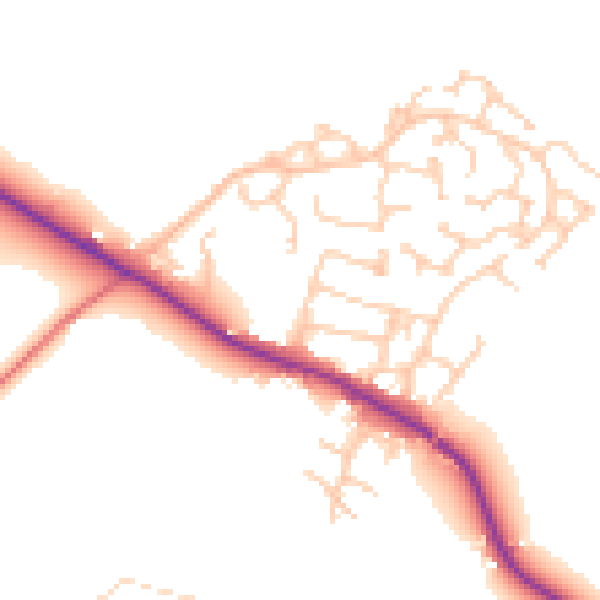
Daytime· 07:00 – 23:00
49.7dB

Night-time· 23:00 – 07:00
42.2dB