3 Almshouses, Philipot Path, London, SE9 5DJ
About 3 Almshouses
3 Almshouses is a mid-terrace house in London (SE9 5DJ). It has a recorded floor area of 55 m² (around 592 sq ft), construction records dating it to 1930-1949 and council tax band B. At 55 m² this is the 3rd smallest of 4 units on EPC record in 3 Almshouses, where floor areas span 45–63 m². On EPC score it ranks last in the building (70 versus a best of 77). The latest certificate (January 2019) shows a C (score 70).
At 55 m² it's 17% larger than the typical home in the postcode (47 m² median across 35 EPCs).
Everything you need to know about 3 Almshouses
The true value, the hidden risks and the full sale history, in one report.
30-day money-back guarantee

The data behind every report


Energy performance
EPC Rating
Planning history
3 Almshouses has no planning applications on record.
Notable planning nearby
10applications of note in the surrounding area
We flagged 1 thing worth checking at 3 Almshouses
Independent checks surfaced things a buyer would want to understand before offering. The report explains each one in full, with the underlying data and what to ask.
- Signs of HMO activity in the area
30-day money-back guarantee
Sales history & valuation
3 Almshouses has no Land Registry sales on file, suggesting it has stayed in the same hands since registration began.
£260,000
Modelled from EPC, postcode comparables.
No sales recorded with HM Land Registry
That can mean the property has never traded since the registry began publishing in 1995, was a new build that hasn't been registered yet, or is held in the same hands long-term.
Versus other Philipot Path homes
On co₂ emissions, 3 Almshouses runs well behind the street norm.
EPC Rating
70 (C)
Street avg 74 (C)
Floor Area
55 m²
Street avg 51 m²
CO₂ Emissions
2.2 t/year
Street avg 1.6 t/year
Habitable Rooms
2 rooms
Street avg 2 rooms
Everything you need to know about 3 Almshouses
The true value, the hidden risks and the full sale history, in one report.
30-day money-back guarantee
The data behind every report
Similar properties nearby
1 Almshouses, Philipot Path
SE9 5DJ
1 Pound Place, Greenwich
SE9 5DN
1 Churchbury Road, Greenwich
SE9 5HU
1 Blann Close, Greenwich
SE9 5JJ
1 Beech Court, Kingsground, Greenwich
SE9 5HB
1 Cedar Court, Kingsground, Greenwich
SE9 5HA
1 Kingsground, Greenwich
SE9 5HD
1 Green Way, Greenwich
SE9 5SZ
The neighbourhood at a glance
Rail-style transport is unusually close for this postcode.
Crime
6/mo
Rising year-on-year across the wider district.
Nearest stop
0.1 km
Eltham High Street / Passey Place — bus stop.
Closest school
0.2 km
Eltham Church of England Primary School. 38 schools nearby.
Go deeper on the local area
The full report breaks down crime, transport links, schools and air quality in depth.
Road noise across the postcode
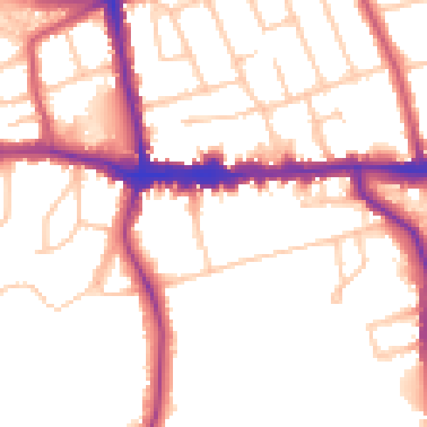
Daytime· 07:00 – 23:00
52.1dB

Night-time· 23:00 – 07:00
43.5dB