11 Brendon Road, Bexley, London, SE9 3RP
About 11 Brendon Road
11 Brendon Road is a property in Bexley, London, London (SE9 3RP). It has council tax band E.
Untraded for 20 years, with the last transfer in January 2006. One planning record on file: an extension approved in 2002. Past consents include an extension and a conservatory, meaningful when judging how the property has evolved. Across 1997–2006, sale prices on this property compounded at 13% per year.
Everything you need to know about 11 Brendon Road
The true value, the hidden risks and the full sale history, in one report.
30-day money-back guarantee

The data behind every report


Energy performance
No EPC on record
This property doesn't have an Energy Performance Certificate yet. An EPC is required to sell or let — and unlocks our automated valuation.
Planning history
11 Brendon Road has an approved extension on the planning record.
- Nov 2002ConservatoryFullIn report
Conservatory.
Extension- Documents
- 2 docs on file
- Reference
- 02/02927/FUL
We flagged 1 thing worth checking at 11 Brendon Road
Independent checks surfaced things a buyer would want to understand before offering. The report explains each one in full, with the underlying data and what to ask.
- Signs of HMO activity in the area
30-day money-back guarantee
Sales history & valuation
Sale price has grown by over 3x since 1997.
£340,000
Growth on file: 13.0% per year over 9 years.
Sales timeline
12 January 2006Most recent
£340,000
+200.9%over 8 years17 January 1997
£113,000
Median price across the last 5 sales in SE9 3RP: £550,000 (2023–2015).
Nearby sales in SE9 3RP
7 Brendon Road, Bexley, London, SE9 3RP
Sold Nov 2023
£560,00022 Brendon Road, Bexley, London, SE9 3RP
Sold Oct 2021
£550,0003 Brendon Road, Bexley, London, SE9 3RP
Sold Dec 2017
£490,00018 Brendon Road, Bexley, London, SE9 3RP
Sold Jun 2017
£575,0009 Brendon Road, Bexley, London, SE9 3RP
Sold May 2015
£432,000
Everything you need to know about 11 Brendon Road
The true value, the hidden risks and the full sale history, in one report.
30-day money-back guarantee
The data behind every report
Similar properties nearby
1 Charldane Road, Greenwich
SE9 3PF
1 Chartwell Close, Bexley
SE9 3UQ
1 Bercta Road, Greenwich
SE9 3TZ
1 Agaton Road, Bexley
SE9 3RN
1 Cedric Road, Greenwich
SE9 3SQ
1 Clayfarm Road, Greenwich
SE9 3PS
1 Biddenden Way, Greenwich
SE9 3DN
1 Bill Hamling Close, Greenwich
SE9 3LP
The neighbourhood at a glance
Rail-style transport is unusually close for this postcode.
Crime
6/mo
Rising year-on-year across the wider district.
Nearest stop
0.2 km
County Gate — bus stop.
Closest school
0.2 km
Dulverton Primary School. 34 schools nearby.
Go deeper on the local area
The full report breaks down crime, transport links, schools and air quality in depth.
Road noise across the postcode
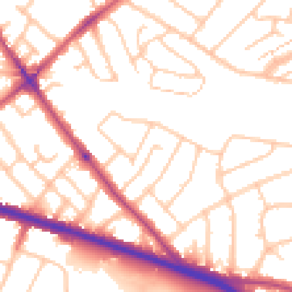
Daytime· 07:00 – 23:00
52.6dB

Night-time· 23:00 – 07:00
42.9dB