48 Horle Walk, Lambeth, London, SE5 9EF
About 48 Horle Walk
48 Horle Walk is a two-bedroom mid-terrace house in Lambeth, London, London (SE5 9EF). It has a recorded floor area of 59 m² (around 635 sq ft), construction records dating it to 1967-1975 and council tax band B. The latest certificate (August 2018) shows a C (score 75), near the top of the C band. When first surveyed in October 2013 the rating was D, the property has climbed 1 band since. Between certificates, wall efficiency went from Poor to Average and lighting went from Good to Very Good.
One planning record on file: an extension approved in 2015. Past consents include an extension and new windows, meaningful when judging how the property has evolved. Across 2005–2018, sale prices on this property compounded at 11.1% per year. On a £-per-square-foot basis, the last sale (£821/sq ft) was about 220.4% above the typical sold price in the postcode. Most recent transfer: November 2018 at £521,500.
Know exactly what you're buying at 48 Horle Walk
Before you offer, see what the listing won't tell you, the true value, the red flags and the full history.
Already flagged here
Valuation
against the asking price
Risks
planning & flood
Sold prices
similar homes nearby
Trends
the local market
What this property has
Inside
- Bedrooms2
- Bathrooms1
Outside
- Private gardenYes
- ParkingOff street
Energy performance
EPC Rating
Property Improvements
Changes detected from historical EPC data
Fuel source changed
Cavity wall insulation installed
More low energy lighting installed
Planning history
48 Horle Walk has an approved single-storey front extension on the planning record.
- Aug 2015ExtensionFullIn report
Extension: Single storey · Front of property
Erection of a single storey front extension to ground floor flat together with the replacement of the rear windows and single door with bi-fold doors. Erection of a garden 'sun-room' in the rear garden.
New Windows- Documents
- 11 docs on file
- Reference
- 15/02916/FUL
We flagged 1 thing worth checking at 48 Horle Walk
Independent checks surfaced things a buyer would want to understand before offering. The report explains each one in full, with the underlying data and what to ask.
- Larger development activity nearby
30-day money-back guarantee
Sales history & valuation
Latest sale on 48 Horle Walk was the highest on Land Registry record across the postcode.
£510,000
Modelled from EPC, postcode comparables and a sale-price growth of 11.1% per year over 13 years.
£521,500
Growth on file: 11.1% per year over 13 years.
Sales timeline
16 November 2018Most recent
£521,500
+121.9%over 4 years2 October 2014
£235,000
+80.8%over 9 years25 September 2005
£130,000
Median price across the last 5 sales in SE5 9EF: £426,000 (2023–2017).
Nearby sales in SE5 9EF
22 Horle Walk, Lambeth, London, SE5 9EF
Sold Dec 2023
£426,00030 Horle Walk, Lambeth, London, SE5 9EF
Sold Aug 2022
£382,50011 Horle Walk, Lambeth, London, SE5 9EF
Sold Jun 2021
£430,00032 Horle Walk, Lambeth, London, SE5 9EF
Sold Jun 2021
£468,55516 Horle Walk, Lambeth, London, SE5 9EF
Sold Jun 2015
£320,000
Everything we know about 48 Horle Walk, in one report
What it's really worth, what could be wrong, and the planning, sales and area data in full.
What we flagged
- Larger development activity nearby

Versus other Horle Walk homes
48 Horle Walk outperforms the street on price per m² by a wide margin.
Price per m²
£8,839
Street avg £3,977
Floor Area
59 m²
Street avg 60 m²
Habitable Rooms
3 rooms
Street avg 3 rooms
CO₂ Emissions
1.6 t/year
Street avg 2.0 t/year
Similar properties nearby
1 Herschell Mews, Lambeth
SE5 9AT
1 Bavent Road, Lambeth
SE5 9RY
1 Caldecot Road, Lambeth
SE5 9RL
1 Empress Mews, Lambeth
SE5 9BT
1 Northway Road, Lambeth
SE5 9AN
1 Halsmere Road, Lambeth
SE5 9LN
1 Carre Mews, Lambeth
SE5 9LS
1 Mcdowall Road, Southwark
SE5 9LD
The neighbourhood at a glance
Rail-style transport is unusually close for this postcode.
Crime
13/mo
Rising year-on-year across the wider district.
Nearest stop
0.0 km
Lilford Road (SW9) — bus stop.
Closest school
0.1 km
Loughborough Primary School. 97 schools nearby.
Go deeper on the local area
The full report breaks down crime, transport links, schools and air quality in depth.
Road noise across the postcode
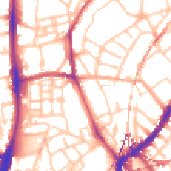
Daytime· 07:00 – 23:00
54.8dB

Night-time· 23:00 – 07:00
44.5dB