7 Ashlar Place, Greenwich, London, SE18 6EQ
About 7 Ashlar Place
7 Ashlar Place is a property in Greenwich, London, London (SE18 6EQ). It has council tax band D.
Energy performance
No EPC on record
This property doesn't have an Energy Performance Certificate yet. An EPC is required to sell or let — and unlocks our automated valuation.
Get a survey for this property
Level 2 HomeBuyer Report
We've checked 10 risk factors against the available data for this property and believe a Level 2 HomeBuyer Report could be a suitable option for you.
Planning history
No planning applications are recorded against 7 Ashlar Place, Greenwich, London, SE18 6EQ. The full report also covers planning activity across the surrounding area.
Similar properties nearby
1 2, Ferry Place, Greenwich
SE18 6DT
1 3, Vincent Road, Greenwich
SE18 6RF
1 Anglesea Avenue, Greenwich
SE18 6EH
1 Argyll Road, Greenwich
SE18 6SE
1 Ashlar Place, Greenwich
SE18 6EQ
1 Bignell Road, Greenwich
SE18 6SB
1 Brookhill Road, Greenwich
SE18 6UF
1 Caldwell Close, Greenwich
SE18 6FX
The neighbourhood at a glance
Rail-style transport is unusually close for this postcode.
Crime
13/mo
Rising year-on-year across the wider district.
Nearest stop
0.2 km
Vincent Road — bus stop.
Closest school
0.1 km
St Peter's Catholic Primary School. 41 schools nearby.
Road noise across the postcode
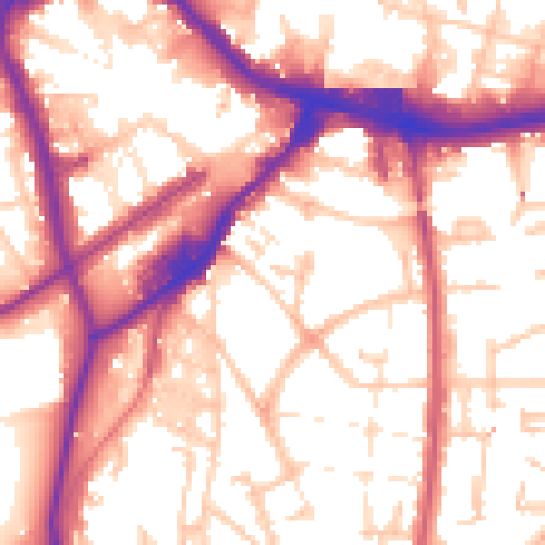
Daytime· 07:00 – 23:00
55.9dB

Night-time· 23:00 – 07:00
46.0dB