49 Shepherd Lane, Thurnscoe, Rotherham, S63 0JS
About 49 Shepherd Lane
49 Shepherd Lane is a three-bedroom semi-detached house in Thurnscoe, Rotherham, Rotherham (S63 0JS). It has a recorded floor area of 117 m² (around 1259 sq ft), construction records dating it to before 1900 and council tax band C. The latest certificate (September 2013) shows an F (score 36), near the bottom of the EPC scale. The recommended improvements would lift it to D (score 64), a 2-band jump. The latest certificate is from September 2013, so improvements made since then won't be reflected. Other recorded features include a basement. Period features are noted in the property record.
2 planning records sit against the property, 1 approved, 1 refused. Past consents include tree works, meaningful when judging how the property has evolved. The record references listed-building consent, which constrain future alterations. At 117 m² it's 20.6% larger than the typical home in the postcode (97 m² median across 29 EPCs). It lags the bulk of the postcode on energy efficiency (less efficient than 83% of similar EPCs). Across 2004–2023, sale prices on this property compounded at 1.4% per year. Today's modelled estimate of £154,000 is 18.5% above the 2023 sale price. On a £-per-square-foot basis, the last sale (£103/sq ft) was about 31.4% above the typical sold price in the postcode. Last sale on file: £130,000 in March 2023.
What this property has
Inside
- Bedrooms3
- BasementYes
Building
- Period featuresYes
Everything you need to know about 49 Shepherd Lane
The true value, the hidden risks and the full sale history, in one report.
Pick your report · every report is £14.99
One time fee only - money back guarantee

The data behind every report


Energy performance
49 Shepherd Lane's carbon output runs well above what efficient homes in the postcode produce.
EPC Expired
This certificate is over 10 years old and is no longer valid.Expired 30 Sept 2023
EPC Rating
Get a survey for this property
Level 3 Building Survey
Because the property was built before 1919 and has solid (non-cavity) walls, we believe a Level 3 building survey should be considered.
From £820 · Includes VAT
Planning history
49 Shepherd Lane has a listed-building consent on record — alterations to a listed property are tightly controlled.
2 applications on record at 49 Shepherd Lane, Thurnscoe, Rotherham, S63 0JS
- May 2012RenovationHeritageOutcome in report
Replacement of windows and doors to a Grade II Listed Building (Listed Building Consent)
ListedNew Windows- Documents
- 3 docs on file
- Reference
- 2012/0075
- More recent applications — locked
- Tree WorksAug 2024Decision
Unlock 49 Shepherd Lane, Thurnscoe, Rotherham, S63 0JS's full planning history
You're seeing the shape of it. The report has the substance.
- Every decision — granted, refused or withdrawn (2 on record)
- All 2 applications on this property in full, plus 3 notable nearby
- The 16 documents, officer reports & conditions
- What the pattern means for extending or converting here
One time fee only - money back guarantee
Sales history & valuation
49 Shepherd Lane's sale-price growth has lagged the wider UK trajectory across its history on file.
£154,000
Modelled from EPC, postcode comparables and a sale-price growth of 1.4% per year over 19 years.
£130,000
Growth on file: 1.4% per year over 19 years.
Sales timeline
30 March 2023Most recent
£130,000
+30.0%over 18 years10 June 2004
£100,000
Median price across the last 5 sales in S63 0JS: £125,000 (2025–2023).
Nearby sales in S63 0JS
9 Shepherd Lane, Thurnscoe, Rotherham, S63 0JS
Sold Jul 2025
£105,00045b, Shepherd Lane, Thurnscoe, Rotherham, S63 0JS
Sold Jun 2024
£200,00015 Shepherd Lane, Thurnscoe, Rotherham, S63 0JS
Sold Jun 2024
£114,00017 Shepherd Lane, Thurnscoe, Rotherham, S63 0JS
Sold Nov 2023
£125,000The Old Barn, Shepherd Lane, Thurnscoe, Rotherham, S63 0JS
Sold Aug 2023
£165,000
Versus other Shepherd Lane homes
On co₂ emissions, 49 Shepherd Lane runs well behind the street norm.
Price per m²
£1,111
Street avg £1,231
Floor Area
117 m²
Street avg 104 m²
Habitable Rooms
4 rooms
Street avg 5 rooms
CO₂ Emissions
10.0 t/year
Street avg 5.7 t/year
Everything you need to know about 49 Shepherd Lane
The true value, the hidden risks and the full sale history, in one report.
Pick your report · every report is £14.99
One time fee only - money back guarantee
The data behind every report
Similar properties nearby
1 Blossom Way, Thurnscoe
S63 0AS
1 Beechlea, Thurnscoe
S63 0NZ
1 Clayton Avenue, Thurnscoe
S63 0RY
1 Ashberry Close, Thurnscoe
S63 0LX
1 Butcher Street, Thurnscoe
S63 0RB
1 Ashlea, Thurnscoe
S63 0GY
1 Burntwood Close, Thurnscoe
S63 0QQ
1 Bateman Square, Thurnscoe
S63 0QN
The neighbourhood at a glance
Rail-style transport is unusually close for this postcode.
Crime
6/mo
Steady year-on-year across the wider district.
Nearest stop
0.0 km
Shepherd Lane/Houghton Road — bus stop.
Closest school
0.9 km
Gooseacre Primary Academy. 10 schools nearby.
Go deeper on the local area
A Local Area report breaks down crime, transport links, schools and air quality in depth.
Road noise across the postcode
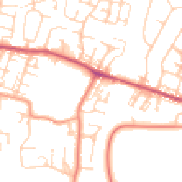
Daytime· 07:00 – 23:00
50.8dB

Night-time· 23:00 – 07:00
40.1dB