8 Roslin Road, Sheffield, S10 1FA
About 8 Roslin Road
8 Roslin Road is a four-bedroom detached house in Sheffield (S10 1FA). It has a recorded floor area of 176 m² (around 1894 sq ft), construction records dating it to before 1900 and council tax band D. The latest certificate (September 2019) shows an E (score 48), well below the UK norm with real room to improve. The recommended improvements would lift it to C (score 78), a 2-band jump. Other recorded features include a basement.
Today's modelled estimate of £569,000 is 42.3% above the 2019 sale price. On a £-per-square-foot basis, the last sale (£211/sq ft) was about 101.6% above the typical sold price in the postcode. Last sale on file: £400,000 in December 2019.
What this property has
Inside
- Bedrooms4
- Bathrooms2
- Dining roomYes
- EnsuiteYes
- BasementYes
Outside
- Private gardenYes
- GarageYes
Everything you need to know about 8 Roslin Road
The true value, the hidden risks and the full sale history, in one report.
Pick your report · every report is £14.99
One time fee only - money back guarantee

The data behind every report


Energy performance
8 Roslin Road's carbon output runs well above what efficient homes in the postcode produce.
EPC Rating
Get a survey for this property
Level 3 Building Survey
Because the property was built before 1919, we believe a Level 3 building survey should be considered.
From £1,085 · Includes VAT
Planning history
8 Roslin Road has no planning applications on record.
But the area is active
21 notable applications nearby — larger schemes and conversions that could reshape the street. The report maps them all.
Sales history & valuation
Latest sale on 8 Roslin Road was the highest on Land Registry record across the postcode.
£569,000
Modelled from EPC, postcode comparables.
£400,000
Recorded with HM Land Registry.
Sales timeline
13 December 2019Most recent
£400,000
Median price across the last 5 sales in S10 1FA: £280,000 (2015–2006).
Versus other Roslin Road homes
On price per m², 8 Roslin Road stands well clear of the street.
Price per m²
£2,273
Street avg £1,333
Floor Area
176 m²
Street avg 171 m²
Habitable Rooms
6 rooms
Street avg 8 rooms
CO₂ Emissions
12.0 t/year
Street avg 9.6 t/year
Everything you need to know about 8 Roslin Road
The true value, the hidden risks and the full sale history, in one report.
Pick your report · every report is £14.99
One time fee only - money back guarantee
The data behind every report
Similar properties nearby
1 Forres Avenue
S10 1WG
1 Arran Road
S10 1WQ
1 Leamington Street
S10 1LU
1 Embankment Road
S10 1EZ
1 Heavygate Road
S10 1PE
1 Hawthorn Terrace
S10 1BT
1 Brighton Terrace Road
S10 1NT
1 Bates Street
S10 1NP
The neighbourhood at a glance
Crime
4/mo
Steady year-on-year across the wider district.
Nearest stop
0.1 km
Crookesmoor Road/Crookes Road — bus stop.
Closest school
0.4 km
Broomhill Infant School. 35 schools nearby.
Go deeper on the local area
A Local Area report breaks down crime, transport links, schools and air quality in depth.
Road noise across the postcode
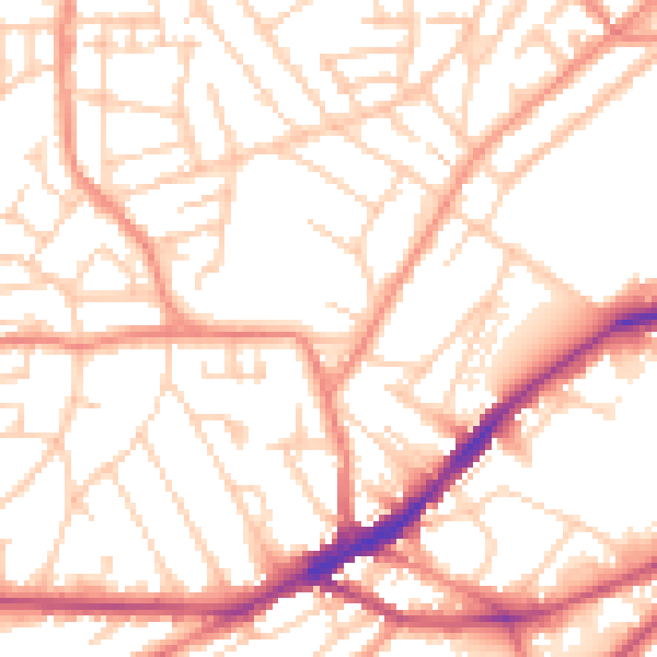
Daytime· 07:00 – 23:00
52.8dB

Night-time· 23:00 – 07:00
42.1dB