11 Craven Gardens, Harold Wood, Romford, RM3 0DF
About 11 Craven Gardens
11 Craven Gardens is a three-bedroom semi-detached house in Harold Wood, Romford, Romford (RM3 0DF). It has a recorded floor area of 93 m² (around 1001 sq ft), construction records dating it to 1930-1949 and council tax band D. The latest certificate (February 2016) shows a D (score 57), a step below the typical UK home. The recommended improvements would lift it to B (score 83), a 2-band jump. The latest certificate is from February 2016, so improvements made since then won't be reflected.
Untraded for 19 years, with the last transfer in June 2007. That sale landed at the peak of the pre-credit-crunch market, which is a useful reference point when interpreting the price. Today's modelled estimate of £496,000 sits 115.7% above the 2007 sale of £230,000. On a £-per-square-foot basis, the last sale (£230/sq ft) was about 33.8% below the postcode norm. At 93 m² it's 16.3% larger than the typical home in the postcode (80 m² median across 11 EPCs). 4 planning records sit against the property, 0 approved, 0 refused.
Know exactly what you're buying at 11 Craven Gardens
Before you offer, see what the listing won't tell you, the true value, the red flags and the full history.
Already flagged here
Valuation
against the asking price
Risks
planning & flood
Sold prices
similar homes nearby
Trends
the local market
What this property has
Inside
- Bedrooms3
Energy performance
Recommended upgrades on file would lift this property by multiple EPC bands.
EPC Expired
This certificate is over 10 years old and is no longer valid.Expired 22 Feb 2026
EPC Rating
Planning history
Planning history includes recorded demolition works, indicating a major rebuild phase at this address.
- Apr 2023ExtensionFullIn report
Extension: Side and rear of property
Single storey side/rear extension
- Documents
- 6 docs on file
- Reference
- P0324.23
- Dec 2022PorchFullIn report
Extension: Side and rear of property
Replacement of front porch and steps to entrance & single storey side/rear extension following demolition of existing attached garage
ExtensionDemolition- Documents
- 5 docs on file
- Reference
- P1654.22
We flagged 2 things worth checking at 11 Craven Gardens
Independent checks surfaced things a buyer would want to understand before offering. The report explains each one in full, with the underlying data and what to ask.
- Signs of HMO activity in the area
- Larger development activity nearby
30-day money-back guarantee
Sales history & valuation
The latest sale landed at the peak of the pre-credit-crunch market — a high-water reference point.
£496,000
Modelled from EPC, postcode comparables.
£230,000
Recorded with HM Land Registry.
Sales timeline
24 June 2007Most recent
£230,000
Median price across the last 5 sales in RM3 0DF: £467,000 (2024–2022).
Nearby sales in RM3 0DF
10 Craven Gardens, Harold Wood, Romford, RM3 0DF
Sold Dec 2024
£445,0002 Craven Gardens, Harold Wood, Romford, RM3 0DF
Sold Nov 2024
£510,0005 Craven Gardens, Harold Wood, Romford, RM3 0DF
Sold Sept 2024
£467,0006 Craven Gardens, Harold Wood, Romford, RM3 0DF
Sold Oct 2022
£437,0007 Craven Gardens, Harold Wood, Romford, RM3 0DF
Sold May 2022
£435,000
Everything we know about 11 Craven Gardens, in one report
What it's really worth, what could be wrong, and the planning, sales and area data in full.
What we flagged
- Signs of HMO activity in the area
- Larger development activity nearby

Versus other Craven Gardens homes
Years Held for 11 Craven Gardens runs comfortably ahead of the street norm.
Price per m²
£2,473
Street avg £4,674
Floor Area
93 m²
Street avg 94 m²
Habitable Rooms
4 rooms
Street avg 5 rooms
CO₂ Emissions
5.0 t/year
Street avg 4.1 t/year
Similar properties nearby
1 Aubrietia Close
RM3 0XG
1 Blakeborough Drive, Harold Wood
RM3 0WS
1 Chelsworth Close
RM3 0ET
1 Ashflower Drive
RM3 0FL
1 Cavell Crescent, Harold Wood
RM3 0WL
1 Bennison Drive, Harold Wood
RM3 0WJ
1 Cane Hill, Harold Wood
RM3 0WH
1 Archibald Road
RM3 0RD
The neighbourhood at a glance
Reported crime in the wider district is trending notably upward year-on-year.
Crime
6/mo
Rising year-on-year across the wider district.
Nearest stop
0.2 km
Maylands Way — bus stop.
Closest school
0.9 km
Harold Court Primary School. 14 schools nearby.
Go deeper on the local area
The full report breaks down crime, transport links, schools and air quality in depth.
Road noise across the postcode
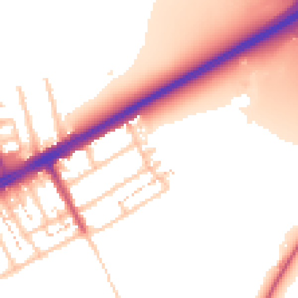
Daytime· 07:00 – 23:00
54.5dB

Night-time· 23:00 – 07:00
47.0dB