16 Cam Wood Fold, Clayton Le Woods, Chorley, PR6 7SD
About 16 Cam Wood Fold
16 Cam Wood Fold is a property in Clayton-Le-Woods, Chorley, Chorley (PR6 7SD). It has council tax band F.
Untraded for 25 years, with the last transfer in February 2001. Only one transfer is on record with HM Land Registry, suggesting it has stayed in the same hands for a long time.
Everything you need to know about 16 Cam Wood Fold
The true value, the hidden risks and the full sale history, in one report.
Pick your report · every report is £14.99
One time fee only - money back guarantee

The data behind every report


Energy performance
No EPC on record
This property doesn't have an Energy Performance Certificate yet. An EPC is required to sell or let — and unlocks our automated valuation.
Get a survey for this property
Level 2 HomeBuyer Report
We've checked 10 risk factors against the available data for this property and believe a Level 2 HomeBuyer Report could be a suitable option for you.
Planning history
16 Cam Wood Fold has no planning applications on record.
A planning report still maps activity across the surrounding area and reads this property's extension & conversion potential.
Sales history & valuation
£122,000
Recorded with HM Land Registry.
Sales timeline
1 February 2001Most recent
£122,000
Median price across the last 5 sales in PR6 7SD: £355,000 (2025–2022).
Nearby sales in PR6 7SD
9 Cam Wood Fold, Clayton Le Woods, Chorley, PR6 7SD
Sold Oct 2025
£411,00062 Cam Wood Fold, Clayton Le Woods, Chorley, PR6 7SD
Sold Mar 2025
£300,00063 Cam Wood Fold, Clayton Le Woods, Chorley, PR6 7SD
Sold Oct 2024
£590,00031 Cam Wood Fold, Clayton Le Woods, Chorley, PR6 7SD
Sold Oct 2022
£355,00025 Cam Wood Fold, Clayton Le Woods, Chorley, PR6 7SD
Sold Oct 2022
£395,000
Everything you need to know about 16 Cam Wood Fold
The true value, the hidden risks and the full sale history, in one report.
Pick your report · every report is £14.99
One time fee only - money back guarantee
The data behind every report
Similar properties nearby
1 Brookfield Lane, Clayton Le Woods
PR6 7FG
1 Bingley Close, Clayton Le Woods
PR6 7ST
1 Buckton Close, Whittle Le Woods
PR6 7GY
1 Cedar Field, Clayton Le Woods
PR6 7RW
1 Birch Field, Clayton Le Woods
PR6 7RE
1 Baytree Road, Clayton Le Woods
PR6 7JW
1 Cam Wood Fold, Clayton Le Woods
PR6 7SD
1 Catley Close, Whittle Le Woods
PR6 7GZ
The neighbourhood at a glance
Crime
2/mo
Steady year-on-year across the wider district.
Nearest stop
0.1 km
The Martindales — bus stop.
Closest school
0.5 km
St Bede's Catholic Primary School. 15 schools nearby.
Go deeper on the local area
A Local Area report breaks down crime, transport links, schools and air quality in depth.
Road noise across the postcode
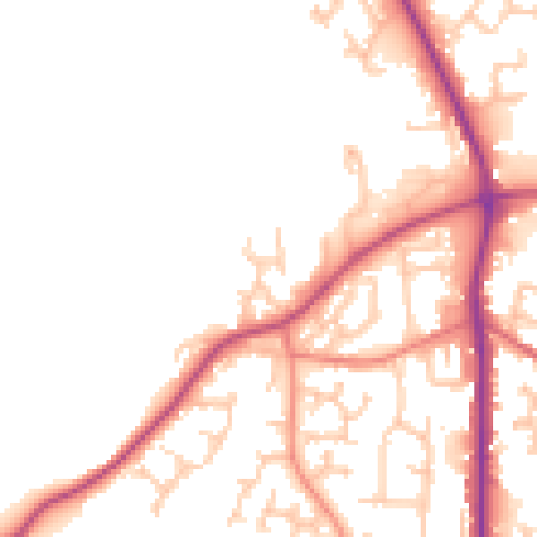
Daytime· 07:00 – 23:00
52.0dB
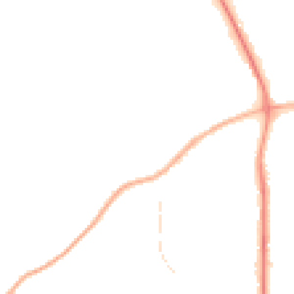
Night-time· 23:00 – 07:00
43.5dB