Beech Croft, Cottam Lane, Ingol, Preston, PR2 3XW
About Beech Croft
Beech Croft is a five-bedroom detached house in Ingol, Preston, Preston (PR2 3XW). It has a recorded floor area of 192 m² (around 2067 sq ft), construction records dating it to before 1900 and council tax band E. The latest certificate (February 2013) shows a C (score 71). The latest certificate is from February 2013, so improvements made since then won't be reflected. The home occupies a corner plot.
3 planning records sit against the property, 3 approved, 0 refused. Past consents include an extension, a porch, a garage conversion and a conservatory, meaningful when judging how the property has evolved. At 192 m² it's 29.7% larger than the typical home in the postcode (148 m² median across 5 EPCs). 5 bedrooms is on the larger side for this postcode, where 3 is the typical count. Across 2015–2023, sale prices on this property compounded at 3.6% per year. Today's modelled estimate of £413,000 is 10.1% above the 2023 sale price. On a £-per-square-foot basis, the last sale (£181/sq ft) was about 44.5% above the typical sold price in the postcode. Sold March 2023 for £375,000.
Know exactly what you're buying at Beech Croft
Before you offer, see what the listing won't tell you, the true value, the red flags and the full history.
Already flagged here
Valuation
against the asking price
Risks
planning & flood
Sold prices
similar homes nearby
Trends
the local market
What this property has
Inside
- Bedrooms5
- Bathrooms5
- Dining roomYes
- EnsuiteYes
Outside
- Private gardenYes
- ParkingOff road
- Corner plotYes
Energy performance
Beech Croft's EPC is over a decade old — improvements since won't be reflected.
EPC Expired
This certificate is over 10 years old and is no longer valid.Expired 27 Feb 2023
EPC Rating
Planning history
- Jan 2003PorchFullIn report
Extension: Single storey · Rear of property
Erection of single storey extension to rear of dwelling and porch extension to the front.
Extension- Reference
- 06/2002/1189
- Aug 2002PorchFullIn report
Extension: Single storey
Alterations to dwelling including erection of porch and dormer extensions at first floor level.
Extension- Reference
- 06/2002/0607
We flagged 1 thing worth checking at Beech Croft
Independent checks surfaced things a buyer would want to understand before offering. The report explains each one in full, with the underlying data and what to ask.
- Signs of HMO activity in the area
30-day money-back guarantee
Sales history & valuation
Beech Croft valuation sits well clear of the typical sold price in this postcode.
£413,000
Modelled from EPC, postcode comparables and a sale-price growth of 3.6% per year over 8 years.
£375,000
Growth on file: 3.6% per year over 8 years.
Sales timeline
3 March 2023Most recent
£375,000
+31.6%over 7 years2 July 2015
£285,000
Median price across the last 5 sales in PR2 3XW: £205,000 (2019–2002).
Nearby sales in PR2 3XW
Beech Cottage, Cottam Lane, Ingol, Preston, PR2 3XW
Sold Feb 2019
£205,000Mill Cottage, Cottam Lane, Ingol, Preston, PR2 3XW
Sold Feb 2018
£380,000Mill House, Cottam Lane, Ingol, Preston, PR2 3XW
Sold Dec 2017
£250,000Bridge House, Cottam Lane, Ingol, Preston, PR2 3XW
Sold Jul 1999
£78,0002 Cottam Nurseries, Cottam Lane, Ingol, Preston, PR2 3XW
Sold Dec 1995
£59,950
Everything we know about Beech Croft, in one report
What it's really worth, what could be wrong, and the planning, sales and area data in full.
What we flagged
- Signs of HMO activity in the area

Versus other Cottam Lane homes
Price per m² for Beech Croft runs comfortably ahead of the street norm.
Price per m²
£1,953
Street avg £1,628
Floor Area
192 m²
Street avg 176 m²
Habitable Rooms
10 rooms
Street avg 6 rooms
CO₂ Emissions
5.8 t/year
Street avg 8.4 t/year
Similar properties nearby
1 Beacon Grove, Fulwood
PR2 3QU
1 Briar Grove, Ingol
PR2 3UR
1 Aubigny Drive, Fulwood
PR2 3QL
1 Beechwood Avenue, Fulwood
PR2 3TL
1 Beech Drive, Fulwood
PR2 3NB
1 Alvern Crescent, Fulwood
PR2 3QS
1 Athelstan Fold, Fulwood
PR2 3SS
1 Barnsfold, Fulwood
PR2 3EU
The neighbourhood at a glance
Crime
6/mo
Steady year-on-year across the wider district.
Nearest stop
0.1 km
Dunbar Road — bus stop.
Closest school
0.5 km
Ingol Community Primary School. 27 schools nearby.
Go deeper on the local area
The full report breaks down crime, transport links, schools and air quality in depth.
Road noise across the postcode
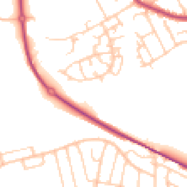
Daytime· 07:00 – 23:00
50.3dB

Night-time· 23:00 – 07:00
40.9dB