15a, Ryelands Crescent, Ashton On Ribble, Preston, PR2 1PX
About 15a
15a is a detached house in Ashton-On-Ribble, Preston, Preston (PR2 1PX). It has a recorded floor area of 105 m² (around 1130 sq ft) and construction records dating it to 1950-1966. The latest certificate (January 2014) shows a D (score 58), a step below the typical UK home. The recommended improvements would push it to C (score 72). The latest certificate is from January 2014, so improvements made since then won't be reflected.
Across 1998–2020, sale prices on this property compounded at 6.4% per year. Today's modelled estimate of £267,000 is 16.6% below the 2020 sale of £320,000, a rare downward gap that often correlates with deferred maintenance or unfinished works. On a £-per-square-foot basis, the last sale (£283/sq ft) was about 170% above the typical sold price in the postcode. At 105 m² the property is well over the postcode median (79 m² across 30 EPCs), placing it in the larger end of the local stock. It lags the bulk of the postcode on energy efficiency (less efficient than 73% of similar EPCs). Most recent transfer: July 2020 at £320,000. Across the public record there are 4 sales, relatively high churn for a single property. One historical planning record sits against the property in 2021.
Know exactly what you're buying at 15a
Before you offer, see what the listing won't tell you, the true value, the red flags and the full history.
Already flagged here
Valuation
against the asking price
Risks
planning & flood
Sold prices
similar homes nearby
Trends
the local market
Energy performance
15a's EPC is over a decade old — improvements since won't be reflected.
EPC Expired
This certificate is over 10 years old and is no longer valid.Expired 11 Jan 2024
EPC Rating
Planning history
- Jul 2021ConversionFullIn report
Conversion of the existing dwelling into 2no. self-contained supported living apartments with ancillary on-site staff office/accommodation (Class C3(b)) (Retrospective application)
Retrospective- Documents
- 17 docs on file
- Reference
- 06/2021/0793
We flagged 2 things worth checking at 15a
Independent checks surfaced things a buyer would want to understand before offering. The report explains each one in full, with the underlying data and what to ask.
- Signs of HMO activity in the area
- Larger development activity nearby
30-day money-back guarantee
Sales history & valuation
Latest sale on 15a was the highest on Land Registry record across the postcode.
£267,000
Modelled from EPC, postcode comparables and a sale-price growth of 6.4% per year over 23 years.
£320,000
Growth on file: 6.4% per year over 23 years.
Sales timeline
26 July 2020Most recent
£320,000
+117.7%over 17 years8 May 2003
£147,000
+59.8%over 3 years27 January 2000
£92,000
+17.2%over 2 years9 January 1998
£78,500
Median price across the last 5 sales in PR2 1PX: £112,000 (2025–2018).
Nearby sales in PR2 1PX
33 Ryelands Crescent, Ashton On Ribble, Preston, PR2 1PX
Sold Feb 2025
£132,00043 Ryelands Crescent, Ashton On Ribble, Preston, PR2 1PX
Sold Feb 2024
£125,0005 Ryelands Crescent, Ashton On Ribble, Preston, PR2 1PX
Sold Apr 2022
£112,00045 Ryelands Crescent, Ashton On Ribble, Preston, PR2 1PX
Sold Nov 2020
£98,00057 Ryelands Crescent, Ashton On Ribble, Preston, PR2 1PX
Sold Dec 2018
£105,000
Everything we know about 15a, in one report
What it's really worth, what could be wrong, and the planning, sales and area data in full.
What we flagged
- Signs of HMO activity in the area
- Larger development activity nearby

Versus other Ryelands Crescent homes
15a outperforms the street on price per m² by a wide margin.
Price per m²
£3,048
Street avg £1,224
Floor Area
105 m²
Street avg 78 m²
Habitable Rooms
5 rooms
Street avg 4 rooms
CO₂ Emissions
5.1 t/year
Street avg 3.1 t/year
Similar properties nearby
1 Aldwych Drive, Ashton On Ribble
PR2 1SJ
1 Alder Coppice, Lea
PR2 1YG
1 Brooklands, Ashton On Ribble
PR2 1AP
1 Bilsborough Meadow, Lea
PR2 1YY
1 Ashton Bank Way, Ashton On Ribble
PR2 1BZ
1 Aldfield Avenue, Lea
PR2 1XQ
1 Ash Meadow, Lea
PR2 1RX
1 Campion Drive, Lea
PR2 1QG
The neighbourhood at a glance
Crime
6/mo
Steady year-on-year across the wider district.
Nearest stop
0.2 km
Makro — bus stop.
Closest school
0.5 km
Lea Community Primary School. 23 schools nearby.
Go deeper on the local area
The full report breaks down crime, transport links, schools and air quality in depth.
Road noise across the postcode
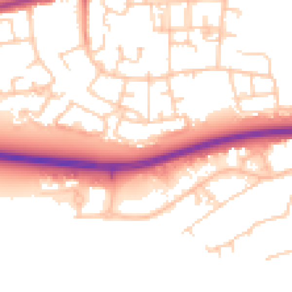
Daytime· 07:00 – 23:00
52.8dB

Night-time· 23:00 – 07:00
43.2dB