Flat 1, 21 St Andrews Road, Southsea, PO5 1EP
About Flat 1
Flat 1 is a two-bedroom semi-detached house in Southsea (PO5 1EP). It has a recorded floor area of 54 m² (around 581 sq ft), construction records dating it to 1900-1929 and council tax band B. The latest certificate (March 2022) shows a D (score 65), on the cusp of jumping into the C band. The rating has held steady at D across 3 certificates since February 2010. Between certificates, window efficiency went from Average to Good and lighting went from Poor to Very Good. The recommended improvements would push it to C (score 75). At 54 m² this is the 2nd smallest of 5 units on EPC record in the building, where floor areas span 48–72 m². The building's EPC ratings span E to C across 5 units on file.
Most recent transfer: August 2021 at £180,000. Across the public record there are 6 sales, relatively high churn for a single property. That sale was during the post-pandemic price surge, when transactions cleared materially above pre-2020 trend. Across 1997–2021, sale prices on this property compounded at 3.5% per year. Today's modelled estimate of £201,000 is 11.7% above the 2021 sale price. On a £-per-square-foot basis, the last sale (£310/sq ft) was about 54.5% above the typical sold price in the postcode.
Know exactly what you're buying at Flat 1
Before you offer, see what the listing won't tell you, the true value, the red flags and the full history.
Already flagged here
Launch offer · save £5
Valuation
against the asking price
Risks
planning & flood
Sold prices
similar homes nearby
Trends
the local market
What this property has
Inside
- Bedrooms2
- Bathrooms1
Outside
- Private gardenYes
Building
- Central heatingYes
- RefurbishedYes
Energy performance
EPC Rating
Property Improvements
Changes detected from historical EPC data
Heating controls changed
Cavity wall insulation installed
Floor insulation added or improved
Window efficiency improved
More low energy lighting installed
Planning history
Flat 1 has no planning applications on record.
Notable planning nearby
111applications of note in the surrounding area
We flagged 1 thing worth checking at Flat 1
Independent checks surfaced things a buyer would want to understand before offering. The report explains each one in full, with the underlying data and what to ask.
- Signs of HMO activity in the area
30-day money-back guarantee
Sales history & valuation
Flat 1 has more than doubled in price since the earliest registered sale in 1997.
£201,000
Modelled from EPC, postcode comparables and a sale-price growth of 3.5% per year over 25 years.
£180,000
Growth on file: 3.5% per year over 25 years.
Sales timeline
23 August 2021Most recent
£180,000
+31.4%over 8 years28 March 2013
£137,000
+3.8%over 7 years30 June 2005
£132,000
-47.2%over 6 months17 December 2004
£250,000
30 March 2004
£249,995
+224.7%over 7 years31 January 1997
£77,000
Median price across the last 5 sales in PO5 1EP: £175,000 (2022–2018).
Nearby sales in PO5 1EP
Flat 2, 31 St Andrews Road, Southsea, PO5 1EP
Sold Dec 2022
£225,000Flat 2, 33 St Andrews Road, Southsea, PO5 1EP
Sold Mar 2022
£195,000Flat 2, 9 St Andrews Road, Southsea, PO5 1EP
Sold Sept 2021
£175,000Flat 5, 9 St Andrews Road, Southsea, PO5 1EP
Sold Feb 2019
£153,000Flat 3, 29 St Andrews Road, Southsea, PO5 1EP
Sold Dec 2018
£172,500
Everything we know about Flat 1, in one report
What it's really worth, what could be wrong, and the planning, sales and area data in full.
What we flagged
- Signs of HMO activity in the area

Versus other St Andrews Road homes
Flat 1 outperforms the street on price per m² by a wide margin.
Price per m²
£3,333
Street avg £2,464
Floor Area
54 m²
Street avg 63 m²
Habitable Rooms
3 rooms
Street avg 3 rooms
CO₂ Emissions
2.4 t/year
Street avg 2.7 t/year
Similar properties nearby
111 113, Flat B, Elm Grove
PO5 1LH
24a, Flat 4, Elm Grove
PO5 1JG
26a, Top Flat, Cottage Grove
PO5 1EN
23 25, Flat 7, St Andrews Road
PO5 1EP
165a, Flat 2, Elm Grove
PO5 1LU
23 25, Flat 3 9, St Andrews Road
PO5 1EP
23 25, Flat 9, St Andrews Road
PO5 1EP
111 113, Flat C, Elm Grove
PO5 1LH
The neighbourhood at a glance
Crime
11/mo
Steady year-on-year across the wider district.
Nearest stop
0.1 km
Elm Grove — bus stop.
Closest school
0.3 km
Cottage Grove Primary School and Nursery. 31 schools nearby.
Go deeper on the local area
The full report breaks down crime, transport links, schools and air quality in depth.
Road noise across the postcode
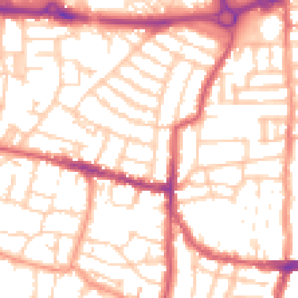
Daytime· 07:00 – 23:00
53.6dB

Night-time· 23:00 – 07:00
42.5dB