20 Arnold Road, Ryde, PO33 3RJ
About 20 Arnold Road
20 Arnold Road is a four-bedroom semi-detached house in Ryde (PO33 3RJ). It has a recorded floor area of 120 m² (around 1292 sq ft), construction records dating it to 1930-1949 and council tax band C. The latest certificate (January 2018) shows a D (score 63), on the cusp of jumping into the C band. The recommended improvements would push it to C (score 80). Other recorded features include a conservatory. Records show the property has been extended at some point in its history.
Across 2001–2018, sale prices on this property compounded at 6.2% per year. Today's modelled estimate of £375,000 is 29.5% above the 2018 sale price. On a £-per-square-foot basis, the last sale (£224/sq ft) was about 43.4% above the typical sold price in the postcode. Last sale on file: £289,500 in June 2018.
What this property has
Inside
- Bedrooms4
- Bathrooms2
- Dining roomYes
- EnsuiteYes
- ConservatoryYes
Outside
- Private gardenYes
- ParkingOff road
Building
- Previously extendedYes
Everything you need to know about 20 Arnold Road
The true value, the hidden risks and the full sale history, in one report.
30-day money-back guarantee

The data behind every report


Energy performance
EPC Rating
Planning history
20 Arnold Road has no planning applications on record.
Notable planning nearby
1applications of note in the surrounding area
We flagged 1 thing worth checking at 20 Arnold Road
Independent checks surfaced things a buyer would want to understand before offering. The report explains each one in full, with the underlying data and what to ask.
- Larger development activity nearby
30-day money-back guarantee
Sales history & valuation
Sale price has at least doubled since 2001.
£375,000
Modelled from EPC, postcode comparables and a sale-price growth of 6.2% per year over 17 years.
£289,500
Growth on file: 6.2% per year over 17 years.
Sales timeline
14 June 2018Most recent
£289,500
+23.2%over 11 years23 February 2007
£235,000
+121.7%over 5 years3 October 2001
£106,000
Median price across the last 5 sales in PO33 3RJ: £300,000 (2022–2016).
Versus other Arnold Road homes
On price per m², 20 Arnold Road stands well clear of the street.
Price per m²
£2,413
Street avg £1,997
Floor Area
120 m²
Street avg 129 m²
Habitable Rooms
6 rooms
Street avg 6 rooms
CO₂ Emissions
4.6 t/year
Street avg 8.9 t/year
Everything you need to know about 20 Arnold Road
The true value, the hidden risks and the full sale history, in one report.
30-day money-back guarantee
The data behind every report
Similar properties nearby
1 Beatrice Close
PO33 3PB
1 Adelaide Place
PO33 3DP
1 Bourn Close
PO33 3TW
1 Birch Gardens
PO33 3XB
1 Binstead Lodge Road
PO33 3SG
1 Cemetery Road
PO33 3RE
1 Arthur Street
PO33 3BT
1 Binstead Hill
PO33 3RR
The neighbourhood at a glance
Daytime road noise here sits well below conversation level — a quiet pocket of the postcode.
Crime
7/mo
Steady year-on-year across the wider district.
Nearest stop
0.1 km
Kings Road — bus stop.
Closest school
0.3 km
Binstead Primary School. 6 schools nearby.
Go deeper on the local area
The full report breaks down crime, transport links, schools and air quality in depth.
Road noise across the postcode
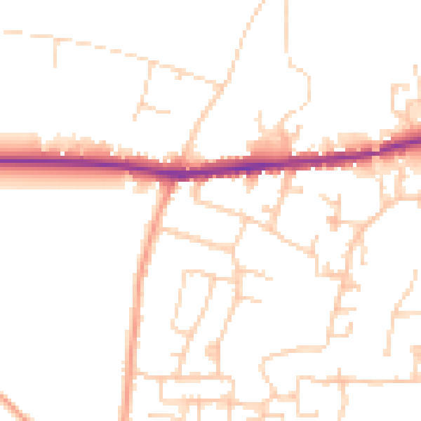
Daytime· 07:00 – 23:00
48.9dB

Night-time· 23:00 – 07:00
40.0dB