9 Barwell Grove, Emsworth, PO10 7XY
About 9 Barwell Grove
9 Barwell Grove is a three-bedroom detached house in Emsworth (PO10 7XY). It has a recorded floor area of 72 m² (around 775 sq ft), construction records dating it to 1976-1982 and council tax band C. The latest certificate (January 2013) shows a C (score 72). The recommended improvements would push it to B (score 86). The latest certificate is from January 2013, so improvements made since then won't be reflected.
Across 1996–2013, sale prices on this property compounded at 8.3% per year. Today's modelled estimate of £374,000 sits 50.5% above the 2013 sale of £248,500. On a £-per-square-foot basis, the last sale (£321/sq ft) was about 53.1% above the typical sold price in the postcode. 13 years since the last transfer (June 2013). Across the public record there are 6 sales, relatively high churn for a single property. 2 planning records sit against the property, 2 approved, 0 refused. Past consents include tree works, meaningful when judging how the property has evolved.
Know exactly what you're buying at 9 Barwell Grove
Before you offer, see what the listing won't tell you, the true value, the red flags and the full history.
Already flagged here
Launch offer · save £5
Valuation
against the asking price
Risks
planning & flood
Sold prices
similar homes nearby
Trends
the local market
What this property has
Inside
- Bedrooms3
Energy performance
9 Barwell Grove's EPC is over a decade old — improvements since won't be reflected.
EPC Expired
This certificate is over 10 years old and is no longer valid.Expired 22 Jan 2023
EPC Rating
Planning history
Planning history at 9 Barwell Grove is exclusively tree-management applications — typical for a property with mature trees on or near the plot.
- Feb 2024Tree WorksTreesIn report
1No Oak (T1) crown reduce by 2m overall leaving a height of 12m by 10m width. Subject to TPO 0996.
- Agent
- Michael Reed & Co Tree Service Ltd
- Documents
- 4 docs on file
- Reference
- APP/24/00021
- Dec 2012Tree WorksTreesIn report
Reduce major limb growing towards the house back to original pruning point and crown reduce canopy by 1m Oak within Area Order 1 of TPO 0996.
- Documents
- 4 docs on file
- Reference
- APP/12/01171
We flagged 1 thing worth checking at 9 Barwell Grove
Independent checks surfaced things a buyer would want to understand before offering. The report explains each one in full, with the underlying data and what to ask.
- Larger development activity nearby
30-day money-back guarantee
Sales history & valuation
Sale price has grown by over 3x since 1996.
£374,000
Modelled from EPC, postcode comparables and a sale-price growth of 8.3% per year over 17 years.
£248,500
Growth on file: 8.3% per year over 17 years.
Sales timeline
13 June 2013Most recent
£248,500
+28.1%over 4 years4 December 2008
£194,000
-7.6%over 3 years28 April 2005
£210,000
+82.6%over 4 years3 April 2001
£115,000
+35.3%over 1 year8 April 1999
£84,995
+28.8%over 2 years2 October 1996
£66,000
Median price across the last 5 sales in PO10 7XY: £337,500 (2025–2021).
Nearby sales in PO10 7XY
Everything we know about 9 Barwell Grove, in one report
What it's really worth, what could be wrong, and the planning, sales and area data in full.
What we flagged
- Larger development activity nearby

Versus other Barwell Grove homes
EPC Rating for 9 Barwell Grove runs comfortably ahead of the street norm.
Price per m²
£3,451
Street avg £3,688
Floor Area
72 m²
Street avg 75 m²
Habitable Rooms
5 rooms
Street avg 4 rooms
CO₂ Emissions
2.2 t/year
Street avg 2.8 t/year
Similar properties nearby
1 Bullfinch Close, Brushwood Grove
PO10 7GX
1 Barwell Grove
PO10 7XY
1 Birch Tree Drive
PO10 7RS
1 Churchill Drive
PO10 7SL
1 Bath Road
PO10 7EP
1 Chequers Quay, 37 Queen Street
PO10 7AD
1 Bridgefoot Path
PO10 7EA
1 Bridge Road
PO10 7DT
The neighbourhood at a glance
Crime
2/mo
Steady year-on-year across the wider district.
Nearest stop
0.2 km
Allendale Avenue — bus stop.
Closest school
0.6 km
St James Church of England Controlled Primary School. 13 schools nearby.
Go deeper on the local area
The full report breaks down crime, transport links, schools and air quality in depth.
Road noise across the postcode
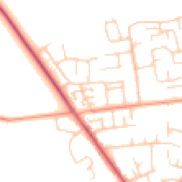
Daytime· 07:00 – 23:00
50.2dB

Night-time· 23:00 – 07:00
41.0dB