69 Norfolk Street, King's Lynn, PE30 1AG
About 69 Norfolk Street
69 Norfolk Street is a one-bedroom mid-terrace house in King's Lynn (PE30 1AG). It has a recorded floor area of 40 m² (around 431 sq ft), construction records dating it to 2012 onwards and council tax band A. The latest certificate (May 2023) returns a B (score 83), comfortably above the UK average. When first surveyed in March 2012 the rating was E, the property has climbed 3 bands since. Between certificates, main heating went from Very Poor to Average. Main heating runs on electricity. At 40 m² this is the 7th smallest of 23 units on EPC record in the building, where floor areas span 18–101 m². The building's EPC ratings span G to B, with this unit at the top.
It hasn't traded since February 2010, a hold of 17 years that's notably long for the area. One planning record on file: change of use to residential approved in 2010. Past consents include change of use to residential, meaningful when judging how the property has evolved. At 40 m² it's 24.5% smaller than the typical home in the postcode (53 m² median across 22 EPCs). Its energy rating outperforms most of the postcode (better than 77% of similar EPCs). Across 2006–2010, sale prices on this property compounded at 1.1% per year. On a £-per-square-foot basis, the last sale (£348/sq ft) was about 194.6% above the typical sold price in the postcode.
What this property has
Inside
- Bedrooms1
- Dining roomYes
Outside
- Private gardenYes
Building
- ConciergeYes
- RefurbishedYes
Everything you need to know about 69 Norfolk Street
The true value, the hidden risks and the full sale history, in one report.
Pick your report · from £14.99
One time fee only - money back guarantee

The data behind every report


Energy performance
For a compact home of this size, this rating sits in the top tier locally.
EPC Rating
Certificate validity
Valid until 22 May 2033
Property Improvements
Changes detected from historical EPC data
Floor insulation added or improved
More low energy lighting installed

Get a survey for this property
Level 3 Building Survey
Because the property has no mains gas supply and has solid (non-cavity) walls, we believe a Level 3 building survey should be considered.
From £820 · Includes VAT
Planning history
1 application on record at 69 Norfolk Street, King's Lynn, PE30 1AG
- May 2010Change of UseFullOutcome in report
1Alterations and conversion of former shop into two residential flats, including removal of existing shopfront
- Documents
- 20 docs on file
- Reference
- 10/00487/F
Unlock 69 Norfolk Street, King's Lynn, PE30 1AG's full planning history
You're seeing the shape of it. The report has the substance.
- Every decision — granted, refused or withdrawn (1 on record)
- All 1 application on this property in full, plus 7 notable nearby
- The 20 documents, officer reports & conditions
- What the pattern means for extending or converting here
One time fee only - money back guarantee
Sales history & valuation
69 Norfolk Street valuation sits well clear of the typical sold price in this postcode.
£144,000
Modelled from EPC, postcode comparables and a sale-price growth of 1.1% per year over 3 years.
£150,000
Growth on file: 1.1% per year over 3 years.
Sales timeline
3 February 2010Most recent
£150,000
+3.4%over 3 years1 December 2006
£145,000
Median price across the last 5 sales in PE30 1AG: £200,000 (2023–2016).
Nearby sales in PE30 1AG
65 Norfolk Street, King's Lynn, PE30 1AG
Sold Apr 2023
£200,00067 Norfolk Street, King's Lynn, PE30 1AG
Sold May 2022
£140,00068a, Norfolk Street, King's Lynn, PE30 1AG
Sold Jan 2022
£125,00058 59, Flat B, Norfolk Street, King's Lynn, PE30 1AG
Sold Apr 2014
£70,00058 59, Flat A, Norfolk Street, King's Lynn, PE30 1AG
Sold Sept 2013
£70,000
Versus other Norfolk Street homes
69 Norfolk Street outperforms the street on years held by a wide margin.
Price per m²
£3,750
Street avg £2,957
Floor Area
40 m²
Street avg 40 m²
Habitable Rooms
2 rooms
Street avg 2 rooms
CO₂ Emissions
1.7 t/year
Street avg 2.7 t/year
Everything you need to know about 69 Norfolk Street
The true value, the hidden risks and the full sale history, in one report.
Pick your report · from £14.99
One time fee only - money back guarantee
The data behind every report
Similar properties nearby
1 Gainsborough Court, Waterloo Street
PE30 1RY
1 Edinburgh Court
PE30 1ND
1 Albion Street
PE30 1NJ
1 Goddard Terrace, Kirby Street
PE30 1QQ
1 Fells Warehouse, Market Lane
PE30 1AX
1 Chapel Court, Chapel Street
PE30 1EG
1 Eagle Yard
PE30 1RG
1 Blackfriars Road
PE30 1NR
The neighbourhood at a glance
Rail-style transport is unusually close for this postcode.
Crime
458/mo
Steady year-on-year across the wider district.
Nearest stop
0.3 km
Kings Lynn Rail Station — railway station.
Closest school
0.2 km
Eastgate Academy. 18 schools nearby.
Go deeper on the local area
A Local Area report breaks down crime, transport links, schools and air quality in depth.
Road noise across the postcode
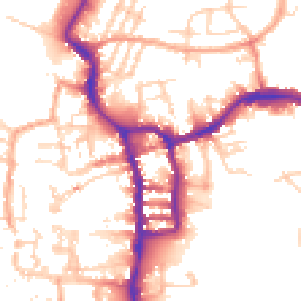
Daytime· 07:00 – 23:00
53.9dB
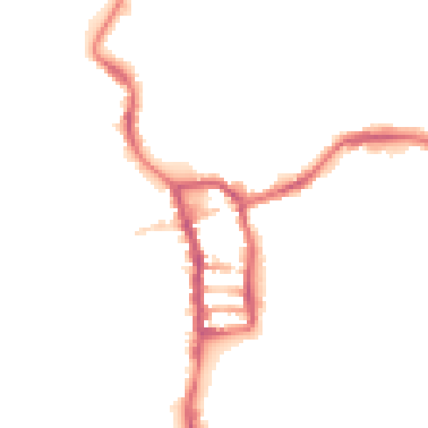
Night-time· 23:00 – 07:00
43.6dB