35 Holly Grove, Chadderton, Oldham, OL9 0DT
About 35 Holly Grove
35 Holly Grove is a property in Chadderton, Oldham, Oldham (OL9 0DT). It has council tax band A.
It hasn't traded since May 1995, a hold of 31 years that's notably long for the area. Only one transfer is on record with HM Land Registry, suggesting it has stayed in the same hands for a long time.
Everything you need to know about 35 Holly Grove
The true value, the hidden risks and the full sale history, in one report.
Pick your report · every report is £14.99
One time fee only - money back guarantee

The data behind every report


Energy performance
No EPC on record
This property doesn't have an Energy Performance Certificate yet. An EPC is required to sell or let — and unlocks our automated valuation.
Get a survey for this property
Level 2 HomeBuyer Report
We've checked 10 risk factors against the available data for this property and believe a Level 2 HomeBuyer Report could be a suitable option for you.
Planning history
35 Holly Grove has no planning applications on record.
But the area is active
2 notable applications nearby — larger schemes and conversions that could reshape the street. The report maps them all.
Sales history & valuation
35 Holly Grove has been held in the same hands since before 2000.
£30,000
Recorded with HM Land Registry.
Sales timeline
2 May 1995Most recent
£30,000
Median price across the last 4 sales in OL9 0DT: £167,500 (2023–1999).
Everything you need to know about 35 Holly Grove
The true value, the hidden risks and the full sale history, in one report.
Pick your report · every report is £14.99
One time fee only - money back guarantee
The data behind every report
Similar properties nearby
1 5, Victoria Street, Chadderton
OL9 0HH
1 Alasdair Close, Chadderton
OL9 0NE
1 Alligin Close, Chadderton
OL9 0LZ
1 Arkle Drive, Chadderton
OL9 0ND
1 Ash Walk, Chadderton
OL9 0JP
1 Avon Road, Chadderton
OL9 0PH
1 Bannach Drive, Chadderton
OL9 0QN
1 Baytree Avenue, Chadderton
OL9 0NH
The neighbourhood at a glance
Crime
1/mo
Steady year-on-year across the wider district.
Nearest stop
0.1 km
Holly Grove — bus stop.
Closest school
0.1 km
Bare Trees Primary School. 44 schools nearby.
Go deeper on the local area
A Local Area report breaks down crime, transport links, schools and air quality in depth.
Road noise across the postcode
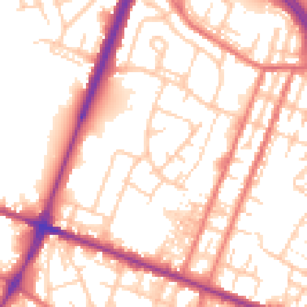
Daytime· 07:00 – 23:00
54.7dB

Night-time· 23:00 – 07:00
44.8dB