52 Oldham Road, Denshaw, Oldham, OL3 5SP
About 52 Oldham Road
52 Oldham Road is a semi-detached house in Denshaw, Oldham, Oldham (OL3 5SP). It has a recorded floor area of 286 m² (around 3078 sq ft), construction records dating it to before 1900 and council tax band F. The latest certificate (March 2015) shows an F (score 27), near the bottom of the EPC scale. The recommended improvements would lift it to C (score 80), a 3-band jump. Main heating runs on oil. The latest certificate is from March 2015, so improvements made since then won't be reflected.
Untraded for 31 years, with the last transfer in May 1995. Only one transfer is on record with HM Land Registry, suggesting it has stayed in the same hands for a long time. At 286 m² the property is well over the postcode median (140 m² across 16 EPCs), placing it in the larger end of the local stock. On energy efficiency it sits in the bottom 10% of properties in this postcode — significant headroom for improvement. Today's modelled estimate of £640,000 sits 384.8% above the 1995 sale of £132,000. On a £-per-square-foot basis, the last sale (£43/sq ft) was about 79.6% below the postcode norm. 2 planning records sit against the property, 1 approved, 1 refused.
Everything you need to know about 52 Oldham Road
The true value, the hidden risks and the full sale history, in one report.
Pick your report · from £14.99
One time fee only - money back guarantee

The data behind every report







Energy performance
52 Oldham Road sits at the bottom of the postcode for energy efficiency — meaningful headroom to improve.
EPC Expired
This certificate is over 10 years old and is no longer valid.Expired 26 Mar 2025
EPC Rating
Certificate validity
Expired on 26 March 2025

Get a survey for this property
Level 3 Building Survey
Because the property was built before 1919, we believe a Level 3 building survey should be considered.
From £1,155 · Includes VAT
Planning history
2 applications on record at 52 Oldham Road, Denshaw, Oldham, OL3 5SP
- Aug 2010OutbuildingFullOutcome in report
Erection of detached agricultural storage building
- Documents
- 8 docs on file
- Reference
- PA/058302/10
- More recent applications — locked
- OutbuildingMay 2011Decision
Unlock 52 Oldham Road, Denshaw, Oldham, OL3 5SP's full planning history
You're seeing the shape of it. The report has the substance.
- Every decision — granted, refused or withdrawn (2 on record)
- All 2 applications on this property in full, plus 1 notable nearby
- The 14 documents, officer reports & conditions
- What the pattern means for extending or converting here
One time fee only - money back guarantee
Sales history & valuation
52 Oldham Road's modelled value sits at over four times its earliest registered sale price (1995).
£640,000
Modelled from EPC, postcode comparables.
£132,000
Recorded with HM Land Registry.
Sales timeline
18 May 1995Most recent
£132,000
Median price across the last 5 sales in OL3 5SP: £405,000 (2025–2022).
Nearby sales in OL3 5SP
1 Martins Cottages, Oldham Road, Denshaw, Oldham, OL3 5SP
Sold Mar 2025
£400,000The Coach House, Oldham Road, Denshaw, Oldham, OL3 5SP
Sold May 2024
£610,000Woodbrow Place, Oldham Road, Denshaw, Oldham, OL3 5SP
Sold May 2024
£405,0002 Woodbrow Mill, Oldham Road, Denshaw, Oldham, OL3 5SP
Sold May 2023
£397,50054 Oldham Road, Denshaw, Oldham, OL3 5SP
Sold Jan 2022
£710,000
Versus other Oldham Road homes
On price per m², 52 Oldham Road runs well behind the street norm.
Price per m²
£462
Street avg £2,819
Floor Area
286 m²
Street avg 156 m²
Habitable Rooms
9 rooms
Street avg 7 rooms
CO₂ Emissions
28.0 t/year
Street avg 6.6 t/year
Everything you need to know about 52 Oldham Road
The true value, the hidden risks and the full sale history, in one report.
Pick your report · from £14.99
One time fee only - money back guarantee
The data behind every report
Similar properties nearby
1 Coblers Hill, Delph
OL3 5HT
1 Ammons Way, Delph
OL3 5US
1 Barmeadow, Dobcross
OL3 5QW
1 Buckley Drive, Denshaw
OL3 5RT
1 2, Well Brow, Delph
OL3 5JF
1 Ashley House, Horest Lane, Denshaw
OL3 5SU
1 Clydesdale Rise, Diggle
OL3 5PX
1 Ambrose Crescent, Diggle
OL3 5XG
The neighbourhood at a glance
Crime
1/mo
Steady year-on-year across the wider district.
Nearest stop
0.1 km
The Barracks — bus stop.
Closest school
0.7 km
Christ Church CofE Primary School. 5 schools nearby.
Go deeper on the local area
A Local Area report breaks down crime, transport links, schools and air quality in depth.
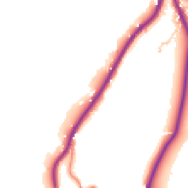
Road noise across the postcode
Daytime· 07:00 – 23:00
50.4dB

Night-time· 23:00 – 07:00
43.0dB