21 Briar Street, Rochdale, OL11 4HD
About 21 Briar Street
21 Briar Street is an end-of-terrace house in Rochdale (OL11 4HD). It has a recorded floor area of 82 m² (around 883 sq ft), construction records dating it to 1900-1929 and council tax band A. The latest certificate (October 2021) shows a C (score 69), just inside the C band. The recommended improvements would push it to B (score 83).
At 82 m² the property is well over the postcode median (62 m² across 19 EPCs), placing it in the larger end of the local stock. Today's modelled estimate of £136,000 sits 60% above the 2022 sale of £85,000. On a £-per-square-foot basis, the last sale (£96/sq ft) was about 39.7% above the typical sold price in the postcode. Last sale on file: £85,000 in May 2022. That sale was during the post-pandemic price surge, when transactions cleared materially above pre-2020 trend. One historical planning record sits against the property in 2007.
Everything you need to know about 21 Briar Street
The true value, the hidden risks and the full sale history, in one report.
30-day money-back guarantee

The data behind every report


Energy performance
EPC Rating
Planning history
- Apr 2007FullIn report
Front And Rear Dormers To Dwelling
- Documents
- 1 doc on file
- Reference
- 07/D48857
We flagged 1 thing worth checking at 21 Briar Street
Independent checks surfaced things a buyer would want to understand before offering. The report explains each one in full, with the underlying data and what to ask.
- Larger development activity nearby
30-day money-back guarantee
Sales history & valuation
21 Briar Street's sale-price growth has lagged the wider UK trajectory across its history on file.
£136,000
Modelled from EPC, postcode comparables and a sale-price growth of 0.2% per year over 14 years.
£85,000
Growth on file: 0.2% per year over 14 years.
Sales timeline
30 May 2022Most recent
£85,000
+21.4%over 7 years17 December 2014
£70,000
-15.7%over 6 years10 March 2008
£83,000
Median price across the last 5 sales in OL11 4HD: £95,000 (2025–2021).
Versus other Briar Street homes
Price per m²
£1,037
Street avg £871
Floor Area
82 m²
Street avg 73 m²
Habitable Rooms
4 rooms
Street avg 4 rooms
CO₂ Emissions
3.4 t/year
Street avg 3.3 t/year
Everything you need to know about 21 Briar Street
The true value, the hidden risks and the full sale history, in one report.
30-day money-back guarantee
The data behind every report
Similar properties nearby
The neighbourhood at a glance
Crime
1/mo
Steady year-on-year across the wider district.
Nearest stop
0.2 km
Rochdale Bus Depot — bus stop.
Closest school
0.5 km
Rochdale Sixth Form College. 37 schools nearby.
Go deeper on the local area
The full report breaks down crime, transport links, schools and air quality in depth.
Road noise across the postcode
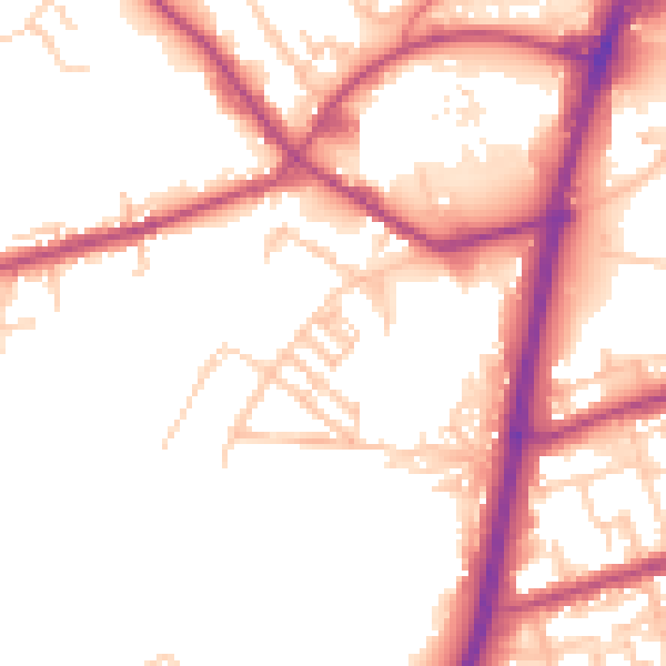
Daytime· 07:00 – 23:00
52.6dB
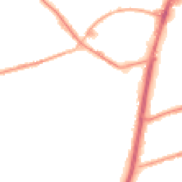
Night-time· 23:00 – 07:00
45.2dB