158 Thorpe Road, Norwich, NR1 1TJ
About 158 Thorpe Road
158 Thorpe Road is a three-bedroom mid-terrace house in Norwich (NR1 1TJ). It has a recorded floor area of 75 m² (around 807 sq ft), construction records dating it to before 1900 and council tax band C. The latest certificate (June 2019) shows a D (score 66), on the cusp of jumping into the C band. When first surveyed in February 2009 the rating was E, the property has climbed 1 band since. Between certificates, roof efficiency went from Very Poor to Average, hot-water efficiency went from Good to Very Good and lighting went from Very Poor to Poor; while wall efficiency dropped from Good to Very Poor. The recommended improvements would lift it to B (score 85), a 2-band jump.
Most recent transfer: September 2019 at £374,000. Across the public record there are 4 sales, relatively high churn for a single property. Across 2000–2019, sale prices on this property compounded at 7.6% per year. On a £-per-square-foot basis, the last sale (£463/sq ft) was about 268.4% above the typical sold price in the postcode. At 75 m² it's 15.7% smaller than the typical home in the postcode (89 m² median across 31 EPCs). One historical planning record sits against the property in 2023.
What this property has
Inside
- Bedrooms3
- Bathrooms1
Everything you need to know about 158 Thorpe Road
The true value, the hidden risks and the full sale history, in one report.
Pick your report · from £14.99
One time fee only - money back guarantee

The data behind every report







Energy performance
Recommended upgrades on file would lift this property by multiple EPC bands.
EPC Rating
Certificate validity
Valid until 25 June 2029
Property Improvements
Changes detected from historical EPC data
Heating controls upgraded for better temperature management
Hot water efficiency improved
Windows upgraded, improving insulation
Roof insulation improved

Get a survey for this property
Level 3 Building Survey
Because the property was built before 1919 and has solid (non-cavity) walls, we believe a Level 3 building survey should be considered.
From £955 · Includes VAT
Planning history
1 application on record at 158 Thorpe Road, Norwich, NR1 1TJ
- Jun 2023Tree WorksTreesOutcome in report
T1 (Beech) Height approx 18metres. Eastern crown radius 10 metres. Southern crown radius 9 metres. Western crown radius 7 metres. Crown clean by removing dead, suppressed and small crossing branches only. Reduce western and eastern aspects of crown up to 2 metres and southern aspect up to 3 metres. Raise crown on southern half of tree up to 5 metres by removing lower branches where possible back to secondary growth points and only primary where no other option. Raise northern aspect by approx 2.5 metres to match with rest of crown.
- Reference
- 23/00680/TCA
Unlock 158 Thorpe Road, Norwich, NR1 1TJ's full planning history
You're seeing the shape of it. The report has the substance.
- Every decision — granted, refused or withdrawn (1 on record)
- All 1 application on this property in full, plus 1 notable nearby
- What the pattern means for extending or converting here
One time fee only - money back guarantee
Sales history & valuation
Price for 158 Thorpe Road has grown more than fourfold since the 2000 starting point.
£389,000
Modelled from EPC, postcode comparables and a sale-price growth of 7.6% per year over 19 years.
£374,000
Growth on file: 7.6% per year over 19 years.
Sales timeline
3 September 2019Most recent
£374,000
+31.2%over 4 years21 May 2015
£285,000
+35.7%over 5 years28 May 2009
£210,000
+133.3%over 9 years13 April 2000
£90,000
Median price across the last 5 sales in NR1 1TJ: £400,000 (2024–2018).
Versus other Thorpe Road homes
On price per m², 158 Thorpe Road stands well clear of the street.
Price per m²
£4,987
Street avg £2,006
Floor Area
75 m²
Street avg 150 m²
Habitable Rooms
5 rooms
Street avg 6 rooms
CO₂ Emissions
3.3 t/year
Street avg 8.1 t/year
Everything you need to know about 158 Thorpe Road
The true value, the hidden risks and the full sale history, in one report.
Pick your report · from £14.99
One time fee only - money back guarantee
The data behind every report
Similar properties nearby
1 Aspland Road
NR1 1SH
1 Clarence Harbour Court, Carrow Road
NR1 1JF
1 Ashman Bank, Geoffrey Watling Way
NR1 1HB
1 Cedar Road
NR1 1HL
1 Cremorne Lane
NR1 1TX
1 Cozens Road
NR1 1JJ
1 Fuggles Yard
NR1 1RW
1 Greyfriars Road
NR1 1PR
The neighbourhood at a glance
Rail-style transport is unusually close for this postcode.
Crime
329/mo
Falling year-on-year across the wider district.
Nearest stop
0.9 km
Norwich Rail Station — railway station.
Closest school
0.3 km
Lionwood Infant and Nursery School. 28 schools nearby.
Go deeper on the local area
A Local Area report breaks down crime, transport links, schools and air quality in depth.
Road noise across the postcode
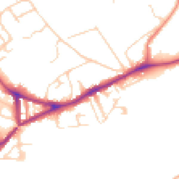
Daytime· 07:00 – 23:00
48.8dB
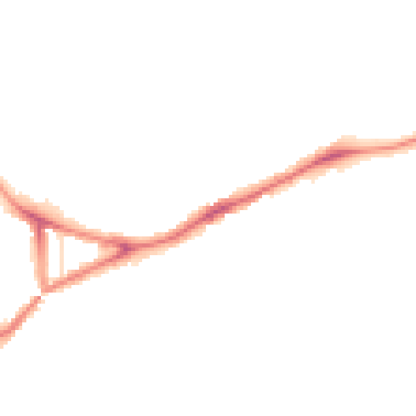
Night-time· 23:00 – 07:00
40.2dB