43 Chatsworth Drive, Wellingborough, NN8 5FD
About 43 Chatsworth Drive
43 Chatsworth Drive is a two-bedroom semi-detached house in Wellingborough (NN8 5FD). It has a recorded floor area of 61 m² (around 655 sq ft), construction records dating it to 1991-1995 and council tax band B. The latest certificate (August 2011) shows a D (score 67), on the cusp of jumping into the C band. The latest certificate is from August 2011, so improvements made since then won't be reflected.
Across 2004–2012, sale prices on this property compounded at 1% per year. Today's modelled estimate of £209,000 sits 83.3% above the 2012 sale of £114,000. At 61 m² it sits well below the postcode median (95 m² across 22 EPCs), making it one of the more compact homes locally. 2 bedrooms is on the smaller side for this postcode, where 4 is the typical count. On the market in February 2012 and unlisted since — roughly 14 years.
What this property has
Inside
- Bedrooms2
Outside
- GarageSingle
Building
- Heating systemGas
- RefurbishedYes
Everything you need to know about 43 Chatsworth Drive
The true value, the hidden risks and the full sale history, in one report.
Pick your report · every report is £14.99
One time fee only - money back guarantee

The data behind every report


Energy performance
43 Chatsworth Drive's EPC is over a decade old — improvements since won't be reflected.
EPC Expired
This certificate is over 10 years old and is no longer valid.Expired 23 Aug 2021
EPC Rating
Get a survey for this property
Level 2 HomeBuyer Report
We've checked 10 risk factors against the available data for this property and believe a Level 2 HomeBuyer Report could be a suitable option for you.
From £545 · Includes VAT
Planning history
43 Chatsworth Drive has no planning applications on record.
A planning report still maps activity across the surrounding area and reads this property's extension & conversion potential.
Sales history & valuation
43 Chatsworth Drive valuation sits well clear of the typical sold price in this postcode.
£209,000
Modelled from EPC, postcode comparables and a sale-price growth of 1.0% per year over 8 years.
£114,000
Growth on file: 1.0% per year over 8 years.
Sales timeline
17 February 2012Most recent
£114,000
+8.6%over 7 years19 March 2004
£105,000
Median price across the last 5 sales in NN8 5FD: £375,000 (2025–2021).
Nearby sales in NN8 5FD
67 Chatsworth Drive, Wellingborough, NN8 5FD
Sold Jul 2025
£375,00073 Chatsworth Drive, Wellingborough, NN8 5FD
Sold Aug 2022
£460,00019 Chatsworth Drive, Wellingborough, NN8 5FD
Sold Dec 2021
£398,00053 Chatsworth Drive, Wellingborough, NN8 5FD
Sold Jul 2021
£190,00075 Chatsworth Drive, Wellingborough, NN8 5FD
Sold Jun 2021
£301,500
Versus other Chatsworth Drive homes
Floor Area for 43 Chatsworth Drive lags the street by a wide margin.
Price per m²
£1,874
Street avg £2,393
Floor Area
61 m²
Street avg 92 m²
Habitable Rooms
4 rooms
Street avg 6 rooms
CO₂ Emissions
2.5 t/year
Street avg 3.5 t/year
Everything you need to know about 43 Chatsworth Drive
The true value, the hidden risks and the full sale history, in one report.
Pick your report · every report is £14.99
One time fee only - money back guarantee
The data behind every report
Similar properties nearby
The neighbourhood at a glance
Crime
5/mo
Steady year-on-year across the wider district.
Nearest stop
0.2 km
23 Muirfield Road — bus stop.
Closest school
0.7 km
The Glenvale Church of England Primary School. 17 schools nearby.
Go deeper on the local area
A Local Area report breaks down crime, transport links, schools and air quality in depth.
Road noise across the postcode
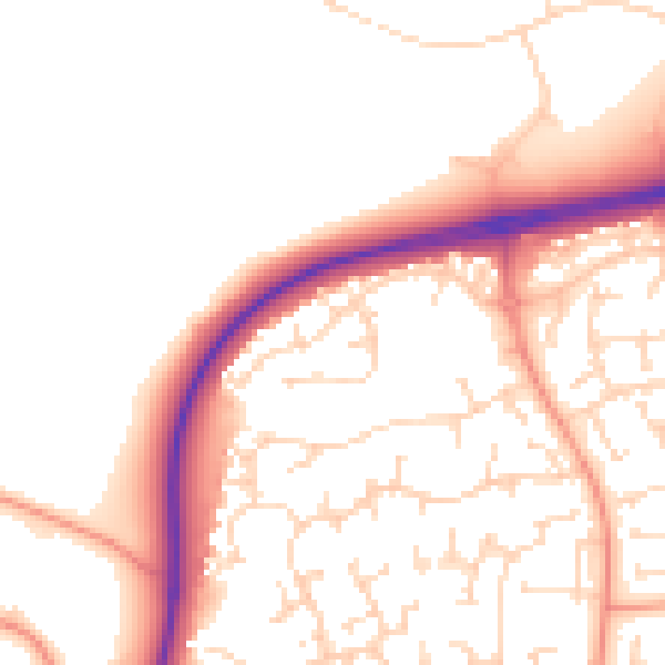
Daytime· 07:00 – 23:00
52.0dB

Night-time· 23:00 – 07:00
42.7dB