17 Croyland Road, Wellingborough, NN8 2LB
About 17 Croyland Road
17 Croyland Road is a three-bedroom detached house in Wellingborough (NN8 2LB). It has a recorded floor area of 105 m² (around 1130 sq ft), construction records dating it to 1930-1949 and council tax band C. The latest certificate (April 2018) shows an F (score 26), near the bottom of the EPC scale. The recommended improvements would lift it to C (score 70), a 3-band jump.
On energy efficiency it sits in the bottom 10% of properties in this postcode — significant headroom for improvement. Across 2006–2018, sale prices on this property compounded at 2.6% per year. Today's modelled estimate of £290,000 is 41.5% above the 2018 sale price. On a £-per-square-foot basis, the last sale (£181/sq ft) was about 16.6% above the typical sold price in the postcode. Last sale on file: £205,000 in August 2018.
What this property has
Inside
- Bedrooms3
Everything you need to know about 17 Croyland Road
The true value, the hidden risks and the full sale history, in one report.
Pick your report · every report is £14.99
One time fee only - money back guarantee

The data behind every report


Energy performance
17 Croyland Road sits at the bottom of the postcode for energy efficiency — meaningful headroom to improve.
EPC Rating
Get a survey for this property
Level 3 Building Survey
Because the property has solid (non-cavity) walls, we believe a Level 3 building survey should be considered.
From £885 · Includes VAT
Planning history
17 Croyland Road has no planning applications on record.
A planning report still maps activity across the surrounding area and reads this property's extension & conversion potential.
Sales history & valuation
17 Croyland Road valuation sits well clear of the typical sold price in this postcode.
£290,000
Modelled from EPC, postcode comparables and a sale-price growth of 2.6% per year over 12 years.
£205,000
Growth on file: 2.6% per year over 12 years.
Sales timeline
1 August 2018Most recent
£205,000
+34.9%over 11 years6 November 2006
£152,000
Median price across the last 5 sales in NN8 2LB: £251,000 (2023–2021).
Nearby sales in NN8 2LB
21 Croyland Road, Wellingborough, NN8 2LB
Sold Jun 2023
£240,0005 Croyland Road, Wellingborough, NN8 2LB
Sold Feb 2023
£251,00013 Croyland Road, Wellingborough, NN8 2LB
Sold Sept 2021
£305,00034 Croyland Road, Wellingborough, NN8 2LB
Sold Apr 2021
£395,00025 Croyland Road, Wellingborough, NN8 2LB
Sold Apr 2021
£218,500
Versus other Croyland Road homes
On epc rating, 17 Croyland Road runs well behind the street norm.
Price per m²
£1,952
Street avg £2,325
Floor Area
105 m²
Street avg 106 m²
Habitable Rooms
5 rooms
Street avg 5 rooms
CO₂ Emissions
8.9 t/year
Street avg 5.0 t/year
Everything you need to know about 17 Croyland Road
The true value, the hidden risks and the full sale history, in one report.
Pick your report · every report is £14.99
One time fee only - money back guarantee
The data behind every report
Similar properties nearby
The neighbourhood at a glance
Crime
5/mo
Steady year-on-year across the wider district.
Nearest stop
0.1 km
Monks Way — bus stop.
Closest school
0.4 km
Wrenn School. 20 schools nearby.
Go deeper on the local area
A Local Area report breaks down crime, transport links, schools and air quality in depth.
Road noise across the postcode
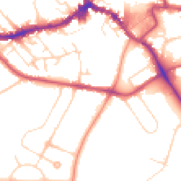
Daytime· 07:00 – 23:00
51.6dB

Night-time· 23:00 – 07:00
42.3dB