4 Central Avenue, Mapperley, Nottingham, NG3 5LD
About 4 Central Avenue
4 Central Avenue is a three-bedroom detached house in Mapperley, Nottingham, Nottingham (NG3 5LD). It has a recorded floor area of 104 m² (around 1119 sq ft), construction records dating it to 1950-1966 and council tax band C. The latest certificate (May 2019) shows an F (score 26), near the bottom of the EPC scale. The recommended improvements would lift it to C (score 80), a 3-band jump. Period features are noted in the property record. Our model identifies extension potential, subject to local planning policy.
At 104 m² it's 17.5% smaller than the typical home in the postcode (126 m² median across 8 EPCs). On energy efficiency it sits in the bottom 10% of properties in this postcode — significant headroom for improvement. On a £-per-square-foot basis, the last sale (£331/sq ft) was about 91.2% above the typical sold price in the postcode. Sold December 2022 for £370,000. That sale was during the post-pandemic price surge, when transactions cleared materially above pre-2020 trend.
What this property has
Inside
- Bedrooms3
- Bathrooms1
- Dining roomYes
Outside
- Private gardenRear
- GarageYes
Building
- Period featuresYes
- Extension potentialPossible
Everything you need to know about 4 Central Avenue
The true value, the hidden risks and the full sale history, in one report.
Pick your report · every report is £14.99
One time fee only - money back guarantee

The data behind every report


Energy performance
4 Central Avenue sits at the bottom of the postcode for energy efficiency — meaningful headroom to improve.
EPC Rating
Get a survey for this property
Level 3 Building Survey
Because the property has been extended more than once and has solid (non-cavity) walls, we believe a Level 3 building survey should be considered.
From £955 · Includes VAT
Planning history
4 Central Avenue has no planning applications on record.
But the area is active
4 notable applications nearby — larger schemes and conversions that could reshape the street. The report maps them all.
Sales history & valuation
Latest sale on 4 Central Avenue was the highest on Land Registry record across the postcode.
£373,000
Modelled from EPC, postcode comparables.
£370,000
Recorded with HM Land Registry.
Sales timeline
20 December 2022Most recent
£370,000
Median price across the last 5 sales in NG3 5LD: £220,000 (2022–2005).
Nearby sales in NG3 5LD
10 Central Avenue, Mapperley, Nottingham, NG3 5LD
Sold Jan 2022
£344,0006 Central Avenue, Mapperley, Nottingham, NG3 5LD
Sold Sept 2017
£240,00014 Central Avenue, Mapperley, Nottingham, NG3 5LD
Sold Jun 2017
£220,00018 Central Avenue, Mapperley, Nottingham, NG3 5LD
Sold Oct 2005
£186,95016 Central Avenue, Mapperley, Nottingham, NG3 5LD
Sold Jun 2003
£165,000
Versus other Central Avenue homes
Price per m² for 4 Central Avenue runs comfortably ahead of the street norm.
Price per m²
£3,558
Street avg £2,316
Floor Area
104 m²
Street avg 128 m²
Habitable Rooms
5 rooms
Street avg 7 rooms
CO₂ Emissions
11.0 t/year
Street avg 6.6 t/year
Everything you need to know about 4 Central Avenue
The true value, the hidden risks and the full sale history, in one report.
Pick your report · every report is £14.99
One time fee only - money back guarantee
The data behind every report
Similar properties nearby
1 Bailey Drive
NG3 5US
1 Carisbrooke Avenue
NG3 5DT
1 Ashwater Drive
NG3 5SJ
1 Beech Avenue, Mapperley
NG3 5JW
1 Bedlington Gardens
NG3 5NW
1 Bennett Street
NG3 5GP
1 Caunton Avenue
NG3 5HH
1 Birkland Avenue, Mapperley
NG3 5LA
The neighbourhood at a glance
Reported crime in the wider district is trending notably upward year-on-year.
Crime
5/mo
Rising year-on-year across the wider district.
Nearest stop
0.1 km
Newbury Close — bus stop.
Closest school
0.0 km
Mapperley Plains Primary and Nursery School. 42 schools nearby.
Go deeper on the local area
A Local Area report breaks down crime, transport links, schools and air quality in depth.
Road noise across the postcode
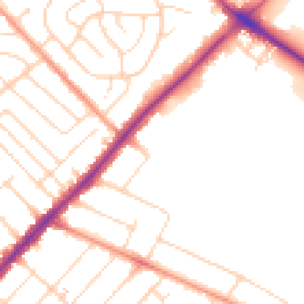
Daytime· 07:00 – 23:00
49.4dB

Night-time· 23:00 – 07:00
40.7dB