6a, Ashcroft Drive, Newcastle Upon Tyne, NE12 9LN
About 6a
6a is a four-bedroom detached house in Newcastle Upon Tyne (NE12 9LN). It has a recorded floor area of 150 m² (around 1615 sq ft), construction records dating it to 2003-2006 and council tax band D. Tenure is freehold. The latest certificate (July 2024) shows a C (score 72). When first surveyed in March 2013 the rating was F, the property has climbed 3 bands since. Between certificates, hot-water efficiency went from Very Poor to Good, lighting went from Poor to Very Good and main heating went from Very Poor to Good.
At 150 m² the property is well over the postcode median (114 m² across 10 EPCs), placing it in the larger end of the local stock. A recent sale: £545,000 in June 2025. 4 planning records sit against the property, 4 approved, 0 refused. Past consents include tree works, meaningful when judging how the property has evolved. Across 2006–2025, sale prices on this property compounded at 6% per year. On a £-per-square-foot basis, the last sale (£338/sq ft) was about 88.9% above the typical sold price in the postcode.
What this property has
Inside
- Bedrooms4
- Bathrooms2
- EnsuiteYes
Outside
- Private gardenYes
- GarageDouble
Building
- TenureFreehold
- RefurbishedYes
Everything you need to know about 6a
The true value, the hidden risks and the full sale history, in one report.
Pick your report · from £14.99
One time fee only - money back guarantee

The data behind every report







Energy performance
EPC Rating
Certificate validity
Valid until 3 July 2034
Property Improvements
Changes detected from historical EPC data
Upgraded to gas central heating
Hot water system upgraded
More low energy lighting installed

Get a survey for this property
Level 2 HomeBuyer Report
We've checked 10 risk factors against the available data for this property and believe a Level 2 HomeBuyer Report could be a suitable option for you.
From £695 · Includes VAT
Planning history
Planning history at 6a is exclusively tree-management applications — typical for a property with mature trees on or near the plot.
4 applications on record at 6a, Ashcroft Drive, Newcastle Upon Tyne, NE12 9LN
- Nov 2012Tree WorksTreesOutcome in report
Remove Maple overhanging building dangerous. Remove 3 small Cherry/Maple self set diameter 45mm within A1 of 6 Ashcroft Drive, Forest Hall TPO 2005
- Documents
- 9 docs on file
- Reference
- 12/01663/TPO
- More recent applications — locked
- Tree WorksMay 2021Decision
- Tree WorksMay 2018Decision
+ 1 more application in the report
Unlock 6a, Ashcroft Drive, Newcastle Upon Tyne, NE12 9LN's full planning history
You're seeing the shape of it. The report has the substance.
- Every decision — granted, refused or withdrawn (4 on record)
- All 4 applications on this property in full, plus 1 notable nearby
- The 23 documents, officer reports & conditions
- What the pattern means for extending or converting here
One time fee only - money back guarantee
Sales history & valuation
Latest sale on 6a was the highest on Land Registry record across the postcode.
£496,000
Modelled from EPC, postcode comparables and a sale-price growth of 6.0% per year over 19 years.
£545,000
Growth on file: 6.0% per year over 19 years.
Sales timeline
19 June 2025Most recent
£545,000
+207.9%over 19 years24 February 2006
£177,000
Median price across the last 5 sales in NE12 9LN: £277,950 (2025–2021).
Nearby sales in NE12 9LN
6 Ashcroft Drive, Newcastle Upon Tyne, NE12 9LN
Sold Nov 2025
£315,0008 Ashcroft Drive, Newcastle Upon Tyne, NE12 9LN
Sold Oct 2024
£277,95011 Ashcroft Drive, Newcastle Upon Tyne, NE12 9LN
Sold Mar 2024
£254,00016 Ashcroft Drive, Newcastle Upon Tyne, NE12 9LN
Sold Nov 2023
£450,0003 Ashcroft Drive, Newcastle Upon Tyne, NE12 9LN
Sold Jun 2021
£177,655
Versus other Ashcroft Drive homes
Price per m² for 6a runs comfortably ahead of the street norm.
Price per m²
£3,633
Street avg £2,102
Floor Area
150 m²
Street avg 125 m²
Habitable Rooms
7 rooms
Street avg 5 rooms
CO₂ Emissions
4.9 t/year
Street avg 5.1 t/year
Everything you need to know about 6a
The true value, the hidden risks and the full sale history, in one report.
Pick your report · from £14.99
One time fee only - money back guarantee
The data behind every report
Similar properties nearby
1 Bede Close
NE12 9SP
1 Colliery Close, Benton
NE12 9TR
1 Ashcroft Drive
NE12 9LN
1 Briarsyde
NE12 9SL
1 Crescent Way
NE12 9AQ
1 Clifton Terrace
NE12 9NP
1 Beal Drive
NE12 9EH
1 Cooperative Terrace, Palmersville
NE12 9HH
The neighbourhood at a glance
Rail-style transport is unusually close for this postcode.
Crime
170/mo
Falling year-on-year across the wider district.
Nearest stop
0.3 km
Meadway-Otterburn Close — bus stop.
Closest school
0.5 km
Ivy Road Primary School. 24 schools nearby.
Go deeper on the local area
A Local Area report breaks down crime, transport links, schools and air quality in depth.
Road noise across the postcode
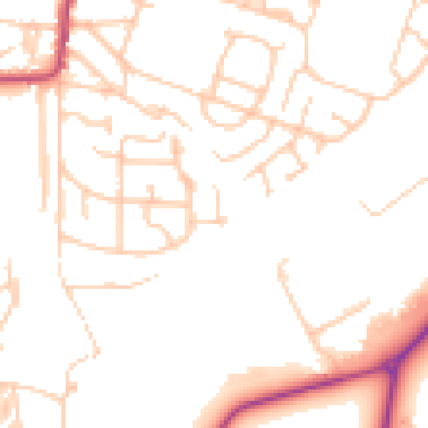
Daytime· 07:00 – 23:00
49.0dB

Night-time· 23:00 – 07:00
39.6dB