61 Huddleston Road, Islington, London, N7 0AE
About 61 Huddleston Road
61 Huddleston Road is a mid-terrace house in Islington, London, London (N7 0AE). It has a recorded floor area of 166 m² (around 1787 sq ft), construction records dating it to 1900-1929 and council tax band G. The latest certificate (April 2019) shows a D (score 56), a step below the typical UK home. The recommended improvements would push it to C (score 80).
8 planning records sit against the property, 5 approved, 0 refused, 1 pending. Past consents include tree works, meaningful when judging how the property has evolved. An active application for tree works is awaiting a decision. The record references conservation-area consent, which constrain future alterations. At 166 m² the property is well over the postcode median (65 m² across 30 EPCs), placing it in the larger end of the local stock. Across 2000–2019, sale prices on this property compounded at 6.7% per year. Today's modelled estimate of £1,961,000 is 10.2% above the 2019 sale price. On a £-per-square-foot basis, the last sale (£996/sq ft) was about 63.4% above the typical sold price in the postcode. Most recent transfer: August 2019 at £1,780,000.
Know exactly what you're buying at 61 Huddleston Road
Before you offer, see what the listing won't tell you, the true value, the red flags and the full history.
Valuation
against the asking price
Risks
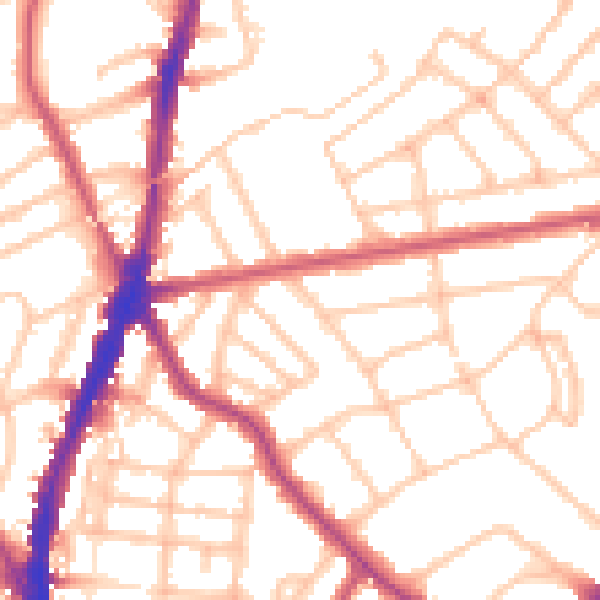
planning & flood
Sold prices
similar homes nearby
Trends
the local market
Energy performance
61 Huddleston Road's carbon output runs well above what efficient homes in the postcode produce.
EPC Rating
Planning history
61 Huddleston Road has been through 5 approved planning applications — a well-evolved property.
- Mar 2025Tree WorksTreesIn report
2 Limes in rear garden, T1, T2 - Reduce crowns to points of previous reduction (2m approx. branch removal), remove up to 50% of epicormic growth throughout trees crowns
- Documents
- 4 docs on file
- Reference
- P2025/0727/TRE
- Oct 2022Tree WorksTreesIn report
Rear garden Lime trees (T1, T2) - Reduce crowns by 1-2m beyond previous points of reduction (max branch removal 3.5m, trees current height approx. 15m, thin crowns by 35-40%, by removal of epicormic growth
- Documents
- 5 docs on file
- Reference
- P2022/3251/TRE
What's in 61 Huddleston Road, Islington, London, N7 0AE's planning history?
6 more on this property, plus refusals, disputes and full decisions nearby, in the report.
Sales history & valuation
Sale price has grown by over 3x since 2000.
£1,961,000
Modelled from EPC, postcode comparables and a sale-price growth of 6.7% per year over 20 years.
£1,780,000
Growth on file: 6.7% per year over 20 years.
Sales timeline
6 August 2019Most recent
£1,780,000
+187.1%over 16 years9 July 2003
£620,000
+24.0%over 3 years14 January 2000
£500,000
Median price across the last 5 sales in N7 0AE: £1,235,000 (2024–2021).
Nearby sales in N7 0AE
First Floor Flat, 89 Huddleston Road, London, N7 0AE
Sold Apr 2024
£773,00063 Huddleston Road, Islington, London, N7 0AE
Sold Nov 2022
£1,235,00083 Huddleston Road, Islington, London, N7 0AE
Sold Feb 2022
£1,950,000Second Floor Flat, 91 Huddleston Road, London, N7 0AE
Sold Jun 2021
£622,00073 Huddleston Road, Islington, London, N7 0AE
Sold Mar 2021
£1,700,000
Everything we know about 61 Huddleston Road, in one report
What it's really worth, what could be wrong, and the planning, sales and area data in full.
- Am I paying too much?
- Is something wrong with it?
- Is the agent's story true?
- Will it hold its value?

Versus other Huddleston Road homes
61 Huddleston Road outperforms the street on price per m² by a wide margin.
Price per m²
£10,723
Street avg £8,734
Floor Area
166 m²
Street avg 179 m²
Habitable Rooms
6 rooms
Street avg 8 rooms
CO₂ Emissions
7.5 t/year
Street avg 8.2 t/year
Similar properties nearby
1 Archibald Road, Islington
N7 0AN
1 Leaf Walk, Islington
N7 0FG
1 Crayford Mews, Islington
N7 0DQ
1 Melyn Close, Islington
N7 0RH
1 Huddleston Road, Islington
N7 0RE
1 Tabley Road, Islington
N7 0NA
1 Moriatry Close, Islington
N7 0EF
1 3, Flat 2, Pleshey Road, Islington
N7 0RA
The neighbourhood at a glance
Rail-style transport is unusually close for this postcode.
Crime
12/mo
Rising year-on-year across the wider district.
Nearest stop
0.1 km
Campdale Road — bus stop.
Closest school
0.4 km
Tufnell Park Primary School. 77 schools nearby.
Go deeper on the local area
The full report breaks down crime, transport links, schools and air quality in depth.
Road noise across the postcode
Daytime· 07:00 – 23:00
53.0dB
Night-time· 23:00 – 07:00
42.5dB