Wicheves, Haysbrook Avenue, Worsley, Manchester, M28 0AY
About Wicheves
Wicheves is a detached house in Worsley, Manchester, Manchester (M28 0AY). It has a recorded floor area of 384 m² (around 4133 sq ft), construction records dating it to 1976-1982 and council tax band C. The latest certificate (May 2022) shows a C (score 71). The rating has held steady at C across 2 certificates since April 2016. Between certificates, window efficiency went from Average to Good and lighting went from Poor to Very Good; while wall efficiency dropped from Good to Average and roof efficiency dropped from Good to Poor. The recommended improvements would push it to B (score 83).
At 384 m² the property is well over the postcode median (66 m² across 7 EPCs), placing it in the larger end of the local stock. Across 2007–2016, sale prices on this property compounded at -1.9% per year. Today's modelled estimate of £535,000 sits 154.8% above the 2016 sale of £210,000. Last sold in December 2016, so it's been off the market for around 9 years.
Everything you need to know about Wicheves
The true value, the hidden risks and the full sale history, in one report.
Pick your report · every report is £14.99
One time fee only - money back guarantee

The data behind every report


Energy performance
Wicheves's carbon output runs well above what efficient homes in the postcode produce.
EPC Rating
Property Improvements
Changes detected from historical EPC data
Window efficiency improved
More low energy lighting installed
Get a survey for this property
Level 3 Building Survey
Because the property is a large detached home over 300m², we believe a Level 3 building survey should be considered.
From £1,085 · Includes VAT
Planning history
Wicheves has no planning applications on record.
But the area is active
5 notable applications nearby — larger schemes and conversions that could reshape the street. The report maps them all.
Sales history & valuation
£535,000
Modelled from EPC, postcode comparables and a sale-price growth of -1.9% per year over 9 years.
£210,000
Growth on file: -1.9% per year over 9 years.
Sales timeline
9 December 2016Most recent
£210,000
-16.0%over 9 years12 September 2007
£249,950
Everything you need to know about Wicheves
The true value, the hidden risks and the full sale history, in one report.
Pick your report · every report is £14.99
One time fee only - money back guarantee
The data behind every report
Similar properties nearby
1 Elsham Drive, Worsley
M28 0RU
1 Cricketfield Lane, Worsley
M28 0AQ
1 Helias Close, Worsley
M28 0YJ
1 Gillers Green, Worsley
M28 0GA
1 Hallview Way, Worsley
M28 0BF
1 Hilton Bank, Worsley
M28 0RX
1 Barrowshaw Close, Worsley
M28 0GF
1 Clock Tower Close, Worsley
M28 0YD
The neighbourhood at a glance
Nearest stop
0.1 km
Armitage Close — bus stop.
Closest school
0.5 km
Star Salford Academy. 33 schools nearby.
Go deeper on the local area
A Local Area report breaks down crime, transport links, schools and air quality in depth.
Road noise across the postcode
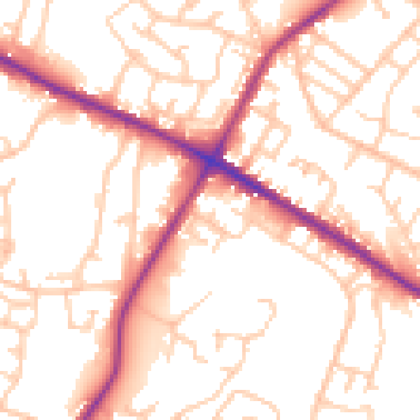
Daytime· 07:00 – 23:00
53.9dB

Night-time· 23:00 – 07:00
45.1dB