Flat 4, 1 Oswald Road, Chorlton Cum Hardy, Manchester, M21 9LH
About Flat 4
Flat 4 is an end-of-terrace house in Chorlton Cum Hardy, Manchester, Manchester (M21 9LH). It has a recorded floor area of 55 m² (around 592 sq ft), construction records dating it to before 1900 and council tax band A. At 55 m² this is the 5th smallest of 9 units on EPC record in the building, where floor areas span 51–87 m². The building's EPC ratings span E to C, with this unit at the top. On EPC score it ranks first in the building (72 versus a worst of 44). The latest certificate (March 2017) shows a C (score 72). When first surveyed in July 2009 the rating was D, the property has climbed 1 band since. Between certificates, wall efficiency went from Very Poor to Good and window efficiency went from Very Poor to Average; while hot-water efficiency dropped from Good to Average and lighting dropped from Very Good to Good.
Its energy rating outperforms most of the postcode (better than 83% of similar EPCs).
Know exactly what you're buying at Flat 4
Before you offer, see what the listing won't tell you, the true value, the red flags and the full history.
Already flagged here
Valuation
against the asking price
Risks
planning & flood
Sold prices
similar homes nearby
Trends
the local market
Energy performance
EPC Rating
Property Improvements
Changes detected from historical EPC data
Hot water efficiency decreased
Single glazing replaced with double or better glazing
Cavity wall insulation installed
Planning history
Flat 4 has no planning applications on record.
Notable planning nearby
4applications of note in the surrounding area
We flagged 1 thing worth checking at Flat 4
Independent checks surfaced things a buyer would want to understand before offering. The report explains each one in full, with the underlying data and what to ask.
- Larger development activity nearby
30-day money-back guarantee
Sales history & valuation
Flat 4 has no Land Registry sales on file, suggesting it has stayed in the same hands since registration began.
£215,000
Modelled from EPC, postcode comparables.
No sales recorded with HM Land Registry
That can mean the property has never traded since the registry began publishing in 1995, was a new build that hasn't been registered yet, or is held in the same hands long-term.
Median price across the last 5 sales in M21 9LH: £275,500 (2023–2016).
Nearby sales in M21 9LH
2b, Oswald Road, Chorlton Cum Hardy, Manchester, M21 9LH
Sold Dec 2023
£275,5002a, Flat 2, Oswald Road, Chorlton Cum Hardy, Manchester, M21 9LH
Sold May 2019
£132,000Flat 6, 3 Oswald Road, Chorlton Cum Hardy, Manchester, M21 9LH
Sold May 2019
£50,0008 Oswald Road, Chorlton Cum Hardy, Manchester, M21 9LH
Sold Jun 2016
£650,0006 Oswald Road, Chorlton Cum Hardy, Manchester, M21 9LH
Sold Jan 2016
£625,000
Everything we know about Flat 4, in one report
What it's really worth, what could be wrong, and the planning, sales and area data in full.
What we flagged
- Larger development activity nearby

Versus other Oswald Road homes
Flat 4 outperforms the street on epc rating by a wide margin.
EPC Rating
72 (C)
Street avg 58 (D)
Floor Area
55 m²
Street avg 63 m²
CO₂ Emissions
1.9 t/year
Street avg 3.4 t/year
Habitable Rooms
2 rooms
Street avg 3 rooms
Similar properties nearby
14 16, Flat 6, Manchester Road, Chorlton Cum Hardy
M21 9JG
14 16, Flat 4, Manchester Road, Chorlton Cum Hardy
M21 9JG
13 15, Flat 2, Stockton Road
M21 9FB
14 16, Flat 2, Manchester Road, Chorlton Cum Hardy
M21 9JG
14 16, Flat 8, Manchester Road, Chorlton Cum Hardy
M21 9JG
13 15, Flat 6, Stockton Road
M21 9FB
14 16, Flat 7, Manchester Road, Chorlton Cum Hardy
M21 9JG
13 15, Flat 3, Stockton Road
M21 9FB
The neighbourhood at a glance
Rail-style transport is unusually close for this postcode.
Nearest stop
0.1 km
Manchester Road — bus stop.
Closest school
0.2 km
Oswald Road Primary School. 39 schools nearby.
Go deeper on the local area
The full report breaks down crime, transport links, schools and air quality in depth.
Road noise across the postcode
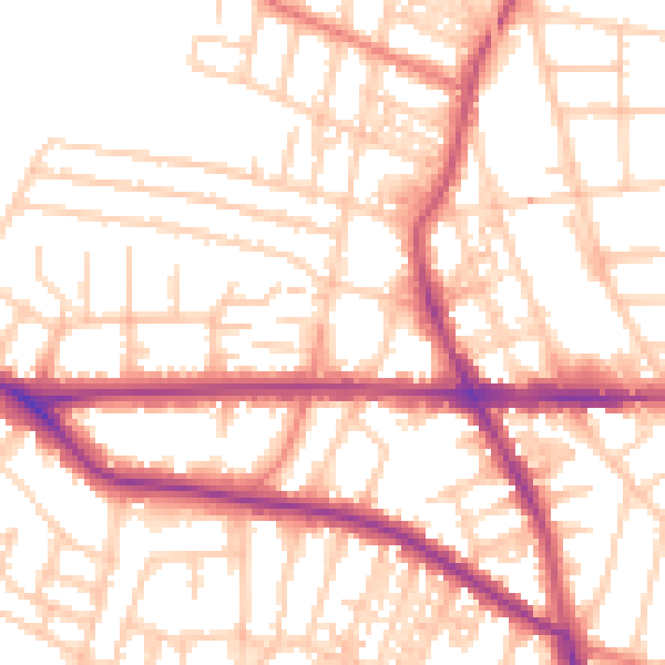
Daytime· 07:00 – 23:00
54.0dB

Night-time· 23:00 – 07:00
43.8dB