33 St Marys Street, Hulme, Manchester, M15 5WB
About 33 St Marys Street
33 St Marys Street is a two-bedroom mid-terrace house in Hulme, Manchester, Manchester (M15 5WB). It has a recorded floor area of 48 m² (around 517 sq ft), construction records dating it to 1996-2002 and council tax band A. At 48 m² this is the 5th smallest of 31 units on EPC record in the building, where floor areas span 46–74 m². The building's EPC ratings span D to C, with this unit at the top. Our model identifies extension potential, subject to local planning policy. The latest certificate (February 2018) shows a C (score 78), near the top of the C band.
Across 2000–2023, sale prices on this property compounded at 4.9% per year. On a £-per-square-foot basis, the last sale (£286/sq ft) was about 69.1% above the typical sold price in the postcode. Sold March 2023 for £148,000.
What this property has
Inside
- Bedrooms2
- Bathrooms1
Outside
- ParkingAllocated
Building
- Extension potentialPossible
Everything you need to know about 33 St Marys Street
The true value, the hidden risks and the full sale history, in one report.
30-day money-back guarantee

The data behind every report


Energy performance
33 St Marys Street's carbon output is low for the local stock.
EPC Rating
Planning history
33 St Marys Street has no planning applications on record.
The full report still covers planning activity across the surrounding area.
Sales history & valuation
Sale price has at least doubled since 2000.
£158,000
Modelled from EPC, postcode comparables and a sale-price growth of 4.9% per year over 23 years.
£148,000
Growth on file: 4.9% per year over 23 years.
Sales timeline
26 March 2023Most recent
£148,000
+52.6%over 18 years3 June 2004
£97,000
+94.2%over 3 years29 June 2000
£49,950
Median price across the last 5 sales in M15 5WB: £140,000 (2025–2023).
Nearby sales in M15 5WB
9e, St Marys Street, Hulme, Manchester, M15 5WB
Sold Sept 2025
£150,00049 St Marys Street, Hulme, Manchester, M15 5WB
Sold Oct 2024
£140,00047 St Marys Street, Hulme, Manchester, M15 5WB
Sold Mar 2024
£130,00019 St Marys Street, Hulme, Manchester, M15 5WB
Sold Dec 2023
£185,00055 St Marys Street, Hulme, Manchester, M15 5WB
Sold Oct 2023
£134,950
Versus other St Marys Street homes
On price per m², 33 St Marys Street stands well clear of the street.
Price per m²
£3,083
Street avg £2,376
Floor Area
48 m²
Street avg 50 m²
Habitable Rooms
3 rooms
Street avg 3 rooms
CO₂ Emissions
1.2 t/year
Street avg 2.1 t/year
Everything you need to know about 33 St Marys Street
The true value, the hidden risks and the full sale history, in one report.
30-day money-back guarantee
The data behind every report
Similar properties nearby
The neighbourhood at a glance
Crime
1/mo
Steady year-on-year across the wider district.
Nearest stop
0.1 km
Loreto College — bus stop.
Closest school
0.2 km
Loreto College. 47 schools nearby.
Go deeper on the local area
The full report breaks down crime, transport links, schools and air quality in depth.
Road noise across the postcode
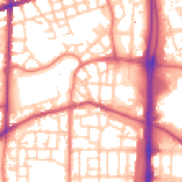
Daytime· 07:00 – 23:00
56.9dB
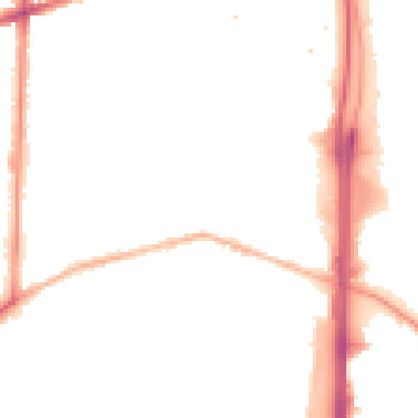
Night-time· 23:00 – 07:00
47.0dB